After much cajoling from the family and the gift of his cast off from my grandson, I've finally arrived in the 21st century and have acquired a smart 'phone. I've been playing with it for the last week and am quite impressed by what I can do with it. A small gadget that fits into a hitherto unused specially designed pocket in my kiwi trousers and can can do much of what what my computer, camera and GPS does looks like a winner. I can now catch up with BcUK without having to sit down at a desktop computer.
A trawl through the aps I can get on it looks promising: plant and fungi identifiers, maps, camp site locations and so on. However, the range and extent of things on offer is a bit bewildering, so I'm seeking advice.
What aps do you have that you find useful and would recommend?
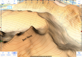
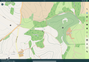
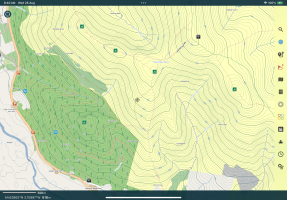
Which are the best mapping and GPS aps?
Are there any apps which are best avoided?
What other questions should I be asking?
A trawl through the aps I can get on it looks promising: plant and fungi identifiers, maps, camp site locations and so on. However, the range and extent of things on offer is a bit bewildering, so I'm seeking advice.
What aps do you have that you find useful and would recommend?
Which are the best mapping and GPS aps?
Are there any apps which are best avoided?
What other questions should I be asking?


")