TGO Challenge 2012 - My Crossing of Scotland
- Thread starter Shewie
- Start date
-
BushMoot: Come along to the amazing Summer Moot 31st July - 5th August (extended Moot : 27th July - 8th August), a festival of bushcrafting and camping in a beautiful woodland PLEASE CLICK HERE for more information.
You are using an out of date browser. It may not display this or other websites correctly.
You should upgrade or use an alternative browser.
You should upgrade or use an alternative browser.
I reckon the last pic answers my Question")
Sorry, I did mean to answer that one
It does look like the same place doesn't it, I think your pic is from Steve Horners blog so I'd have to check his route
Saturday 12th May - Day Two
Glen Affric to Coille an Tuathanaich
14.76 miles (planned)
559 metres of ascent (planned)
19.67 miles (actual)
834 metres of ascent (actual)

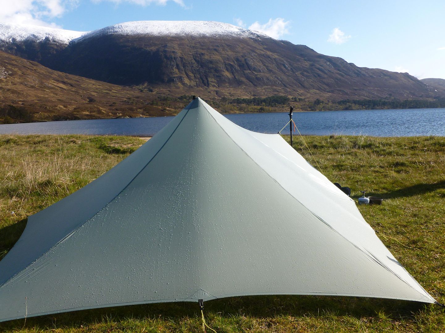
Despite a couple of showers during the night, Saturday started bright with blue skies and sunshine. I’d slept really well again, we’d gone to our beds fairly early but were kept awake by some weird creature of the night. I’m guessing it was an owl of some kind but it sounded like a six year old kid doing an Indian war cry, whilst running around our campsite every minute or so. I ended up putting my mp3 player on to drown it out.
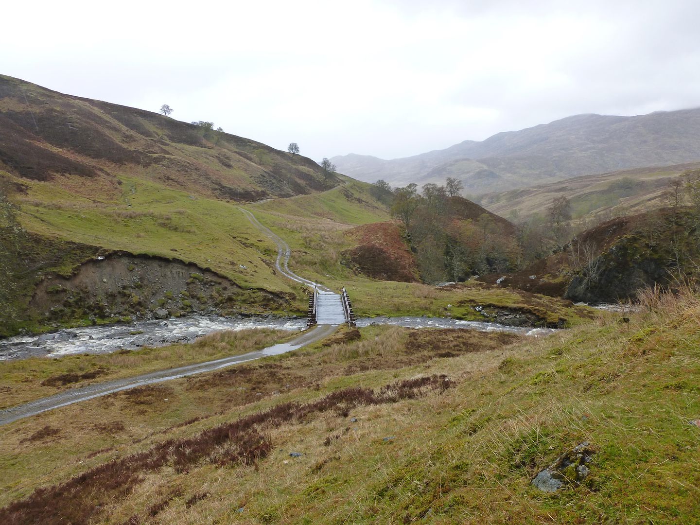
View from the tarp in the morning
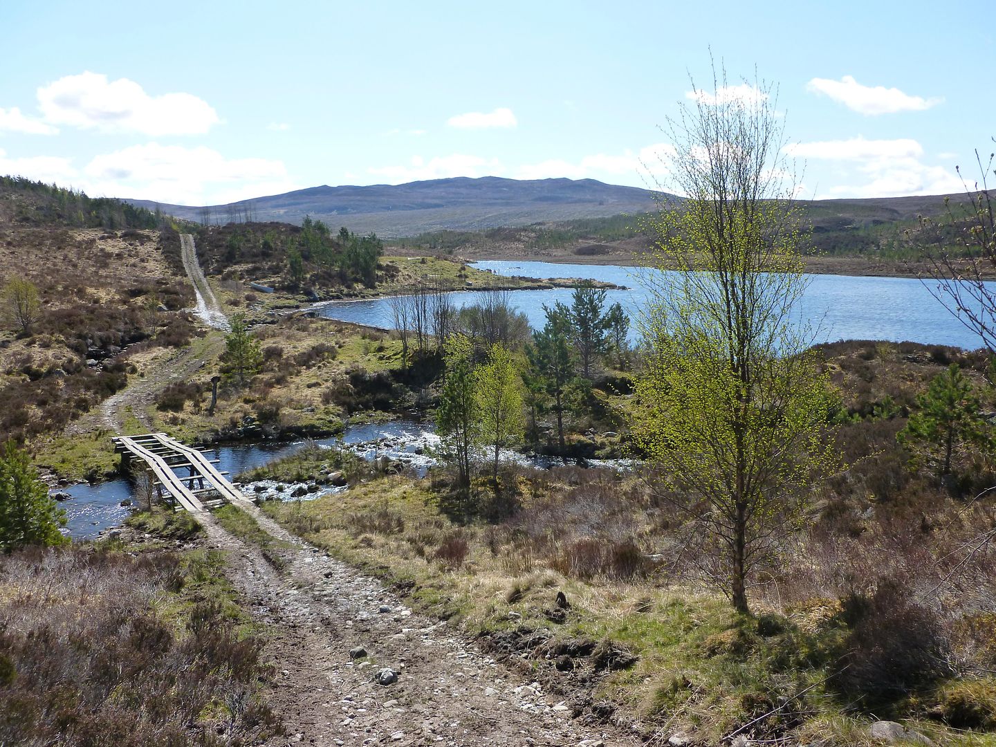
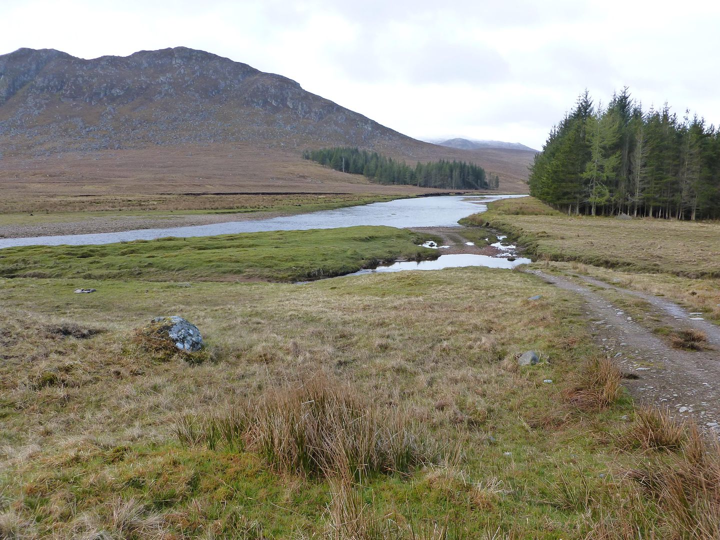
On our way up Glen Affric
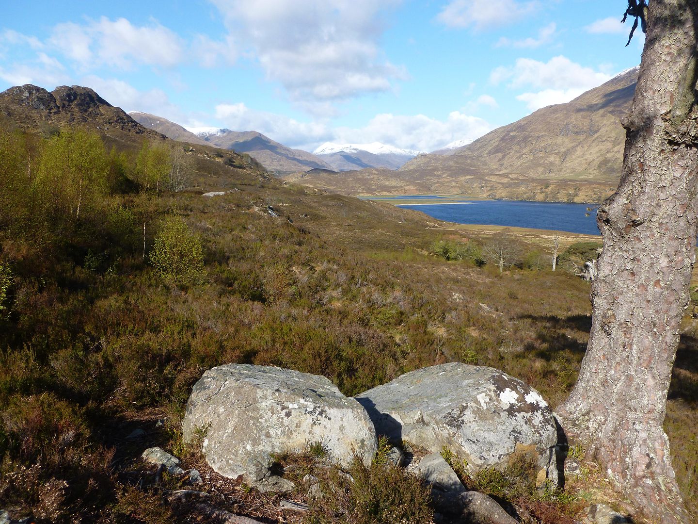
After climbing the bogs of Allt Garbh, looking back down to Loch Affric
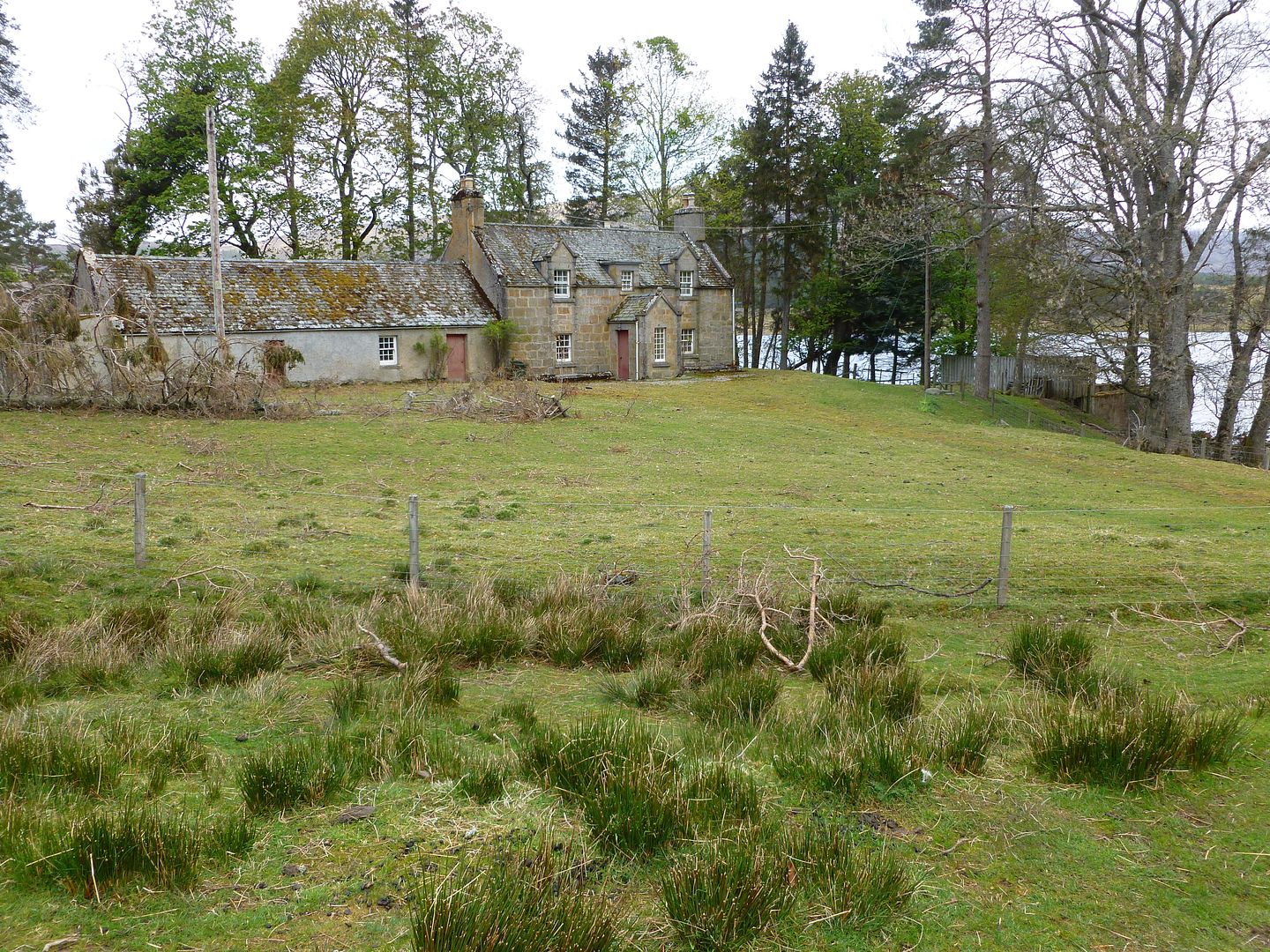
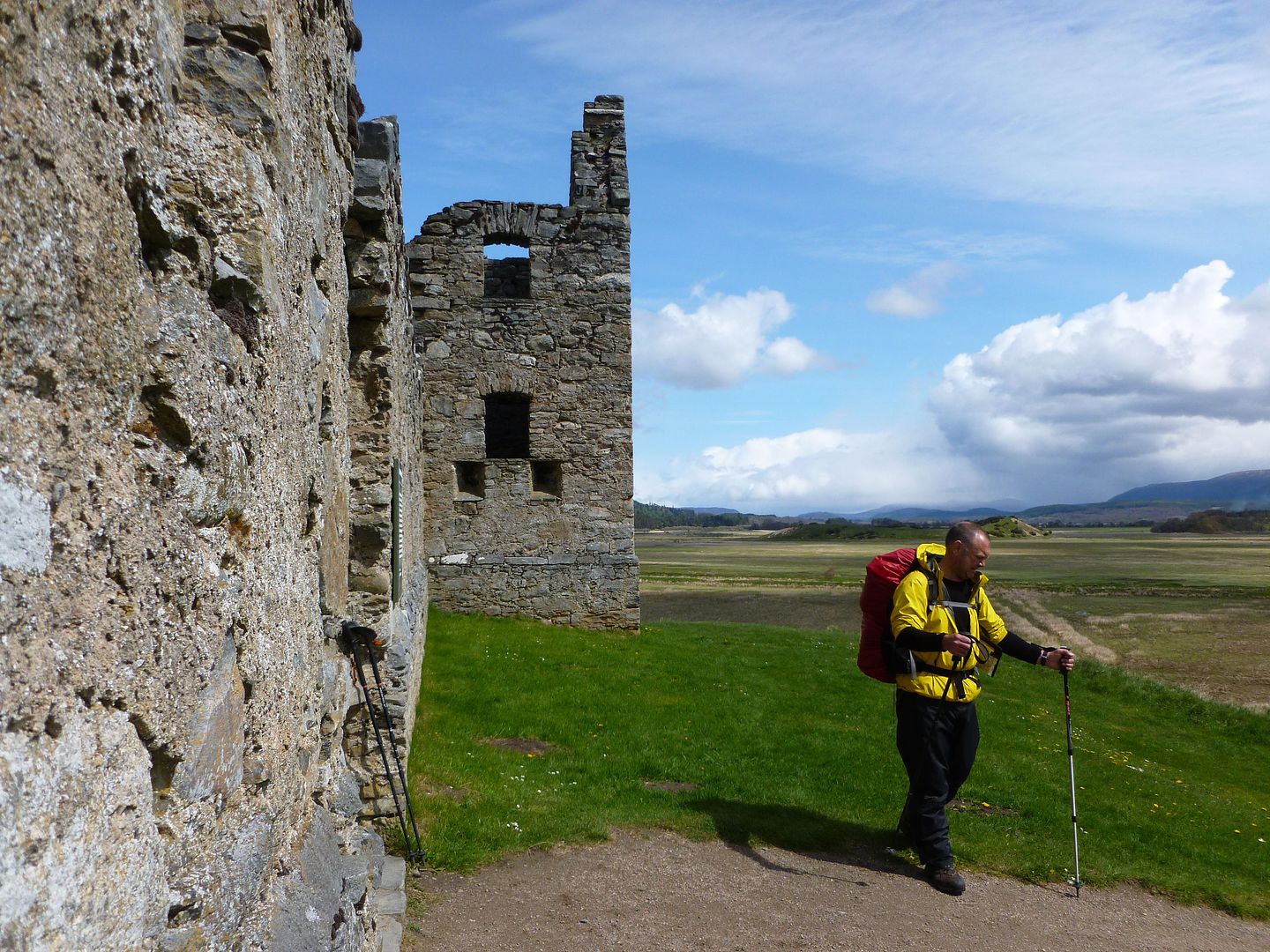
Interesting Landy bridge
We called in at Cougie Lodge to meet TGO hero Val, just in time for a fresh batch of scones too, result. We sat and ate chicken and veg soup with bread rolls, followed by cups of tea and warm scones with jam.
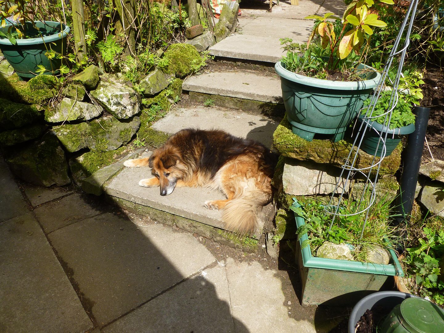
One of Val’s dogs
After leaving Cougie we were down the track, over Garve Bridge and then taking a right at Plodda Falls and up through the forest. We met Gary at Cougie who was also on his first crossing, we walked and chatted with him for a while but he soon shot off when he realised how slow we were, we’d forgotten his name later in the day so he was now called Donny, because that’s where he came from.
We’d planned to camp at the top of the woods originally but it was only around 13:30 as we reached the gate on the perimeter, we’d heard about the impending weather for Sunday so we made the decision to keep going. Big mistake and our only real cock up of the whole trip!! It was here that we picked up a row of powerlines for the first time, they’d feature heavily over the next couple of days.
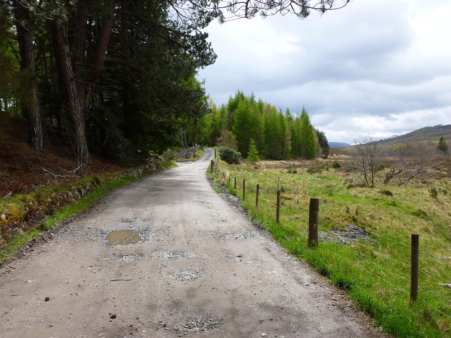
Our route was straight forward and it had recently been made even easier, a new service road had been gouged out of the hill exactly on the course of the original path.
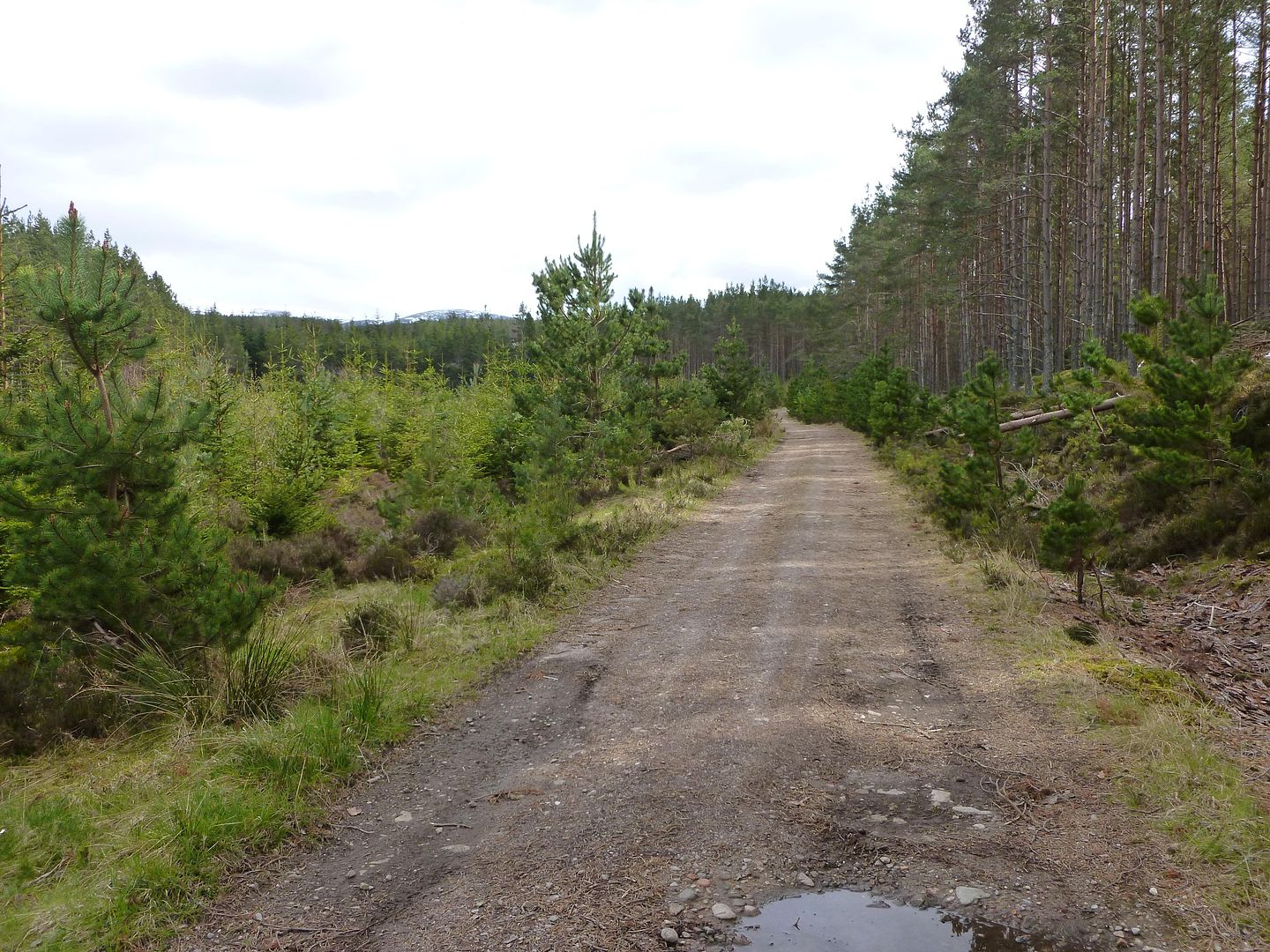
Navigation couldn’t have been simpler but this turned out to be our worst leg of the whole crossing, the track just went on and on, false horizon after false horizon. The landscape was bleak moorland too which made it even worse, and then the constant taking off and putting on of waterproofs every ten minutes was tiresome. Bright yellow plant machinery was dotted all around as well as the orange plastic fencing and H&S signs, the wind picked up from the west bringing more rain and then we started the descent from Beinn Bahn.
My feet were already pretty sore and my left knee was starting to give me some gip, Mick was in much the same way and so the long descent was an absolute killer. We’d split up near the end, Mick was really struggling and I was eager to find somewhere to camp for the night before it got too late, we couldn’t get lost as the track was so obvious so I pulled away at the front. As I came round a final left hander there was a small area of closely grazed grass in view at the bottom of the hill, not exactly flat but it was the best we’d seen since we left Cougie about five hours earlier.
I had my Trailstar pitched and was collecting water by the time Mick arrived, he pitched up between the showers and gales dived into my party tent for some grub. In pain and totally knackered we called it an early night, I passed out about five seconds after hitting my pillow.
No photos were taken after Cougie sorry, I was in no mood to take any shots even if there had been anything to look at.
Sunday 13th May - Day Three
Coille an Tuathanaich to Fort Augustus
17.09 miles (planned)
737 metres of ascent (planned)
10.36 miles (actual)
362 metres of ascent (actual)

I was woken by the sound of a Transit van driving up the track twenty metres from my tarp, another great nights sleep on the deck. My feet were tender though, big hot spots on the outside of each heel and then a giant one on the ball of my left foot, right up under the toes, not blisters yet but after two long days my townie feet were suffering. I gave them some TLC with a bit of Gehwols and got my stuff packed, considering Sunday was supposed to be a horrid day it was actually quite a nice morning. By the time we’d had a brew and packed away the rain was just starting, we took a wrong turn in the woods and had to bushwhack our way out, no biggy but ten minutes wasted.
Down into Glen Moriston and into the next big forestry, our vetter advised us to take an alternative route which turned out to be a bit out of date. We were supposed to pick up the powerlines again and follow them straight up the hill, we found them but there was no path, we checked the GPS and we were right where we should be. The obvious track to our right was fenced off, padlocked and out of bounds, that meant we had to work our way round and bog jump and scramble up a good 90 metres of ascent. The rain was really hammering down by now, the wind was howling through the tree tops too, but we knew once we’d reached the top and found a track we’d be into Fort Augustus in no time. We did find a track eventually and it was going our way, we stopped under the cover of some big pines and smoked a soggy rolly. The forestry paths were easy to follow most of the time, a couple of new routes would throw us off sometimes, especially at crossroads which weren’t on our maps.
We missed a crappy little left hand fork when we’d done all the hard work for the day, it was barely noticeable at the time but it would have saved us a good hour and a half of zig zagging along tracks. By the time we reached Fort Augustus it was midday, we found the campsite and a bunch of other Challengers already there in the lodge building. We managed to grab one of the twin rooms in the lodge and we were even happier to collect the food parcels we’d posted up. All the soggy gear was washed and hung up in the drying room, and we spent the afternoon eating, showering and chatting with folk about routes, alternative routes and mostly about the weather. The little portable telly in the lodge had the footy on so we managed to see City beat Utd to the title which cheered us up a bit, back into the soggy gear and out to the pub. It was still torrential outside, folk were talking about 100mph winds and a months worth of rain that day, I was dead chuffed that Mick talked me into going halves on a room instead of camping.
No pictures of day 3, it was just so wet I had to keep the camera tucked away in a dry bag. It was wet, grey and windy.
Glen Affric to Coille an Tuathanaich
14.76 miles (planned)
559 metres of ascent (planned)
19.67 miles (actual)
834 metres of ascent (actual)
Despite a couple of showers during the night, Saturday started bright with blue skies and sunshine. I’d slept really well again, we’d gone to our beds fairly early but were kept awake by some weird creature of the night. I’m guessing it was an owl of some kind but it sounded like a six year old kid doing an Indian war cry, whilst running around our campsite every minute or so. I ended up putting my mp3 player on to drown it out.
View from the tarp in the morning
On our way up Glen Affric
After climbing the bogs of Allt Garbh, looking back down to Loch Affric
Interesting Landy bridge
We called in at Cougie Lodge to meet TGO hero Val, just in time for a fresh batch of scones too, result. We sat and ate chicken and veg soup with bread rolls, followed by cups of tea and warm scones with jam.
One of Val’s dogs
After leaving Cougie we were down the track, over Garve Bridge and then taking a right at Plodda Falls and up through the forest. We met Gary at Cougie who was also on his first crossing, we walked and chatted with him for a while but he soon shot off when he realised how slow we were, we’d forgotten his name later in the day so he was now called Donny, because that’s where he came from.
We’d planned to camp at the top of the woods originally but it was only around 13:30 as we reached the gate on the perimeter, we’d heard about the impending weather for Sunday so we made the decision to keep going. Big mistake and our only real cock up of the whole trip!! It was here that we picked up a row of powerlines for the first time, they’d feature heavily over the next couple of days.
Our route was straight forward and it had recently been made even easier, a new service road had been gouged out of the hill exactly on the course of the original path.
Navigation couldn’t have been simpler but this turned out to be our worst leg of the whole crossing, the track just went on and on, false horizon after false horizon. The landscape was bleak moorland too which made it even worse, and then the constant taking off and putting on of waterproofs every ten minutes was tiresome. Bright yellow plant machinery was dotted all around as well as the orange plastic fencing and H&S signs, the wind picked up from the west bringing more rain and then we started the descent from Beinn Bahn.
My feet were already pretty sore and my left knee was starting to give me some gip, Mick was in much the same way and so the long descent was an absolute killer. We’d split up near the end, Mick was really struggling and I was eager to find somewhere to camp for the night before it got too late, we couldn’t get lost as the track was so obvious so I pulled away at the front. As I came round a final left hander there was a small area of closely grazed grass in view at the bottom of the hill, not exactly flat but it was the best we’d seen since we left Cougie about five hours earlier.
I had my Trailstar pitched and was collecting water by the time Mick arrived, he pitched up between the showers and gales dived into my party tent for some grub. In pain and totally knackered we called it an early night, I passed out about five seconds after hitting my pillow.
No photos were taken after Cougie sorry, I was in no mood to take any shots even if there had been anything to look at.
Sunday 13th May - Day Three
Coille an Tuathanaich to Fort Augustus
17.09 miles (planned)
737 metres of ascent (planned)
10.36 miles (actual)
362 metres of ascent (actual)
I was woken by the sound of a Transit van driving up the track twenty metres from my tarp, another great nights sleep on the deck. My feet were tender though, big hot spots on the outside of each heel and then a giant one on the ball of my left foot, right up under the toes, not blisters yet but after two long days my townie feet were suffering. I gave them some TLC with a bit of Gehwols and got my stuff packed, considering Sunday was supposed to be a horrid day it was actually quite a nice morning. By the time we’d had a brew and packed away the rain was just starting, we took a wrong turn in the woods and had to bushwhack our way out, no biggy but ten minutes wasted.
Down into Glen Moriston and into the next big forestry, our vetter advised us to take an alternative route which turned out to be a bit out of date. We were supposed to pick up the powerlines again and follow them straight up the hill, we found them but there was no path, we checked the GPS and we were right where we should be. The obvious track to our right was fenced off, padlocked and out of bounds, that meant we had to work our way round and bog jump and scramble up a good 90 metres of ascent. The rain was really hammering down by now, the wind was howling through the tree tops too, but we knew once we’d reached the top and found a track we’d be into Fort Augustus in no time. We did find a track eventually and it was going our way, we stopped under the cover of some big pines and smoked a soggy rolly. The forestry paths were easy to follow most of the time, a couple of new routes would throw us off sometimes, especially at crossroads which weren’t on our maps.
We missed a crappy little left hand fork when we’d done all the hard work for the day, it was barely noticeable at the time but it would have saved us a good hour and a half of zig zagging along tracks. By the time we reached Fort Augustus it was midday, we found the campsite and a bunch of other Challengers already there in the lodge building. We managed to grab one of the twin rooms in the lodge and we were even happier to collect the food parcels we’d posted up. All the soggy gear was washed and hung up in the drying room, and we spent the afternoon eating, showering and chatting with folk about routes, alternative routes and mostly about the weather. The little portable telly in the lodge had the footy on so we managed to see City beat Utd to the title which cheered us up a bit, back into the soggy gear and out to the pub. It was still torrential outside, folk were talking about 100mph winds and a months worth of rain that day, I was dead chuffed that Mick talked me into going halves on a room instead of camping.
No pictures of day 3, it was just so wet I had to keep the camera tucked away in a dry bag. It was wet, grey and windy.
Last edited:
Monday 14th May - Day Four
Fort Augustus to Melgarve
12.38 miles
913 metres of ascent

Day four was going to be high so we were a bit concerned about the recent weather, neither of us were kitted out for winter walking but the only alternative was a forty odd mile detour on tarmac. We woke to a cracking day though, everyone at breakfast was raring to go again, we recovered our dry toasty gear from the drying rooms and packed up and left.
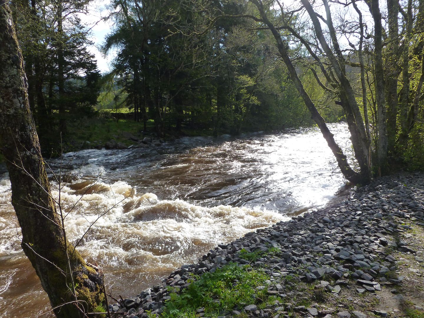
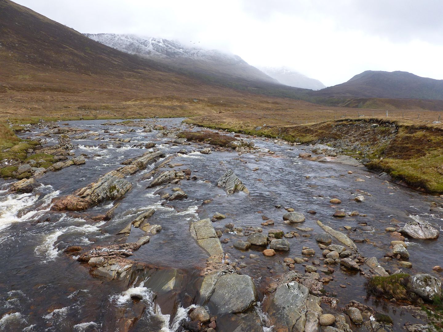
Heading for Glen Tarff, the rivers are looking a bit high today
Sunshine and blue skies
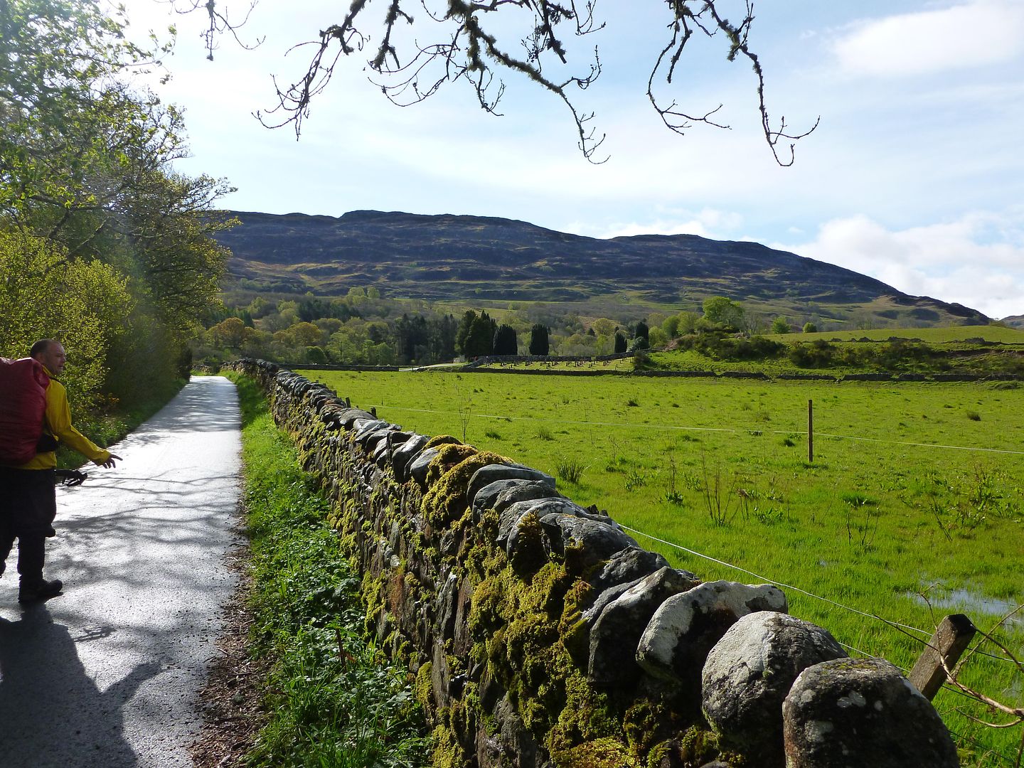
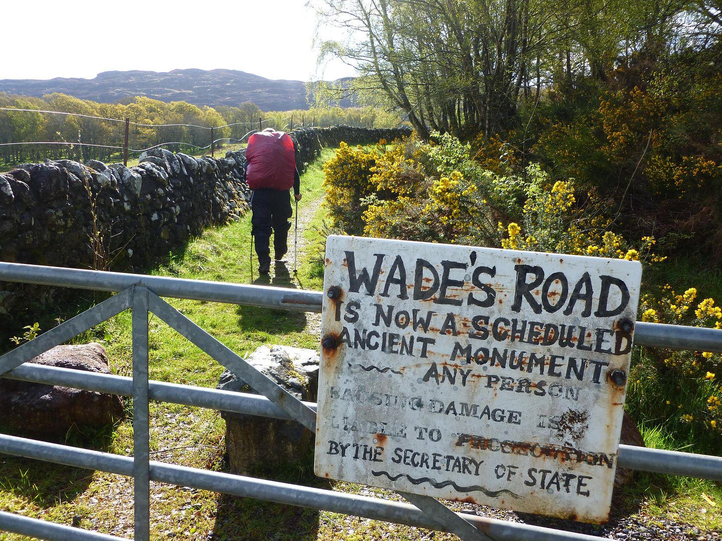
General Wades Military Road, a nice varied route as it turned out
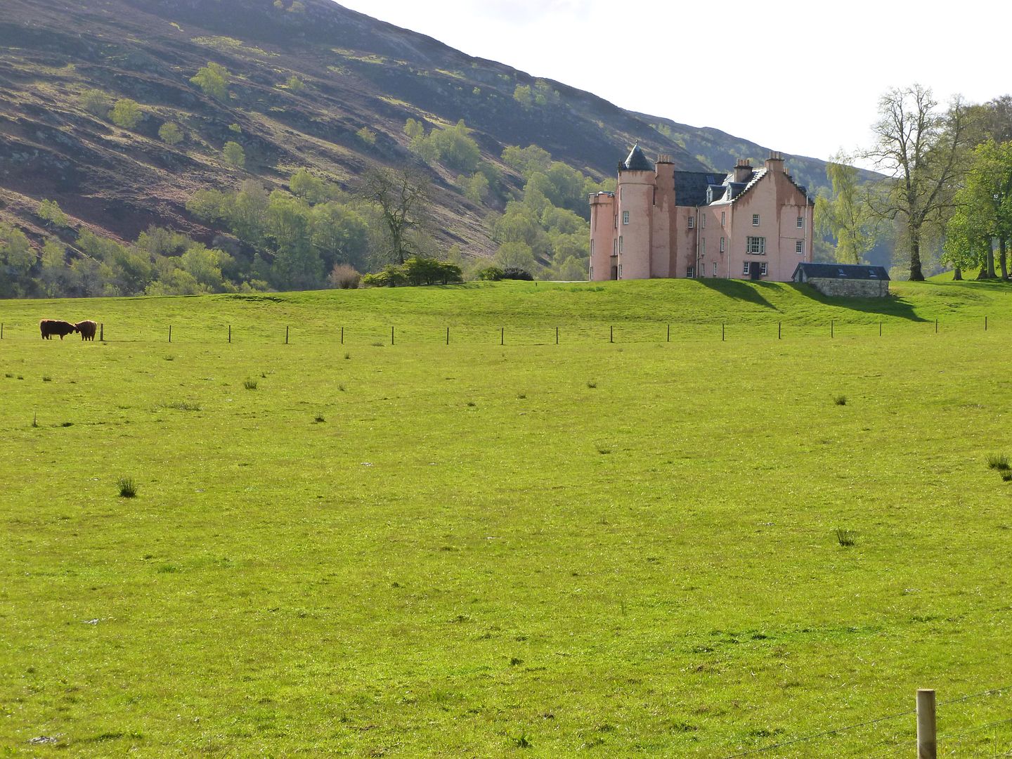
One for Mick’s kids, apparently it looks like Balamory?
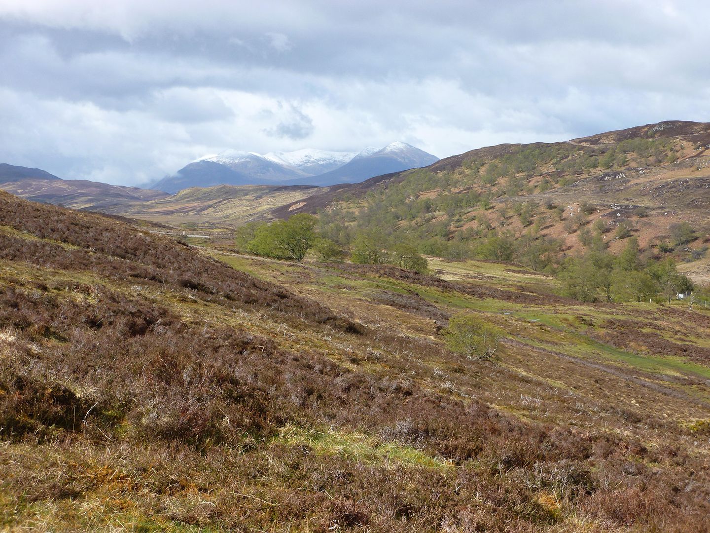
Looking west
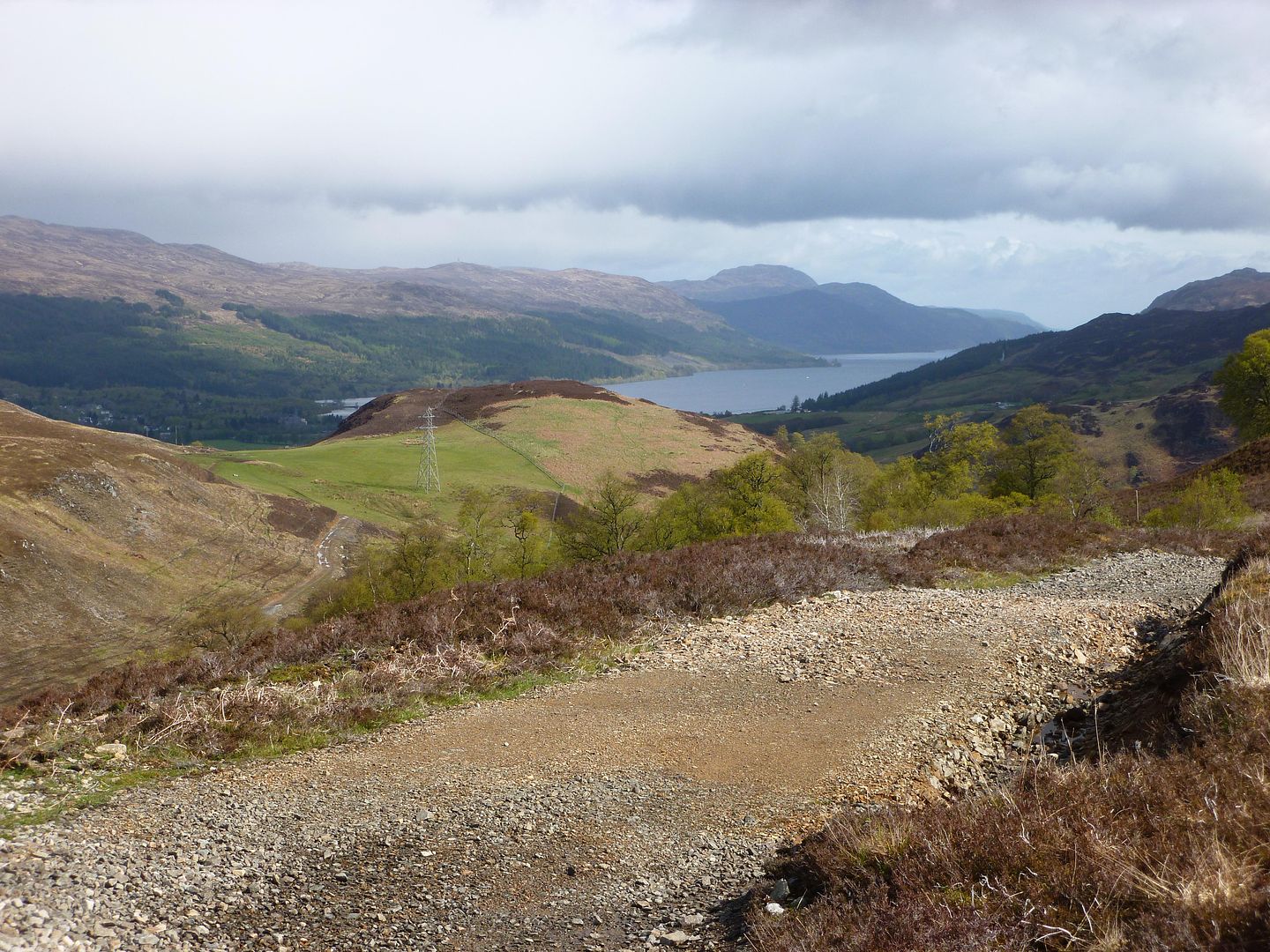
Looking east over Loch Ness and Fort Augustus
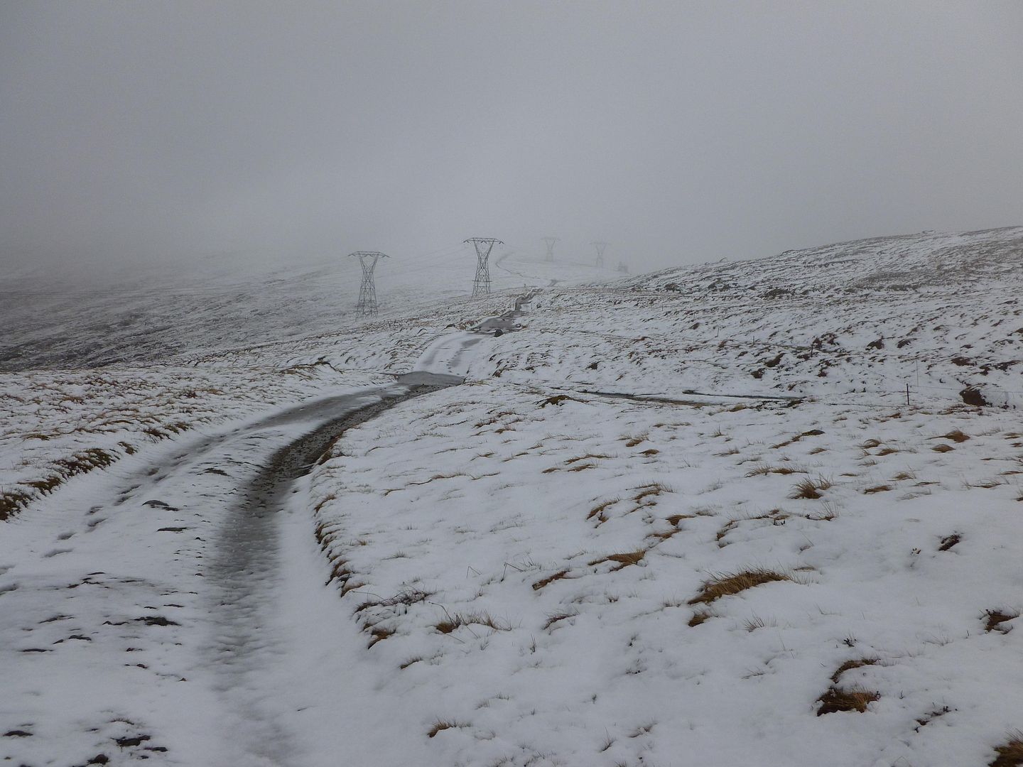
The start of our climb up the Corrieyairack
The Corrieyairack Pass was a pleasant surprise, having watched some vids and read about it during our planning, the surface had been sorted out recently and the going was good. We stopped off at Blackburn bothy on our way up the pass, it was a really nice place but a couple of folk had been stranded here the night before and had to turn back. We met second time Challengers David & Sue, had a quick brew and some scoff and we were on our way again, a fast flowing river crossing in the first few minutes got the legs going. Up and up we went, switchback after switchback, eventually we reached the level of the clouds and into the snow showers. The cloud got thicker and thicker as we went up, snow was starting to appear on the ground and I was wishing I was wearing boots rather than light trainers.
Corrieyairack Pass, nearing the summit (still following powerlines)
Descending from the other side
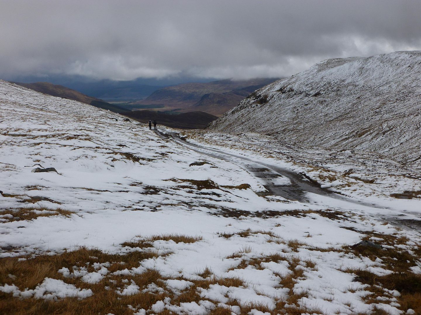
Following the military track down the glen
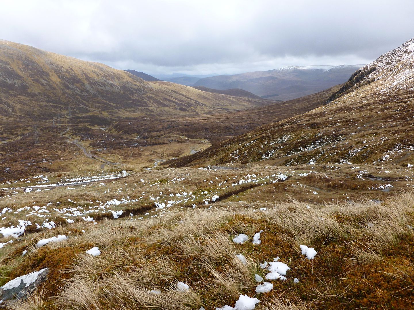
A welcome sight, Melgarve bothy
Cosy
We followed David and Sue all the way to the bothy, they stopped for a brew but then pushed on to Garva Bridge I think. As the afternoon went on folk would come and go, by the time Mick and I called it a night there were four Challengers upstairs, two in the office room, two more outside in a tent, plus the other guy who’d turned up on his bike expecting it to be empty on a Monday night.
Fort Augustus to Melgarve
12.38 miles
913 metres of ascent
Day four was going to be high so we were a bit concerned about the recent weather, neither of us were kitted out for winter walking but the only alternative was a forty odd mile detour on tarmac. We woke to a cracking day though, everyone at breakfast was raring to go again, we recovered our dry toasty gear from the drying rooms and packed up and left.
Heading for Glen Tarff, the rivers are looking a bit high today
Sunshine and blue skies
General Wades Military Road, a nice varied route as it turned out
One for Mick’s kids, apparently it looks like Balamory?
Looking west
Looking east over Loch Ness and Fort Augustus
The start of our climb up the Corrieyairack
The Corrieyairack Pass was a pleasant surprise, having watched some vids and read about it during our planning, the surface had been sorted out recently and the going was good. We stopped off at Blackburn bothy on our way up the pass, it was a really nice place but a couple of folk had been stranded here the night before and had to turn back. We met second time Challengers David & Sue, had a quick brew and some scoff and we were on our way again, a fast flowing river crossing in the first few minutes got the legs going. Up and up we went, switchback after switchback, eventually we reached the level of the clouds and into the snow showers. The cloud got thicker and thicker as we went up, snow was starting to appear on the ground and I was wishing I was wearing boots rather than light trainers.
Corrieyairack Pass, nearing the summit (still following powerlines)
Descending from the other side
Following the military track down the glen
A welcome sight, Melgarve bothy
Cosy
We followed David and Sue all the way to the bothy, they stopped for a brew but then pushed on to Garva Bridge I think. As the afternoon went on folk would come and go, by the time Mick and I called it a night there were four Challengers upstairs, two in the office room, two more outside in a tent, plus the other guy who’d turned up on his bike expecting it to be empty on a Monday night.
Last edited:
Rich said:... smoked a soggy rolly.
Another time (another century!), another place (totally different geography), smilar circumstances; the soggy ciggy is a certain boost.
Love it, Rich.
Keep it up.
Following this avidly.
Just read it all in one go, including the planning and kit part which I read before when you posted it. Well done. It will live in your memory for ever I should think. I've never done this route, but you got me happily thinking about some of my own past adventures.
Thank you very much for taking the time and trouble to write it all up for us to share the vicarious pleasure.
Thank you very much for taking the time and trouble to write it all up for us to share the vicarious pleasure.
Tuesday 15th May - Day Five
Melgarve to Glentruim
15.78 miles
372 metres of ascent

Sleeping in the main room of the bothy we knew we probably wouldn’t get much of a lie in, when I woke up around 06:30 I gave Mick a shout and we got up and got sorted. I had a breakfast of cereal bars and Kenco while Mick was still persevering with the porridge. The other folk upstairs soon came down and the bothy was back to being busy and noisy again. Not wanting to waste an early rise we pressed on.
Hairy coo
The long straight road stretch down to Garva Bridge made my feet sore again in no time, I’d step onto the grass verge whenever it was flat enough just to give them a spongy break. The lad with the bike from the bothy came driving past in his car after half an hour or so, he offered us a lift which was very tempting but we had to decline of course.
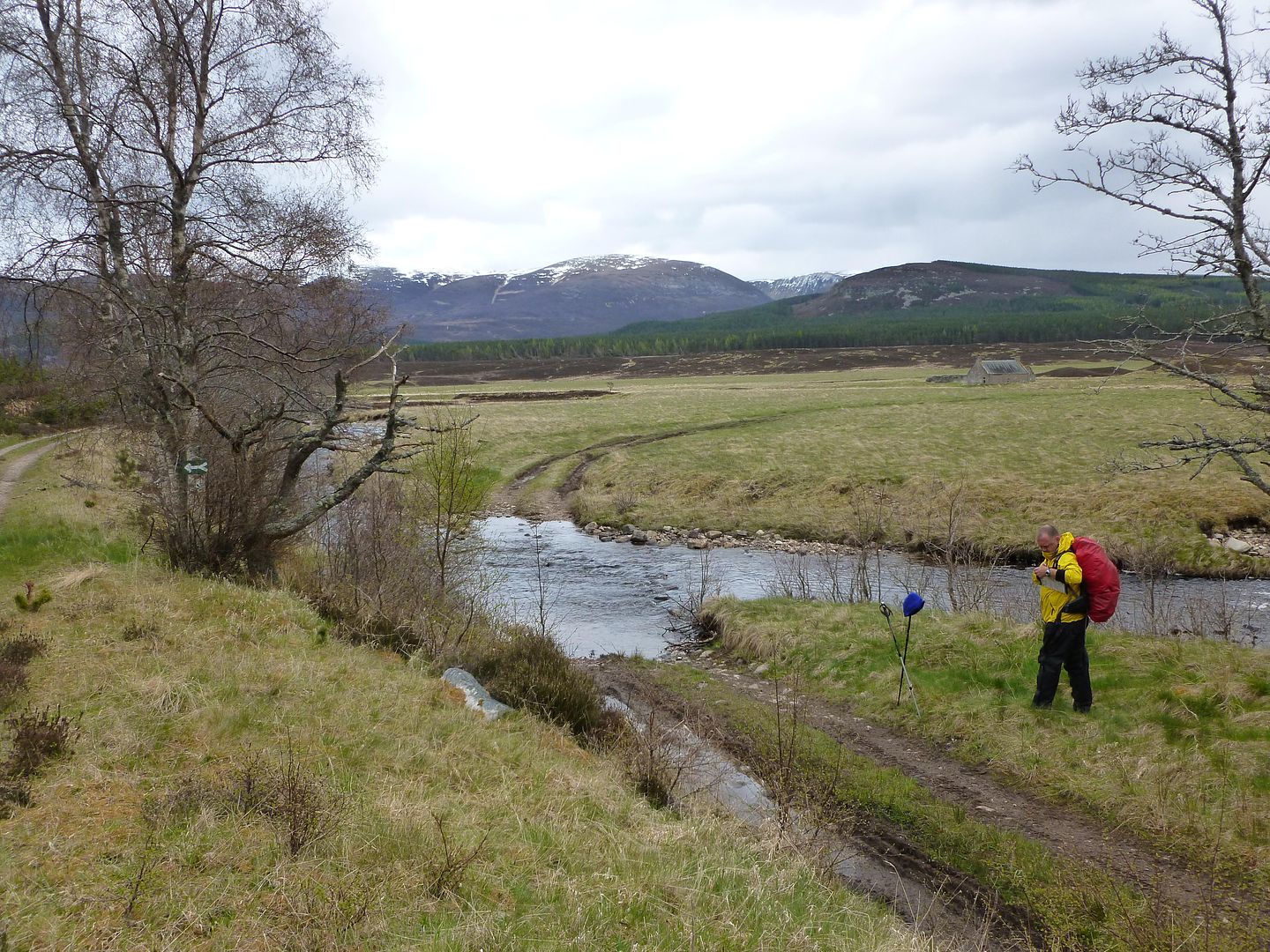
River Spey below Melgarve
River Spey from Garva Bridge
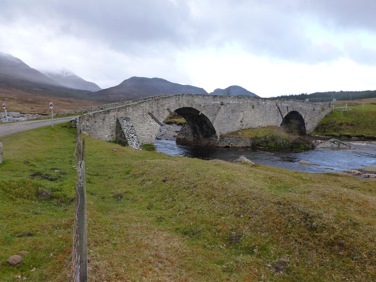
Garva Bridge
Mick & Martin near Sherrabeg
Doerupperer
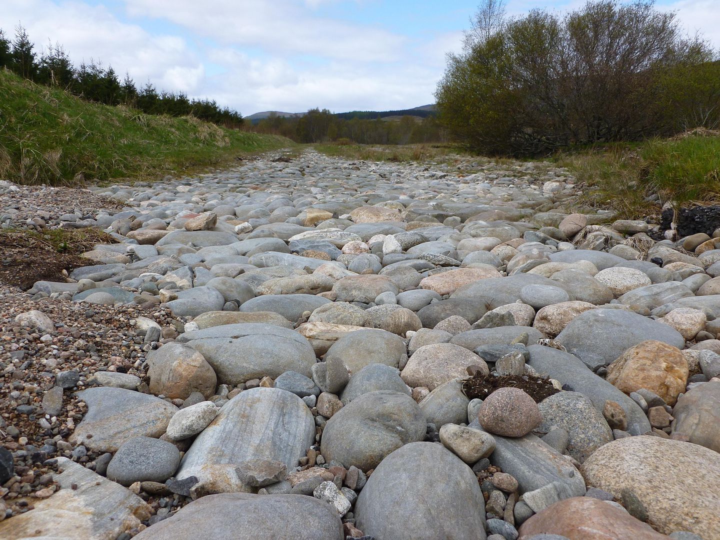
We were still following the course of Wades Road although it wasn’t as obvious now, sometimes it was lying under tarmac and sometimes it just disappeared into a field without any sign. “We stopped for an early lunch” had apparently told Mick on the train up that if we see any large round stones laid down then it’s likely to be the original road surface from the early 1700’s.
Old road
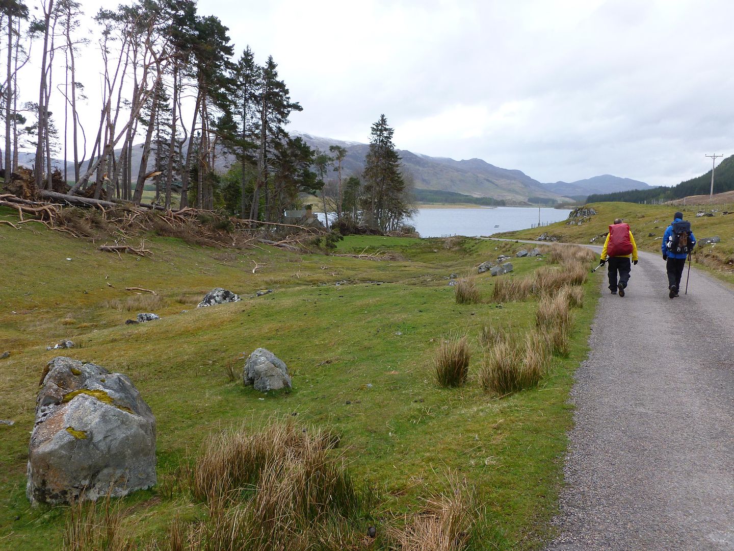
We seemed to be going in a different direction to a lot of folk once we neared Laggan, Martin took the popular road to Newtonmore while Mick and I headed for Glentruim. Much of it was road walking again, the later stages along quiet country lanes beside a river which wasn’t too bad. We stopped off at a posh pub and grabbed a coffee and some lunch, I can’t remember what was in the sandwich but it made a nice change to the dehydrated meals we’d been living on.
We reached the campsite at Glentruim in good time, too early to catch the shop open so we got the tents up and chilled out in the sun. Once the shop opened we were glad to see food parcel number 2 had also arrived, along with shower gel, a fresh can of deodorant and a new gas cart for my stove. The evening was spent in my Trailstar doing some admin stuff and generally pigging out on surplus supplies.
Wednesday 16th May - Day Six
Glentruim to Ruigh-aiteachain bothy
16.77 miles
546 metres of ascent

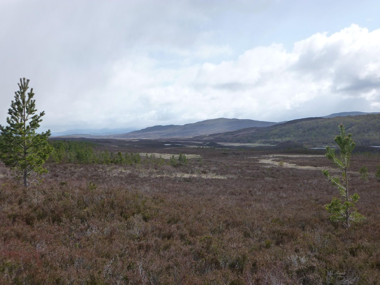
On paper this was going to be one of our nicest days, a mix of heather and woodland leading to the stunning Glen Feshie, from the pictures I’d seen it looked very similar to the Lin of Dee area I visited in the winter. After we left the campsite we picked up another branch of Wades Road and followed it across the heather moorland of Nuide Moss and on towards Ruthven.
Nuide Moss
We screwed up with the map reading once we’d crossed the moor, taking a left too soon and ending up on the grass verge of the A9 about half a kilometre too early. It wasn’t much fun walking head on towards trucks and getting a face full of dust, ten minutes or so later we managed to jump a fence and get off the main road.
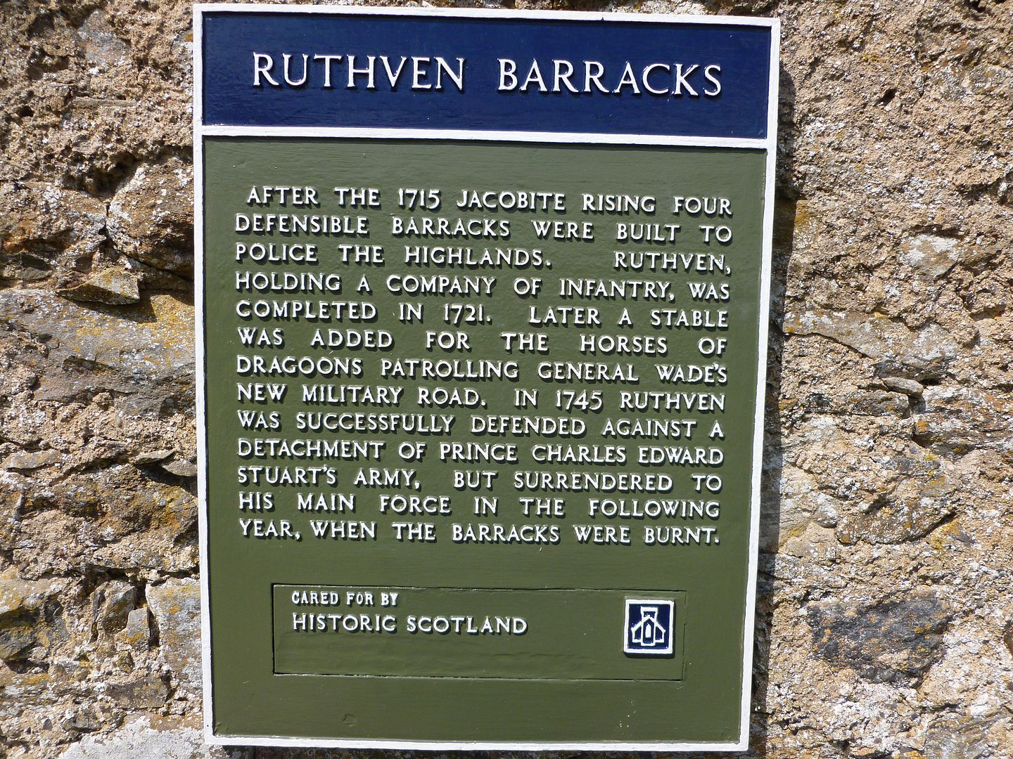
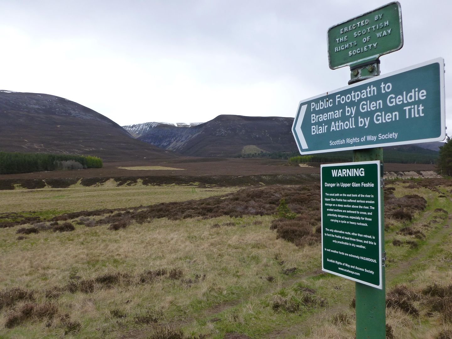
Sign at Ruthven Barracks
We stopped for some lunch at the barracks, enjoying the sunshine between showers, I had peanut butter and chocolate spread on oatcakes, Mick was playing safe with Primula.
Lunch over
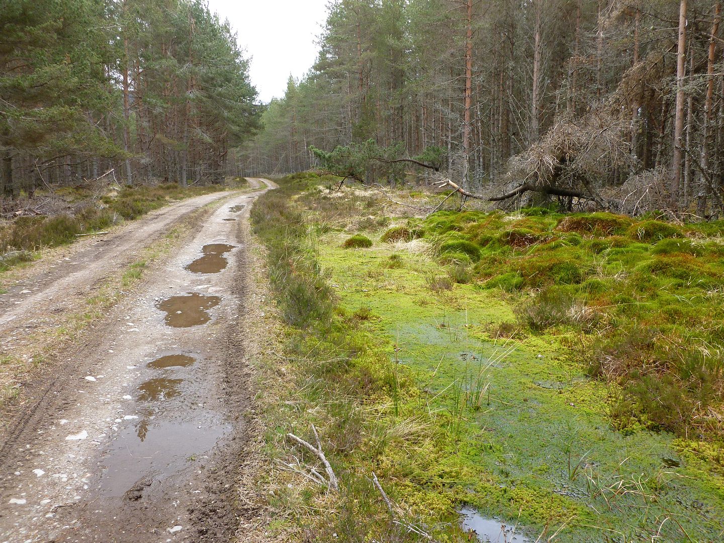
Wooded path near Tromie Bridge
Easy going forestry tracks
Brew stop at Baileguish
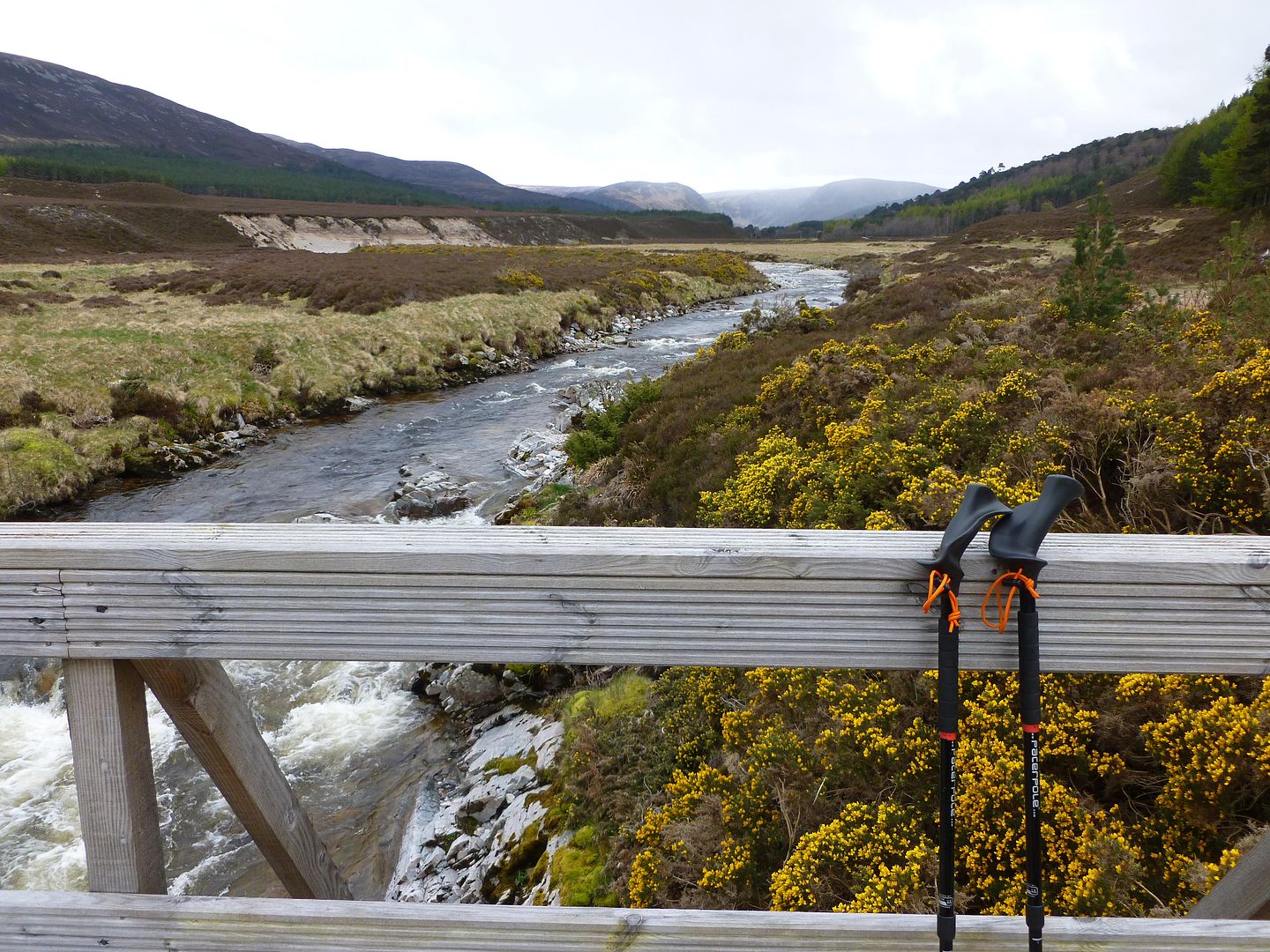
Bridge over the Allt Fhearnasdail
Mosses
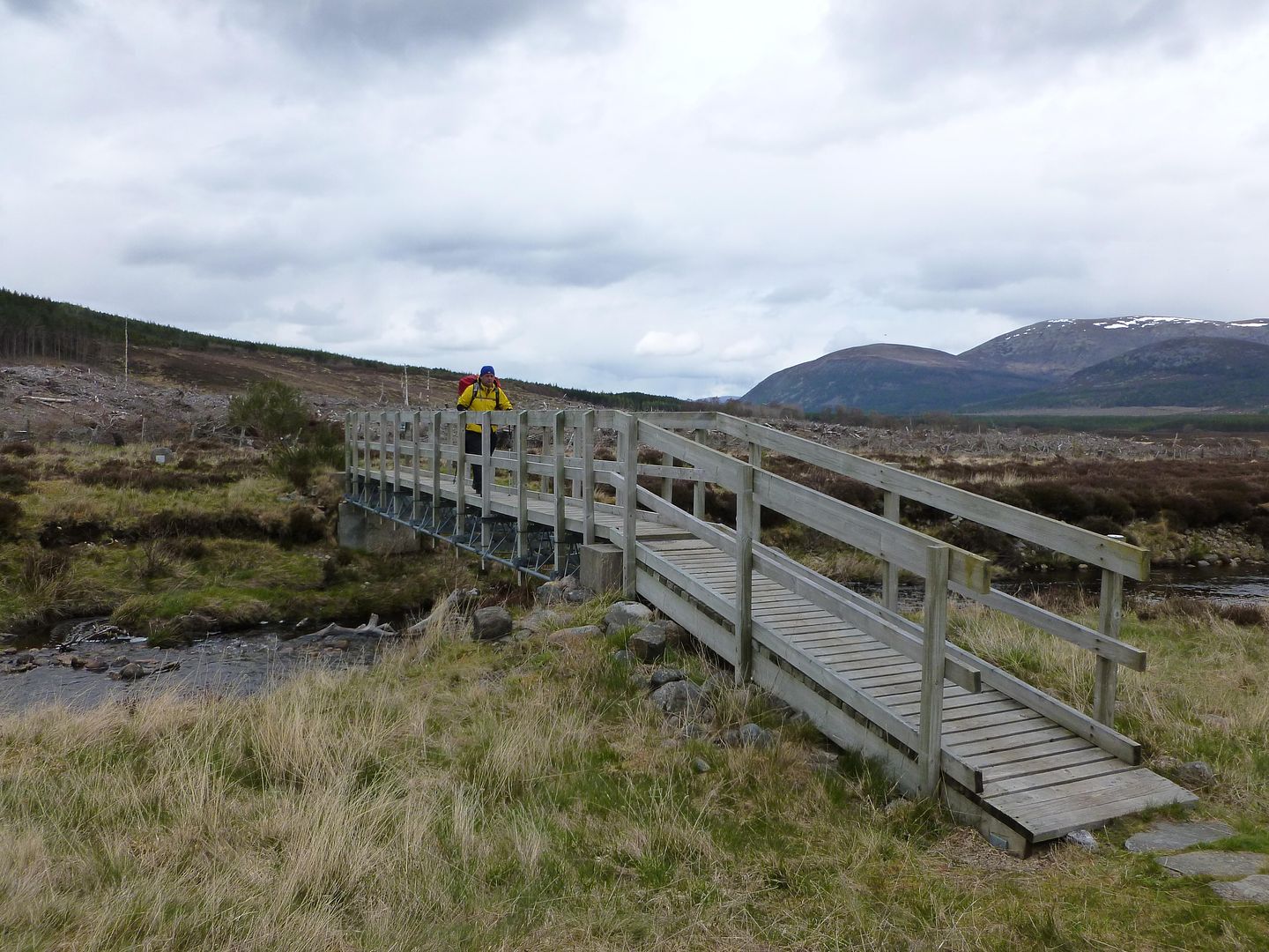
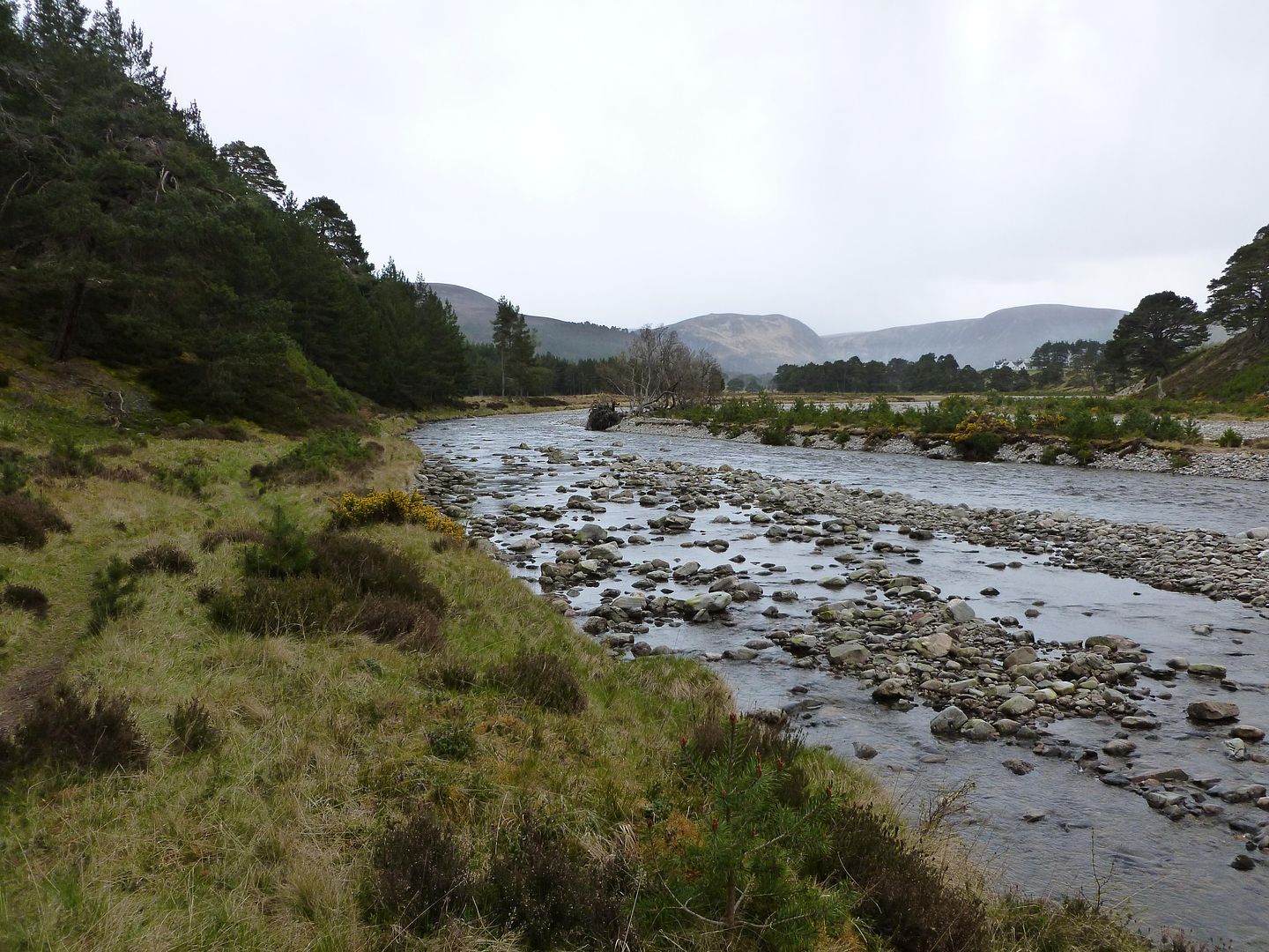
Out of the last forestry and into the head of Glen Feshie
Sticks and gorse
River Feshie
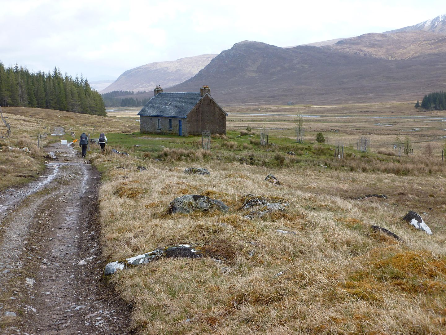
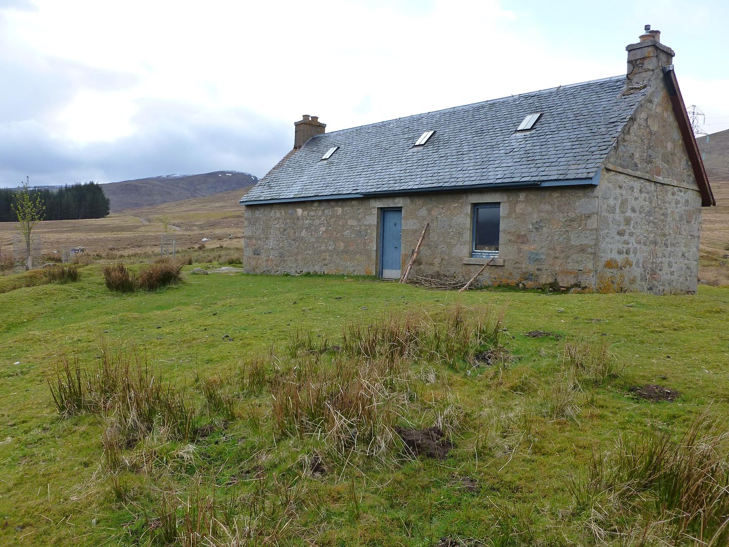
Ruigh-aiteachain bothy, and some random horses
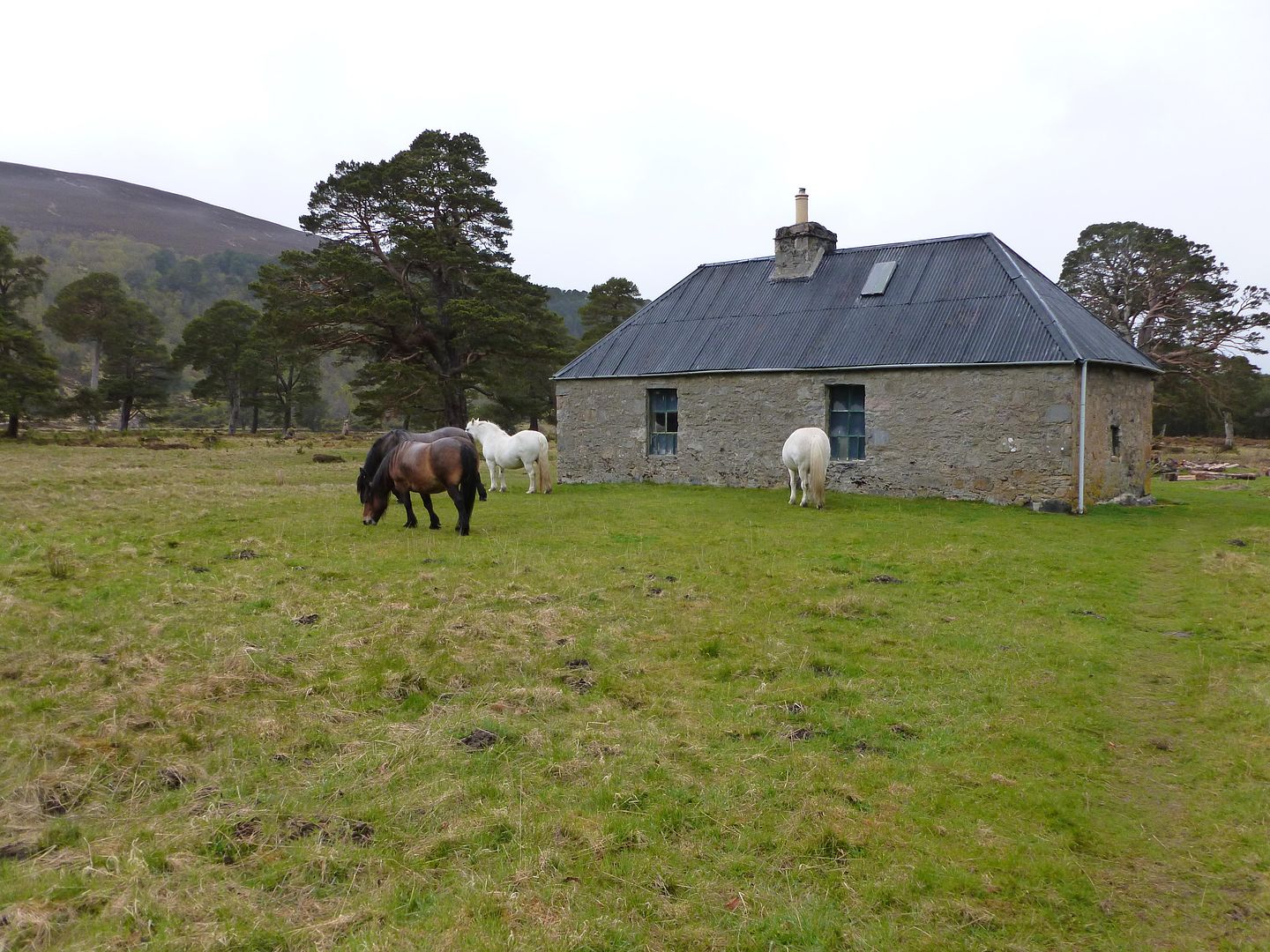
Home for the night
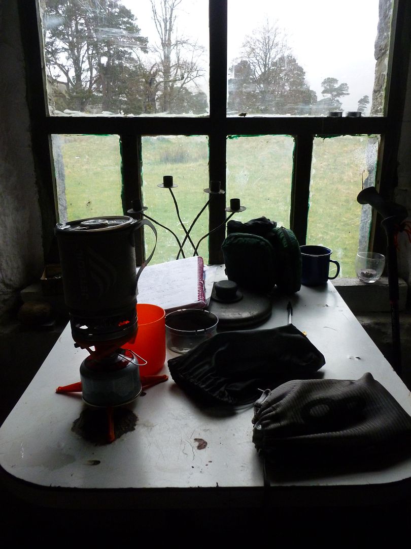
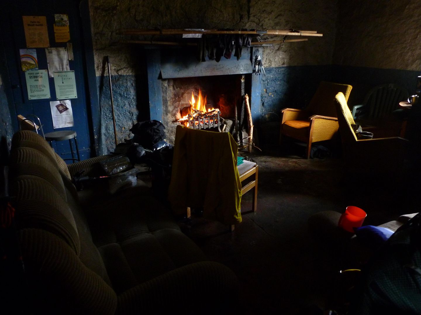
All the mod cons
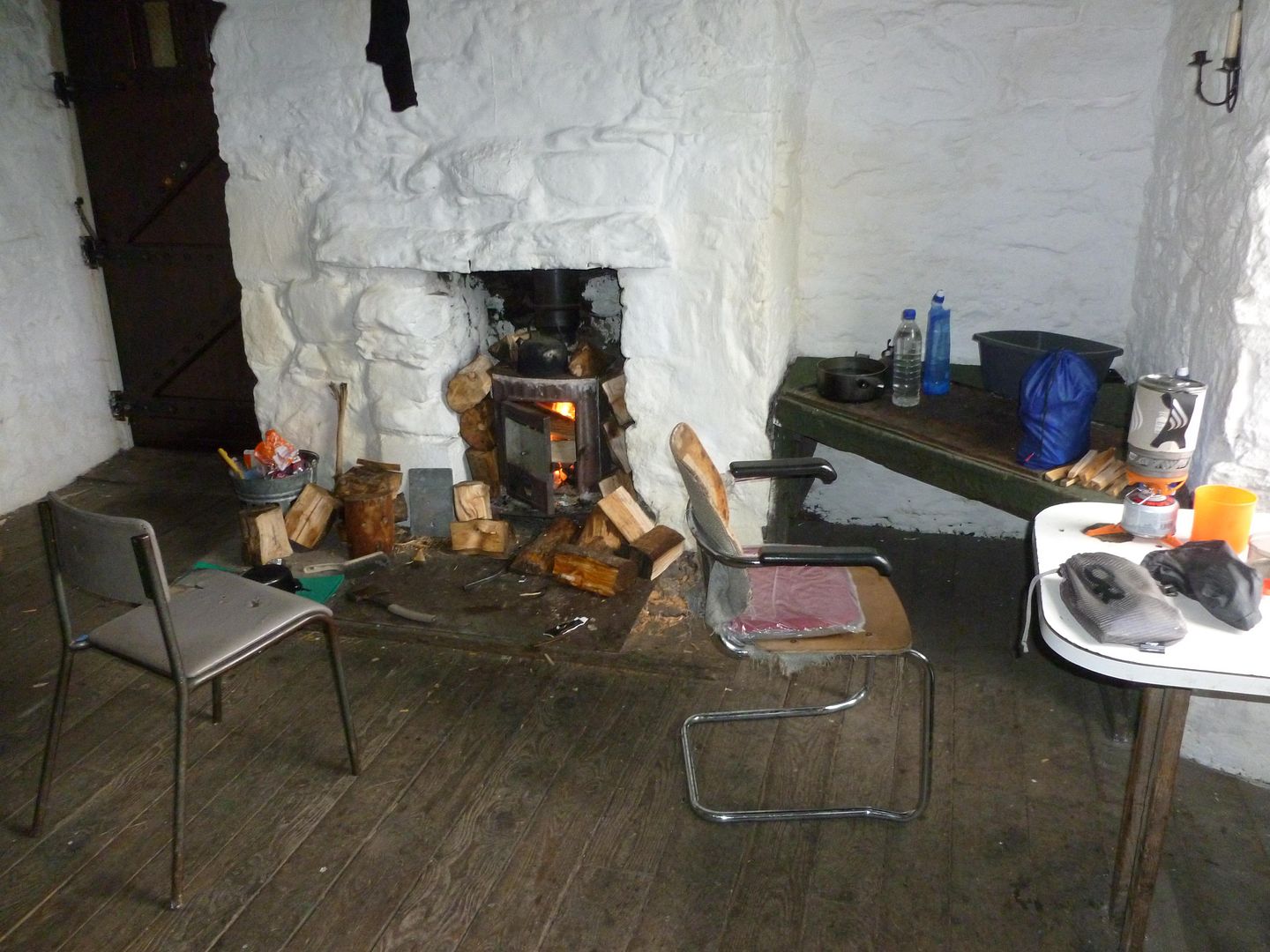
When we reached the bothy we were surprised to find it unoccupied, we knew it was a popular route through to Braemar but it looked like we were going to have the place to ourselves. I checked the guestbook to find David and Sue had already passed through earlier in the day, and another Challenger who I’d heard pulled out at Blackburn bothy and had to retire, good on him for getting out again.
There was a huge pile of logs stacked up outside the door plus an axe and a good selection of saws hanging up. We got our kit laid out on the two sleeping platforms in the main room and chilled out by the fire. The damp pine logs would burn but it was a struggle to get much heat out of the cast iron burner, we found it best to keep the logs small and stacked them up around the outside of the fire. We’d go outside every now and then to watch the rain bounce down and to see if there were any Challengers limping in. One of the wild ponies had a bad case of wind which was hilarious, I suppose you had to be there though.
Nobody else showed up that night so we were spoilt, we later found out that the night after there were sixteen Challengers staying at the bothy, ten or so on the sleeping bunks and the rest outside camping.
Melgarve to Glentruim
15.78 miles
372 metres of ascent
Sleeping in the main room of the bothy we knew we probably wouldn’t get much of a lie in, when I woke up around 06:30 I gave Mick a shout and we got up and got sorted. I had a breakfast of cereal bars and Kenco while Mick was still persevering with the porridge. The other folk upstairs soon came down and the bothy was back to being busy and noisy again. Not wanting to waste an early rise we pressed on.
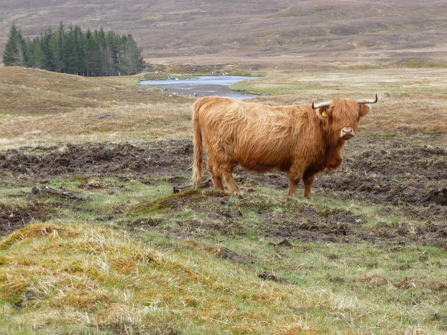
Hairy coo
The long straight road stretch down to Garva Bridge made my feet sore again in no time, I’d step onto the grass verge whenever it was flat enough just to give them a spongy break. The lad with the bike from the bothy came driving past in his car after half an hour or so, he offered us a lift which was very tempting but we had to decline of course.
River Spey below Melgarve
River Spey from Garva Bridge
Garva Bridge
Mick & Martin near Sherrabeg
Doerupperer
We were still following the course of Wades Road although it wasn’t as obvious now, sometimes it was lying under tarmac and sometimes it just disappeared into a field without any sign. “We stopped for an early lunch” had apparently told Mick on the train up that if we see any large round stones laid down then it’s likely to be the original road surface from the early 1700’s.
Old road
We seemed to be going in a different direction to a lot of folk once we neared Laggan, Martin took the popular road to Newtonmore while Mick and I headed for Glentruim. Much of it was road walking again, the later stages along quiet country lanes beside a river which wasn’t too bad. We stopped off at a posh pub and grabbed a coffee and some lunch, I can’t remember what was in the sandwich but it made a nice change to the dehydrated meals we’d been living on.
We reached the campsite at Glentruim in good time, too early to catch the shop open so we got the tents up and chilled out in the sun. Once the shop opened we were glad to see food parcel number 2 had also arrived, along with shower gel, a fresh can of deodorant and a new gas cart for my stove. The evening was spent in my Trailstar doing some admin stuff and generally pigging out on surplus supplies.
Wednesday 16th May - Day Six
Glentruim to Ruigh-aiteachain bothy
16.77 miles
546 metres of ascent
On paper this was going to be one of our nicest days, a mix of heather and woodland leading to the stunning Glen Feshie, from the pictures I’d seen it looked very similar to the Lin of Dee area I visited in the winter. After we left the campsite we picked up another branch of Wades Road and followed it across the heather moorland of Nuide Moss and on towards Ruthven.
Nuide Moss
We screwed up with the map reading once we’d crossed the moor, taking a left too soon and ending up on the grass verge of the A9 about half a kilometre too early. It wasn’t much fun walking head on towards trucks and getting a face full of dust, ten minutes or so later we managed to jump a fence and get off the main road.
Sign at Ruthven Barracks
We stopped for some lunch at the barracks, enjoying the sunshine between showers, I had peanut butter and chocolate spread on oatcakes, Mick was playing safe with Primula.
Lunch over
Wooded path near Tromie Bridge
Easy going forestry tracks
Brew stop at Baileguish
Bridge over the Allt Fhearnasdail
Mosses
Out of the last forestry and into the head of Glen Feshie
Sticks and gorse
River Feshie
Ruigh-aiteachain bothy, and some random horses
Home for the night
All the mod cons
When we reached the bothy we were surprised to find it unoccupied, we knew it was a popular route through to Braemar but it looked like we were going to have the place to ourselves. I checked the guestbook to find David and Sue had already passed through earlier in the day, and another Challenger who I’d heard pulled out at Blackburn bothy and had to retire, good on him for getting out again.
There was a huge pile of logs stacked up outside the door plus an axe and a good selection of saws hanging up. We got our kit laid out on the two sleeping platforms in the main room and chilled out by the fire. The damp pine logs would burn but it was a struggle to get much heat out of the cast iron burner, we found it best to keep the logs small and stacked them up around the outside of the fire. We’d go outside every now and then to watch the rain bounce down and to see if there were any Challengers limping in. One of the wild ponies had a bad case of wind which was hilarious, I suppose you had to be there though.
Nobody else showed up that night so we were spoilt, we later found out that the night after there were sixteen Challengers staying at the bothy, ten or so on the sleeping bunks and the rest outside camping.
Last edited:
From Fort Augustus on I was on the same route but a day behind because I started from Mallaig. The following night I was at Ruigh-aiteachain and it was a proper tent city, there must have been at least 15 pitched in addition to the full bothy. I didn't do much socialising though, I'd slipped and ditched full length in one of the small rivers feeding the Feshie a few km before the bothy so just wanted to get pitched and into dry clothes. You did really well getting under decent shelter that first Sunday, I walked over 40km to try and get into a B&B in Invergarry but ended up having to pitch at the site. It was tough at the end of a very long day with the ground squelching underfoot. I'd have done just about anything for proper shelter that night.
Similar threads
- Replies
- 6
- Views
- 901
- Replies
- 119
- Views
- 9K