I though I'd post a few photos of my recent walk and overnight stop in the hills of North Wales (2/3 May 2012). The purpose of this essay is to illustrate how quickly the weather can change and also to show that some of the best photo opportunities are to be found during periods of inclement weather. It's a pity I didn't take a decent camera but isn't that always the way. Anyway, as it was only a short walk of about 8 KM with 800 metres of ascent, I decided to have a late start at 6.15 PM. The start point was above the village of Nant Peris (grid ref SH606588).
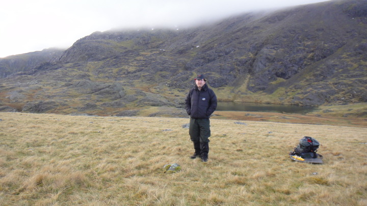
The start of the walk from outside the best mountaineering club hut in the UK.")
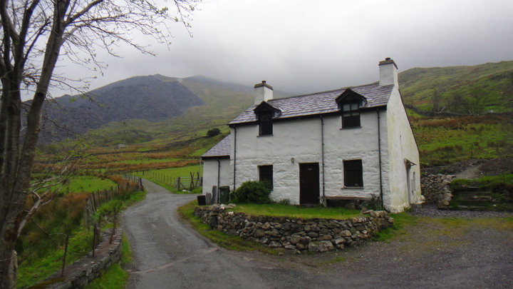
As you can see in the photo above the weather was overcast with low cloud (2500 - 3000 feet) and occasional rain.
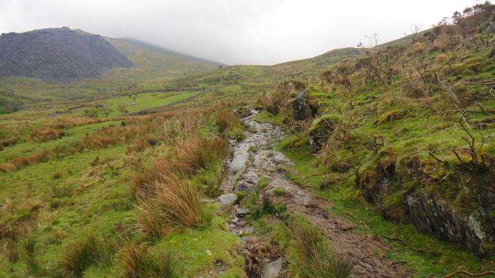
Following the lane to the left (above) I soon came to the footpath that follows the river up the valley. Below we can see how the footpath is turning into a mini river.
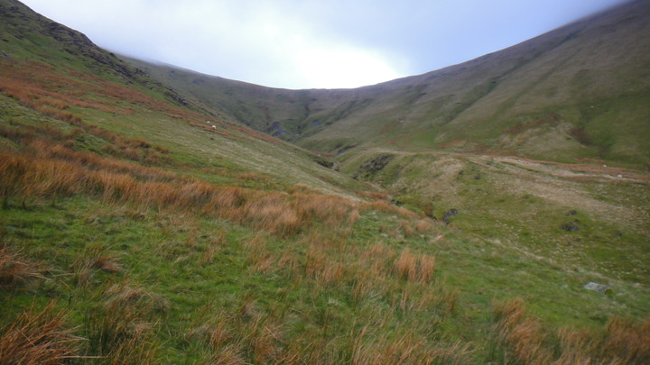
Looking back down the valley we can see that the cloud base is at about 2500 feet.
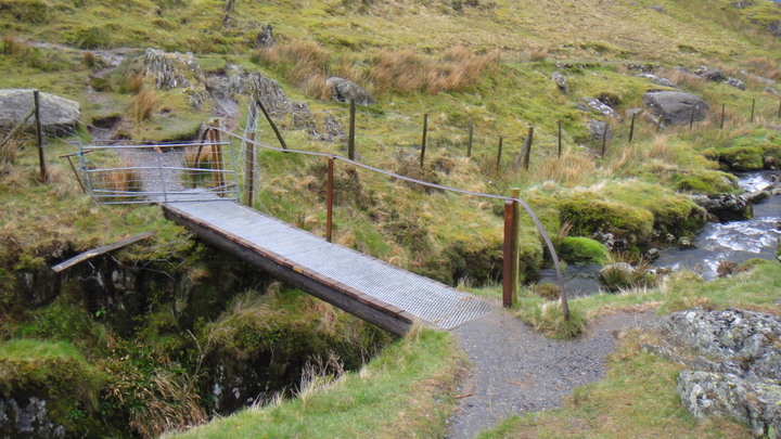
At grid ref SH612599 I arrived at the old bridge crossing the river. The bridge is made from two telegraph poles and some reclaimed ironwork from the quarries.
At about 7.15 PM I'm approaching the head of the valley - Bwlch Y Brecan (Pass of the Blanket?) The cloud has lifted and a bit of blue sky is visible.
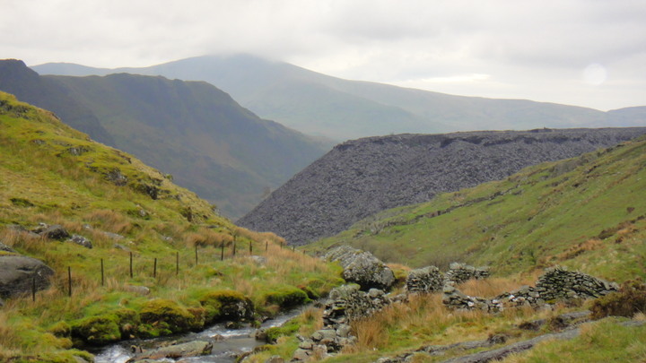
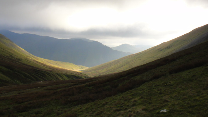
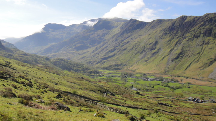
Looking back down the valley, the view is brightened by the breaking clouds. This is a classic U-shaped hanging valley, formed by the forces of glaciation acting on a V-shaped valley.
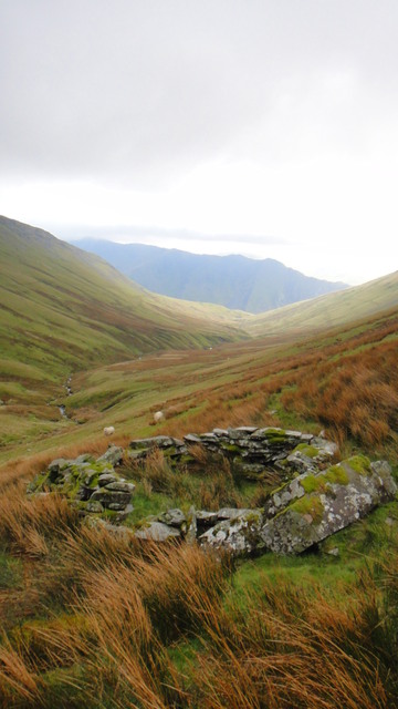
Looking back down the valley, old sheep pen? in the foreground. The time was now 7.40 PM. Notice how it has got lighter and brighter as the cloud has lifted.
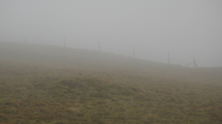
At 8.15 PM I arrived at the top of the valley (Bwlch Y Brecan), notice that I am now back in cloud/fog. On the other side of the fence is a 'quick' way down. (grid ref SH624616)
Navigation was not a problem despite the weather. I know the area very well but it is still very easy to get disorientated if you get careless.
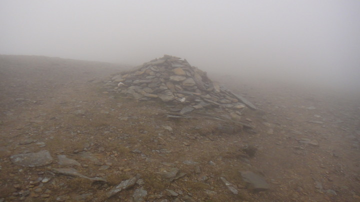
The route is well waymarked with cairns alongside the well worn (eroded) path. I'm not sure if I'm for or against the use of cairns however they did prove useful, I didn't look at a map once on the journey!
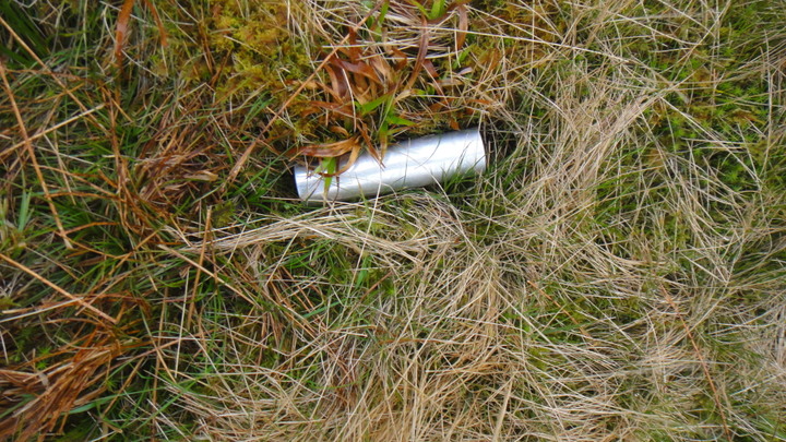
The headend of the valley is obviously a place where the LLanberis Mountain Rescue team practice their helicopter drills, below is a photo of one of their flares. Keep up the good work but kindly remove your litter from my country.
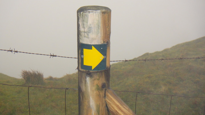
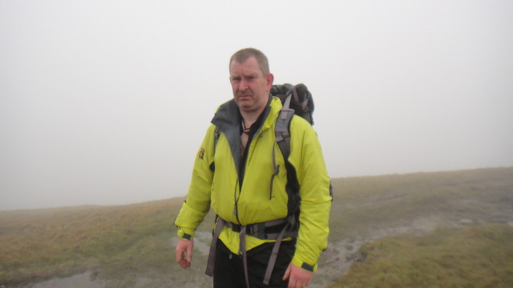
A face only a blind mother could love; the camera was rested on the marker post shown above. Notice how the path is waterlogged. Appologies for the jacket, they were on sale. I guess the colour was not proving popular with the punters. It's a Paramo Quito jacket like the one Pete (Teepee) took to Norway.
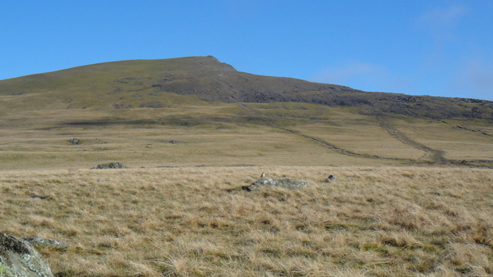
I now had a 2Km walk due south with a climb of 150 metres to the summit of Y Garn (947 metres).
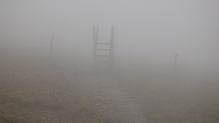
A Stile appears out of the mist.
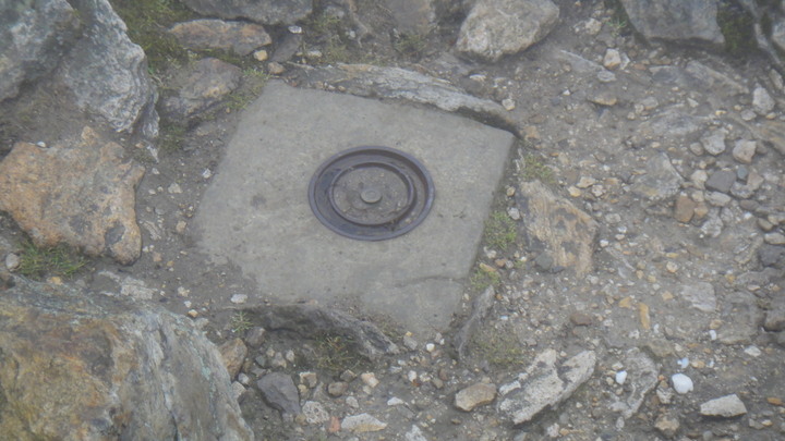
At 8.50PM I reached the summit of Y Garn, note the old survey kit concreted in place.
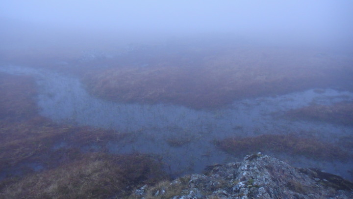
I didn't linger at the top as I was running out of daylight. I carried on south south east for about 1.5Km down to the little lake at 710 metres, LLyn Y Cwn (Lake of the Dogs) at grid ref SH637585. This is a popular bivi site above 'The Devil's Kitchin'. Below is the area where I have camped in the past, obviously in drier times. The thick mist/fog/cloud was making photography difficult.
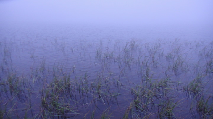
Reeds at the edge of the lake in the mist
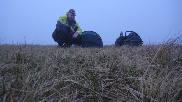
So, as I've been preaching for 30 years or more, as soon as you arrive at your camp site you must sort out your shelter. I was using a double hooped bivi made in the UK by Terra Nova. I purchased the bivi for times when I could not trust my (lighter) 3 season tent.
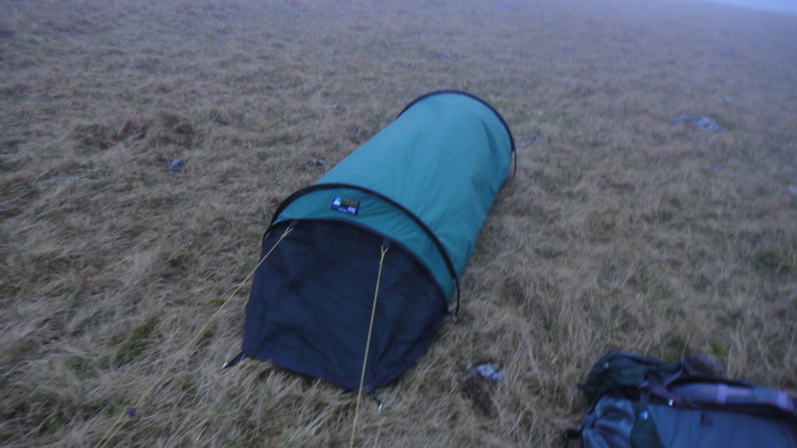
It's not as big as I'd hoped, and no, I'm not a giant. Excuse the photo, I had to rest the camera on the nearest rock. My kipmat was placed under the tent to give me more room inside.
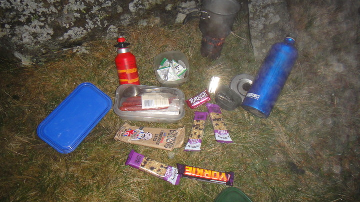
Once my accommodation was sorted it was time for tea. The stove was an Evernew meths stove, the cookware was a Primus aluminium pot. My evening meal consisted of a Chorizo type sausage and a steak pie followed by a dessert of liquorice, chocolate and flapjacks. Tea was brewed and served with UHT milk from a little triangular carton, it reminded me of the milk we got in school in the 60s and 70s. If you didn't get milk at school blame Maggie Thatcher, Milk Snatcher. Notice how the flash is reflecting off the mist!
By 10 PM I was in my 3-season sleeping bag and asleep soon after. I was hoping for an early start but this was foiled by my new found ability to sleep until 0705 AM! Temperature at night had fallen to just above zero (Centigrade).
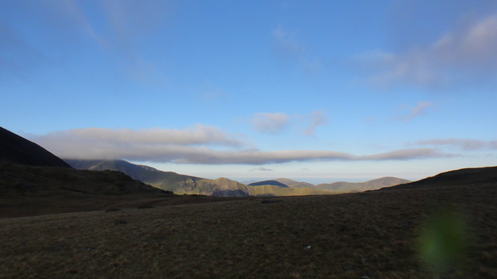
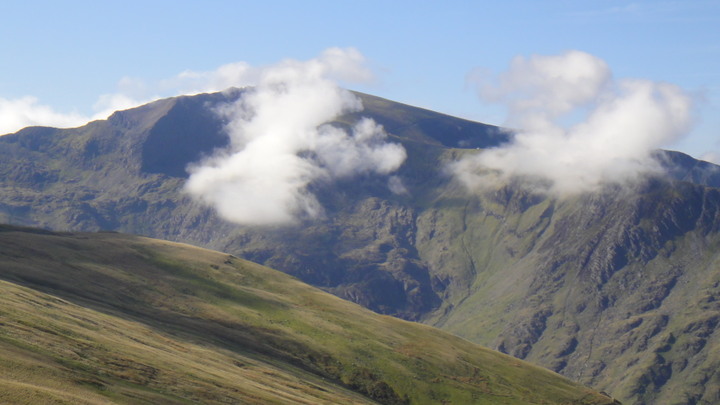
This was the view that greeted me on my exit from the bivi. The mountain on the left in cloud is Snowdon.
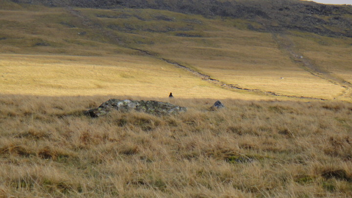
I was joined for breakfast by a raven, you can just make it out in the centre of frame.
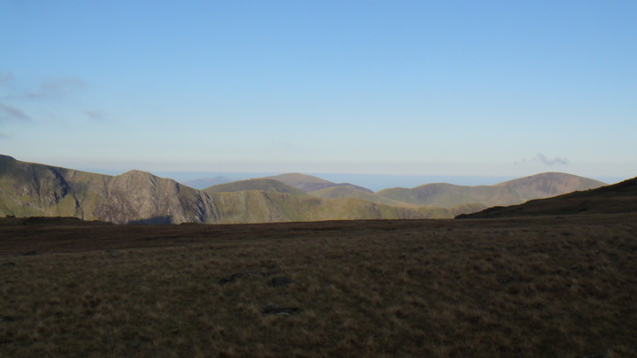
This was the view to the west
While this was looking to the east, Pen Yr Ole Wen (Head of the White Slope) 978 metres high.
The view north up Y Garn (The Cairn) was perfectly clear. The bird in the middle of frame on the rock is a Wheatear. When viewed from above (or from behind) you can understand where their name is derived from (white ar5e). I was fortunate to see a number of the on the cliffs below me, a fantastic site for a closet birdwatcher like me.
After a quick breakfast of a fruit bar and a brew I packed my kit and took a quick photo. You can see the last of this year's snow behind me. I had a good down jacket on and I was not warm! Notice how high I had to move above the lake to find a dry spot.
It was now 8 AM and the light over Pen Yr Ole Wen was improving.
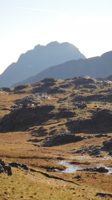
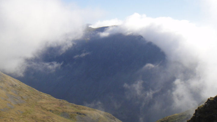
Tryfan (Three Peaks 3010 feet) started to appear out of the mist.
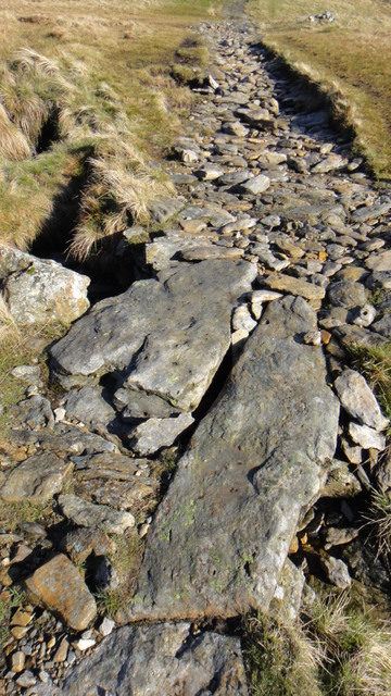
Much as I'd have liked to, I couldn't hang around all day so I set off on the well used path. Much of the path is paved due to errosion problems.
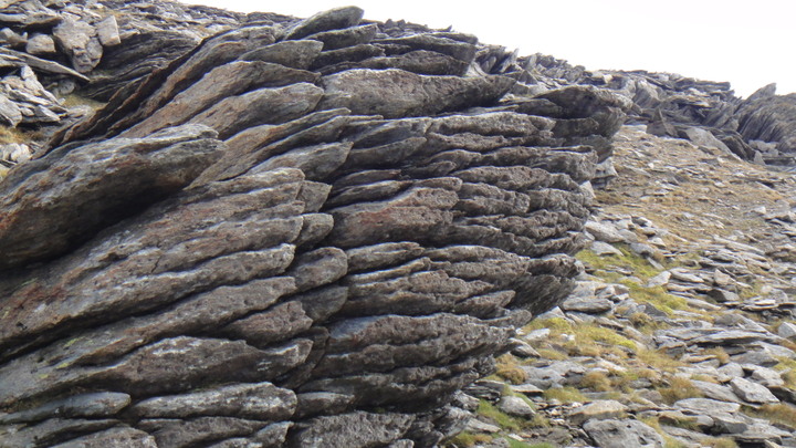
I'm sure this area must be a geologist's dream, a rock at the side of the path up Y Garn.
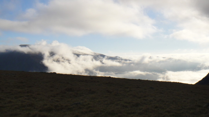
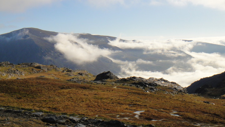
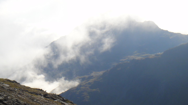
It didn't take long for the mist to return, this is Tryfan again, viewed from Y Garn. This rapid change of conditions must be expected in these coastal mountains.
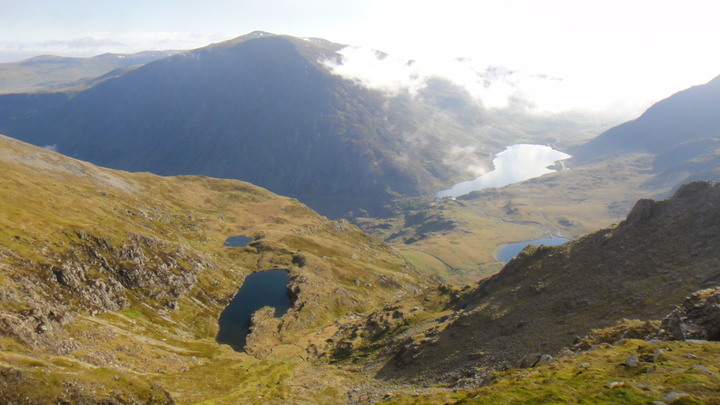
And 10 minutes later the view down the Ogwen Valley cleared up again! From left to right we have LLyn Clyd, Llyn Idwal and Llyn Ogwen. (Sheltered Lake, Lake of Idwal, Lake of Ogwen?) Llyn Ogwen, the largest lake in the photo is barely 3 metres deep but does contain excellent trout.
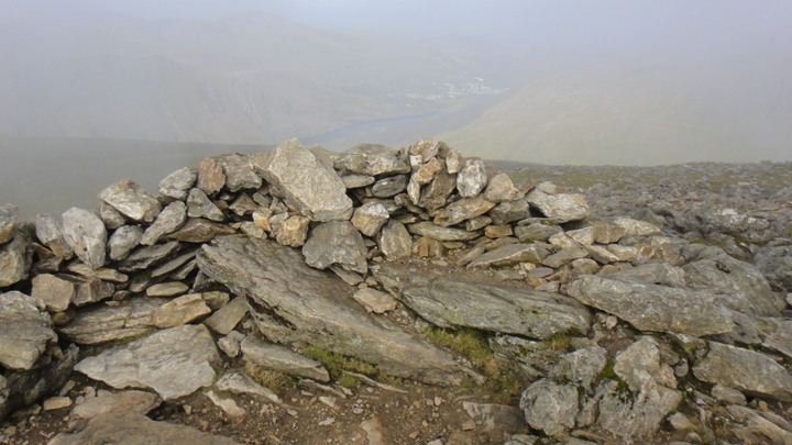
This is the stone shelter at the top of Y Garn, notice how the haze is increasing in the background, you can barely see the village of Llanberis at the foot of the lake.
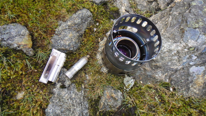
I stopped for a brew on the top of Y Garn. The removeable wick of the Imco lighter is useful for lighting the meths stove, much easier than using a Zippo.
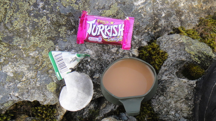
You can't have too many photos of brew kits. I like those folding cups but can you get bigger ones?
My final view of Pen Yr Ole Wen before descending, note how it is now enveloped in mist after being clear 30 minutes earlier.
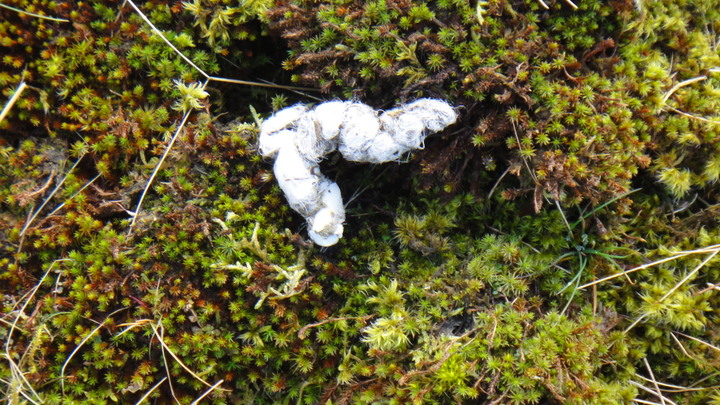
Here's a wool based turd I passed (walked past) on the way down. Fox?
Another look at Snowdon as I descend.
Here's a view of snowdon emerging from the last of the cloud.
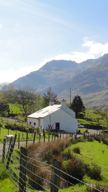
And after an uneventful walk down I approached my club hut; Crib Goch (Red Ridge) on snowdon in the background.
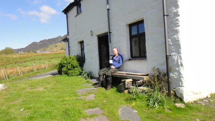
And finally a brew at my mountaineering club hut at 10 AM. I need a few brews before I start a day's work.
The start of the walk from outside the best mountaineering club hut in the UK.
As you can see in the photo above the weather was overcast with low cloud (2500 - 3000 feet) and occasional rain.
Following the lane to the left (above) I soon came to the footpath that follows the river up the valley. Below we can see how the footpath is turning into a mini river.
Looking back down the valley we can see that the cloud base is at about 2500 feet.
At grid ref SH612599 I arrived at the old bridge crossing the river. The bridge is made from two telegraph poles and some reclaimed ironwork from the quarries.
At about 7.15 PM I'm approaching the head of the valley - Bwlch Y Brecan (Pass of the Blanket?) The cloud has lifted and a bit of blue sky is visible.
Looking back down the valley, the view is brightened by the breaking clouds. This is a classic U-shaped hanging valley, formed by the forces of glaciation acting on a V-shaped valley.
Looking back down the valley, old sheep pen? in the foreground. The time was now 7.40 PM. Notice how it has got lighter and brighter as the cloud has lifted.
At 8.15 PM I arrived at the top of the valley (Bwlch Y Brecan), notice that I am now back in cloud/fog. On the other side of the fence is a 'quick' way down. (grid ref SH624616)
Navigation was not a problem despite the weather. I know the area very well but it is still very easy to get disorientated if you get careless.
The route is well waymarked with cairns alongside the well worn (eroded) path. I'm not sure if I'm for or against the use of cairns however they did prove useful, I didn't look at a map once on the journey!
The headend of the valley is obviously a place where the LLanberis Mountain Rescue team practice their helicopter drills, below is a photo of one of their flares. Keep up the good work but kindly remove your litter from my country.
A face only a blind mother could love; the camera was rested on the marker post shown above. Notice how the path is waterlogged. Appologies for the jacket, they were on sale. I guess the colour was not proving popular with the punters. It's a Paramo Quito jacket like the one Pete (Teepee) took to Norway.
I now had a 2Km walk due south with a climb of 150 metres to the summit of Y Garn (947 metres).
A Stile appears out of the mist.
At 8.50PM I reached the summit of Y Garn, note the old survey kit concreted in place.
I didn't linger at the top as I was running out of daylight. I carried on south south east for about 1.5Km down to the little lake at 710 metres, LLyn Y Cwn (Lake of the Dogs) at grid ref SH637585. This is a popular bivi site above 'The Devil's Kitchin'. Below is the area where I have camped in the past, obviously in drier times. The thick mist/fog/cloud was making photography difficult.
Reeds at the edge of the lake in the mist
So, as I've been preaching for 30 years or more, as soon as you arrive at your camp site you must sort out your shelter. I was using a double hooped bivi made in the UK by Terra Nova. I purchased the bivi for times when I could not trust my (lighter) 3 season tent.
It's not as big as I'd hoped, and no, I'm not a giant. Excuse the photo, I had to rest the camera on the nearest rock. My kipmat was placed under the tent to give me more room inside.
Once my accommodation was sorted it was time for tea. The stove was an Evernew meths stove, the cookware was a Primus aluminium pot. My evening meal consisted of a Chorizo type sausage and a steak pie followed by a dessert of liquorice, chocolate and flapjacks. Tea was brewed and served with UHT milk from a little triangular carton, it reminded me of the milk we got in school in the 60s and 70s. If you didn't get milk at school blame Maggie Thatcher, Milk Snatcher.
Notice how the flash is reflecting off the mist!
By 10 PM I was in my 3-season sleeping bag and asleep soon after. I was hoping for an early start but this was foiled by my new found ability to sleep until 0705 AM! Temperature at night had fallen to just above zero (Centigrade).
This was the view that greeted me on my exit from the bivi. The mountain on the left in cloud is Snowdon.
I was joined for breakfast by a raven, you can just make it out in the centre of frame.
This was the view to the west
While this was looking to the east, Pen Yr Ole Wen (Head of the White Slope) 978 metres high.
The view north up Y Garn (The Cairn) was perfectly clear. The bird in the middle of frame on the rock is a Wheatear. When viewed from above (or from behind) you can understand where their name is derived from (white ar5e). I was fortunate to see a number of the on the cliffs below me, a fantastic site for a closet birdwatcher like me.
After a quick breakfast of a fruit bar and a brew I packed my kit and took a quick photo. You can see the last of this year's snow behind me. I had a good down jacket on and I was not warm! Notice how high I had to move above the lake to find a dry spot.
It was now 8 AM and the light over Pen Yr Ole Wen was improving.
Tryfan (Three Peaks 3010 feet) started to appear out of the mist.
Much as I'd have liked to, I couldn't hang around all day so I set off on the well used path. Much of the path is paved due to errosion problems.
I'm sure this area must be a geologist's dream, a rock at the side of the path up Y Garn.
It didn't take long for the mist to return, this is Tryfan again, viewed from Y Garn. This rapid change of conditions must be expected in these coastal mountains.
And 10 minutes later the view down the Ogwen Valley cleared up again! From left to right we have LLyn Clyd, Llyn Idwal and Llyn Ogwen. (Sheltered Lake, Lake of Idwal, Lake of Ogwen?) Llyn Ogwen, the largest lake in the photo is barely 3 metres deep but does contain excellent trout.
This is the stone shelter at the top of Y Garn, notice how the haze is increasing in the background, you can barely see the village of Llanberis at the foot of the lake.
I stopped for a brew on the top of Y Garn. The removeable wick of the Imco lighter is useful for lighting the meths stove, much easier than using a Zippo.
You can't have too many photos of brew kits. I like those folding cups but can you get bigger ones?
My final view of Pen Yr Ole Wen before descending, note how it is now enveloped in mist after being clear 30 minutes earlier.
Here's a wool based turd I passed (walked past) on the way down. Fox?
Another look at Snowdon as I descend.
Here's a view of snowdon emerging from the last of the cloud.
And after an uneventful walk down I approached my club hut; Crib Goch (Red Ridge) on snowdon in the background.
And finally a brew at my mountaineering club hut at 10 AM. I need a few brews before I start a day's work.
Last edited:


