What do you think of GPS units?

  • Hey Guest, Early bird pricing on the Summer Moot (29th July - 10th August) available until April 6th, we'd love you to come. PLEASE CLICK HERE to early bird price and get more information.

What are your views on GPS receivers?

  • They are an essential piece of my kit

    Votes: 20 10.2%
  • They are important for navigation

    Votes: 23 11.7%
  • They are a handy backup

    Votes: 80 40.8%
  • I have one but don't use it much

    Votes: 28 14.3%
  • I don't have one and I'm not bothered either way

    Votes: 26 13.3%
  • I don't have one and I don't want one!

    Votes: 19 9.7%

  • Total voters
    196

Martyn

Bushcrafter through and through
Aug 7, 2003
5,252
33
58
staffordshire
www.britishblades.com
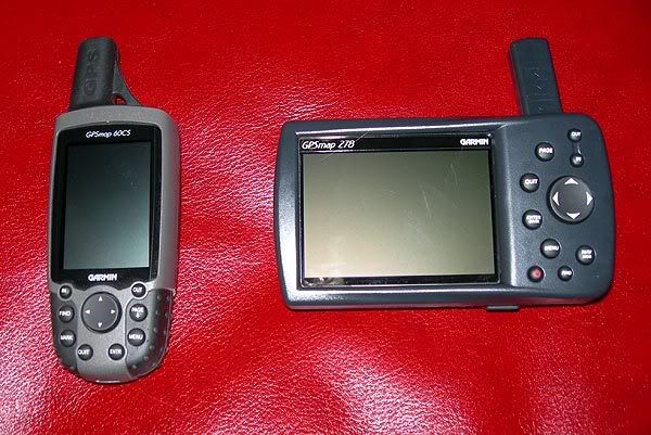
Here's a couple of pics of mine, a Garmin GPSmap278 for in me Landy and a Garmin GPSmap 60cs for in me bag...

both.jpg


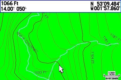
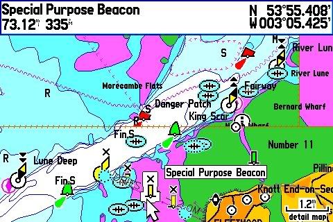
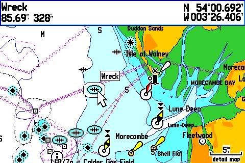
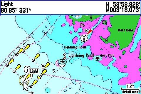
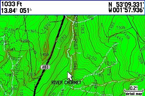
Screenies...

topographic maps....

grab005.jpg


grab004.jpg


Coastal Charts...

grab13.jpg


grab11.jpg


grab12.jpg


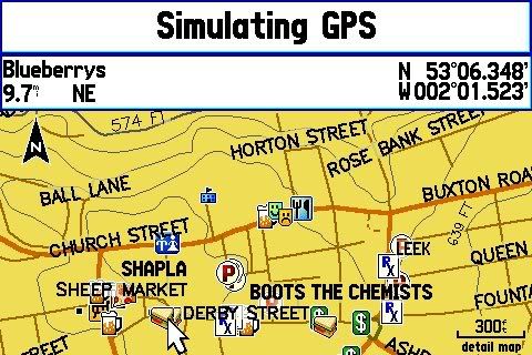
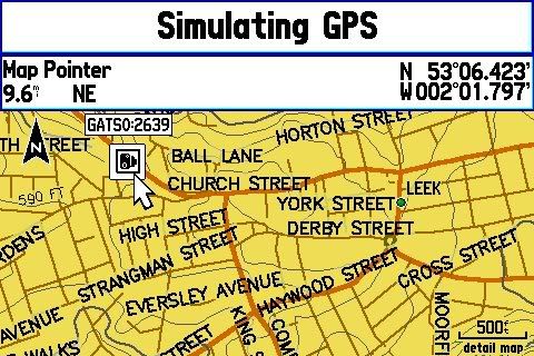
Street navigation...

grab007.jpg


grab006.jpg


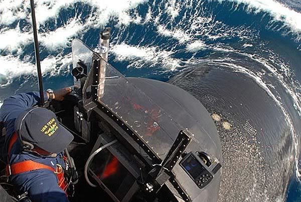
Oh and this is particularly cool. It's the conning tower of the USA's latest fast attack nuclear submarine with a GPSmap 278 stuck to the spray shield...

usstexas.jpg


;)
 

crazyclimber

Need to contact Admin...
Jul 20, 2007
571
2
UK / Qatar
Haha, what a pic!!
I guess someone's also mentioned Galileo - which may or may not be with us by their planned switch-on date of 2013
 

Scots_Charles_River

Bushcrafter (boy, I've got a lot to say!)
Dec 12, 2006
3,277
41
paddling a loch
www.flickr.com
Oh and this is particularly cool. It's the conning tower of the USA's latest fast attack nuclear submarine with a GPSmap 278 stuck to the spray shield...

usstexas.jpg


;)

It's a cool pic. Under military standing orders or something they probably have to have a 'visual lookout' whenever on the surface. Marks can move when navigating into port etc.

The have top secret gyroscope navigation as well.

Nick
 

Rebel

Native
Jun 12, 2005
1,052
6
Hertfordshire (UK)
Ray Mears uses a GPS so they must be good. ;) :D

Sorry, I couldn't resist.

I'm not sure why so many resist GPS. When you think about it good and accurate land maps are something that are created by advanced civilisations with lots of technical gear, they're not exactly primitive. GPS is another manufactured technical aid we can use to help us while it exists and we can use it just about anywhere in the world.

When I was out in the third world the maps were pretty bad (if they could be found at all) and most of the better ones had been made by colonialists or foreign companies. Often what could be found was out of date or only covered specific areas. I mention this because it proves the point that only wealthy nations with skilled technicians are able to produce maps with the detail and accuracy of something like OS.

I think traditional skills are good and useful but if you want to be really traditional then chuck out the compass and map and do it the way primitive tribes do.
 

mrstorey

Forager
I've got a Garmin Geko 201. I don't use it to navigate, really (although it has come in handy) but I use it to to 'record' my route as I go, then I can download the tracklog into my PC digital mapping software when I get home, and see where I ACTUALLY went. It's fun, and also a nice momento of my walks. Damn accurate too - I remember going for a pee stop on Sarn Helen once, and the tracklog faithfully shows me leaving the path, stopping for 30 seconds, then going back on the path and continuing :)

Oh, and because they eat power like stink, I use rechargeable batteries. It's better for the planet, and costs me less in the long run.

BTW, sounds obvious, but not everyone knows this. If your GPS doesn't have a clear 'line of sight' to the sky (rucksack, pocket, etc), it absolutely chews through batteries. So leave it clipped to the top of your bag or something if you want it to still be receiving after lunch.
 

spamel

Banned
Feb 15, 2005
6,833
21
48
Silkstone, Blighty!
My TonTom screamed at me the other day as I was wiothin 1 km of an ROC Post. Out came the torch and camera, and down into the bowels of the earth I went! they are pretty cool, so a GPS aid can be good as it tells you when you are near interesting things!
 

crazyclimber

Need to contact Admin...
Jul 20, 2007
571
2
UK / Qatar
My TonTom screamed at me the other day as I was wiothin 1 km of an ROC Post. Out came the torch and camera, and down into the bowels of the earth I went! they are pretty cool, so a GPS aid can be good as it tells you when you are near interesting things!

You have a database of them in your tomtom then? Are they on there as standard or is that something you've added?
That kinda thing's always interested me too
 

widu13

Bushcrafter (boy, I've got a lot to say!)
Feb 9, 2008
2,334
19
Ubique Quo Fas Et Gloria Ducunt
Why on earth would we use anything other than our feet for travelling? Far more reliable than vehiclular transport?...because like vehicular transport GPS is a useful tool. I rely on units for navigation and even my mobile phone has OS Maps on it. Batteries in constant use last 24 hrs plus. IMHO I can read maps, take brearings, triangulate etc like a demon (in mils and degrees), but why if I don't have to? Dont bother giving anything other than grids to any emergency services if you need to give them your location, as there are so many standards of fixing postitions it's unreal. GPS isn't essential but VERY useful.
 

spamel

Banned
Feb 15, 2005
6,833
21
48
Silkstone, Blighty!
You have a database of them in your tomtom then? Are they on there as standard or is that something you've added?
That kinda thing's always interested me too

Added later. That was fun, figuring out how to do that! I've only done one post so far, but there are many more that are in my sights, I'm thinking of visiting another and a HAA site on the same day. There are loads of them and it is quite interesting. One guy went down an ROC post and there are two waterproof issued rain jackets from eons back still hanging up! There is loads of kit in some of them, which is quite interesting to see. If anybody goes, try to stick to the same ethics that we use with bushcraft and don't take anything out of the Post.
 

crazyclimber

Need to contact Admin...
Jul 20, 2007
571
2
UK / Qatar
Added later. That was fun, figuring out how to do that! I've only done one post so far, but there are many more that are in my sights, I'm thinking of visiting another and a HAA site on the same day. There are loads of them and it is quite interesting. One guy went down an ROC post and there are two waterproof issued rain jackets from eons back still hanging up! There is loads of kit in some of them, which is quite interesting to see. If anybody goes, try to stick to the same ethics that we use with bushcraft and don't take anything out of the Post.

Cool, until I googled them earlier I never realised there were so many of them about. Task for an empty day!
One of the most interesting sites I've visited is Scotland's secret bunker near Anstruther. For anyone interested in cold war history I'd definitely recommend a visit. Slightly different in scale to the ROC posts ;)
 

Carbuncle

Forager
Jan 12, 2009
105
0
54
Merseyside
I'm a compass user, but I do get slightly irked by some of the nonsense that gets thrown about re. GPS.

The straw man that always gets thrown up is that it's Map + Compass vs GPS. With the exception of a few relatively recent units most GPS recievers don't give much in the way of mapping. I have the garmin vista hcx with the UK topo maps and the maps are only good for a little situational awareness. The reality is the debate should be map+compass vs map+gps. And it's not really that complicated a debate - a GPS tells you where you are and a compass tells you where you're pointing, and from each you can extrapolate the other, more or less. Both have their limitations - pricipally revolving around visibility, either of landmarks or the sky. And both have their reliability issues, and though compasses clearly have the advantage here, they're not foolproof. Functionally, GPS recievers are the winners though, being able to backtrack on your breadcrumb can be very handy, and if either fails, you'll have a better chance guessing direction.

Like I say, I use a map and compass, mainly because it's more pleasurable, and connects you with your surrounding landmarks. But I don't understand why people feel the need to create a caricature of GPS users, IF someone decides to wander off the beaten track without a paper map, that's a separate issue. Anyway, the best navigation tool is the ability to relate map to terrain, something two decades of practice has only left me mediocre at best, unfortunately ;-)
 

jonajuna

Banned
Jul 12, 2008
701
1
s
i use memorymap on my HTC touchHD winmo phone

i get OS mapping with my gps postition plotted ontop, plus all the normal gps stuff including compass through BeeLineGPS running in background, plus 3g interwebbing and video/phone calls

oh and if i want, i can sit and play solitaire :p

cant do any of that with a map and compass! (which i carry in case of my phone failing or getting bust)
 

bearbait

Full Member
GPS units are very useful for carrying out habitat and species surveys: you can concentrate on the purpose of the survey rather than painstaking nav.

They are also very useful, and are used by organisations such as mapaction.org, for rapid surveys when producing or updating/revising maps for Relief Organisations in a disaster area where navigational landmarks may no longer be visible or even be there, e.g. N'orlins after Katrina, Thailand and other locations in the Indian Ocean after the Tsunami, the Haiti 'quake and so on. And when the whole topography changes such as Mount St. Helens in the Pacific Northwest of the U.S.

See mapaction.org's website for some great info on how cartography plays a massive role in Disaster Management and Relief.

Despite the undoubted and accurate assistance a GPS unit provides you with, you still need a good grounding in navigational principles: magnetic variation (declination) and deviation, map scales and datums, etc. and be able to read a map!

I have a Garmin GPS60CSX and generally use it only for the stats when I do (what I call) arduous hikes, just so I can feel good about how much I ache afterwards! I also use it if I'm hiking somewhere where I have no map or a poor map - and then just as a backup: I still make notes or leave markers on the trail so I can backtrack. (And I carry a spare set of batteries.)

Incidentally I have rarely lost the signal on my unit, even in deep woods and valleys. I have it on the hip belt of my pack. If you lose the signal with your units, try mounting the unit higher on your pack, or use an external antenna clipped to your cap, or on a stick poking out of your pack.
 

jonnno

Forager
Mar 19, 2009
223
0
50
Belfast
That saved me alot of time :)

No-one with a GPS would ever think of venturing out with it alone but that's the accusation that always gets levelled. The question is what can you do if you end up with no map/compass or GPS. We were hiking a few weeks back and the map dropped into a river and it was only luck that we got it back. Do you have skills that can get you out of a tricky situation with absolutely no modern navigational aids should be the question.

On a side note, modern GPS with high sensitivity receivers are swift to lock and accurate and have a battery life (in my experience) of 12+ hours with moderate use. I use them to track where I've been as well as how long it will take to get where I'm going and being able to download the route to the PC when I get home is awesome - I keep them all!

Also, they enable us to to night hikes where visibility is so low that you wouldn't be overly safe with only a map and compass.

I'm a compass user, but I do get slightly irked by some of the nonsense that gets thrown about re. GPS.

The straw man that always gets thrown up is that it's Map + Compass vs GPS. With the exception of a few relatively recent units most GPS recievers don't give much in the way of mapping. I have the garmin vista hcx with the UK topo maps and the maps are only good for a little situational awareness. The reality is the debate should be map+compass vs map+gps. And it's not really that complicated a debate - a GPS tells you where you are and a compass tells you where you're pointing, and from each you can extrapolate the other, more or less. Both have their limitations - pricipally revolving around visibility, either of landmarks or the sky. And both have their reliability issues, and though compasses clearly have the advantage here, they're not foolproof. Functionally, GPS recievers are the winners though, being able to backtrack on your breadcrumb can be very handy, and if either fails, you'll have a better chance guessing direction.

Like I say, I use a map and compass, mainly because it's more pleasurable, and connects you with your surrounding landmarks. But I don't understand why people feel the need to create a caricature of GPS users, IF someone decides to wander off the beaten track without a paper map, that's a separate issue. Anyway, the best navigation tool is the ability to relate map to terrain, something two decades of practice has only left me mediocre at best, unfortunately ;-)
 

mitch66

Nomad
Mar 8, 2010
466
1
king's lynn norfolk
hi, i bought a gps for a bit of fun something's elce to play with, it's a bit flat here in norfolk. but found it very intresting bought a map & compass and the with the aid of the gps found out how to use the map and compass. i think its better to have one and not need it, than need it and not have it. this tread is like the .177 or .22 air gun cal debate. **** get both and have fun, i find they both complement each other. have fun carl
 
i have a GPS in my phone (nokia 5800) and is usefull specially in big citys (for me) also has a really nice app to track my training while running crosstrail or in the city :)

anyway, i never use it to actually navigate in the woods, localwoods are too well known, and in others not really useful since the phone cant work gps for more that a few hours before running out of battery

Esteban
 

susi

Nomad
Jul 23, 2008
421
0
Finland
I find it a useful tool for measuring how far we've walked through forest, or other places where it is cross-country and you make your own path.
My main concern though, is that the sun is entering a more active phase. This could result in two things: 1. solar flashes which can totally blank out the signal for periods of hours, and 2. general increased activity in the ionosphere, which hinders the time stamp signal and thus reduces accuracy.
 

BCUK Shop

We have a a number of knives, T-Shirts and other items for sale.

SHOP HERE