Monday the 9[SUP]th[/SUP] of July found me getting up early and driving from Weston Super Mare over to The Brecon Beacons for a day out on the hills.
I parked up in the Pont ar Daf car park about ½ a k below the Storey Arms a quick check of my kit and a Banana for a pre walk snack and I was off.
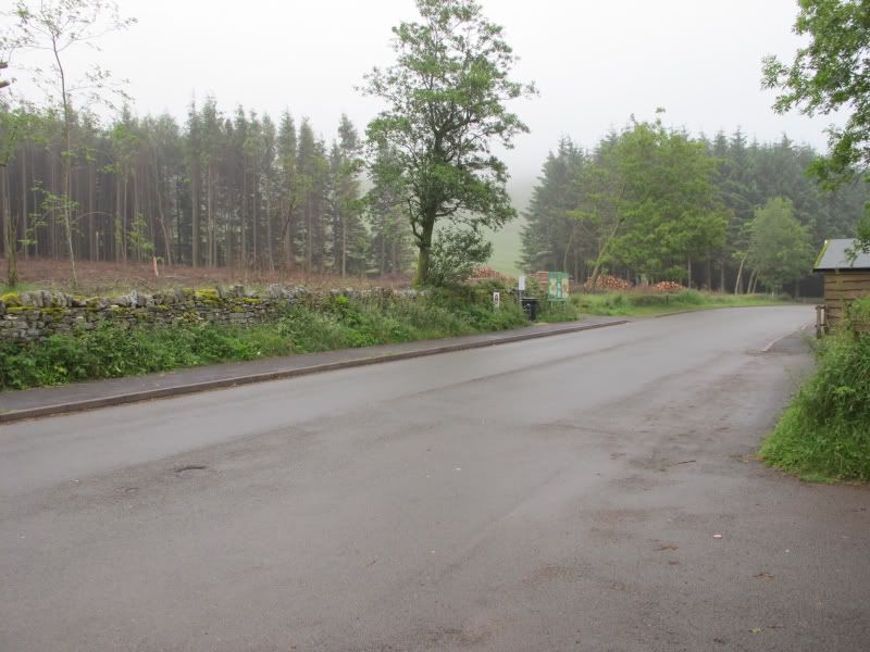
Car park at Pont ar Daf
I had decided on brining over an Old M73 Prismatic compass from NZ as the Prismatic is happy wherever you are in the world I used the compass in conjunction with a home made Protractor and this combination was more than accurate enough for navigation in conjunction with the 1:25K map.
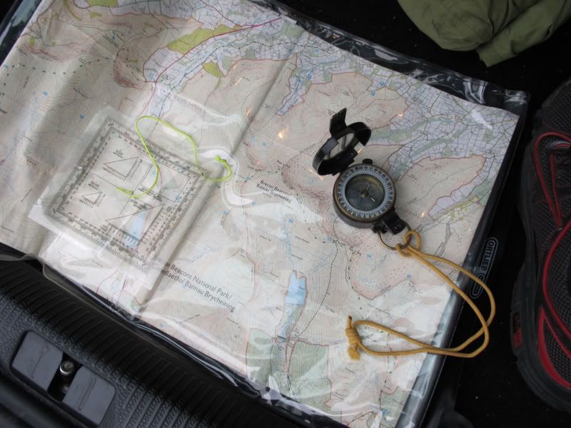
M73 Protractor and map in a decent Ortlieb Map case
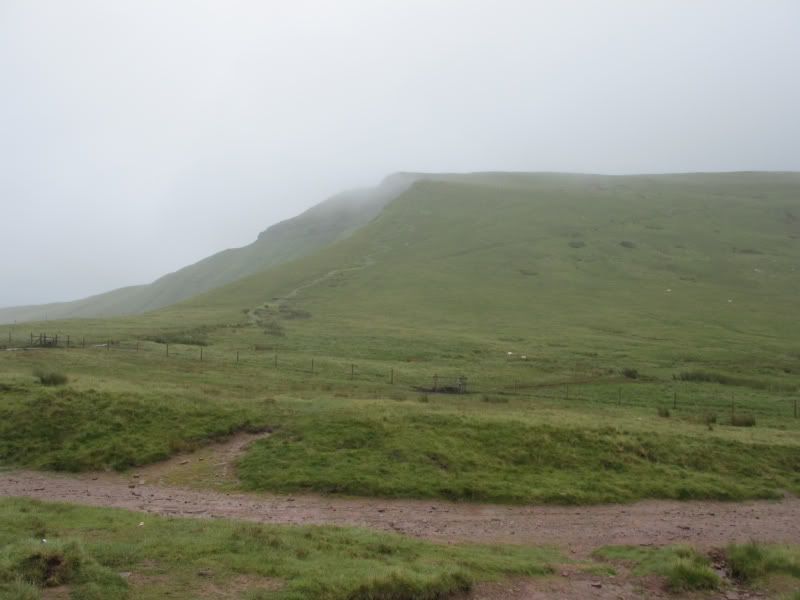
The Weather was pretty clagged in with the odd rain shower but I made good time on the climb up to Bwlch Duwynt hitting the col at about 07:30 I was happy with approx 400m of vertical ascent over about 1.5k in about 30mins of walking.
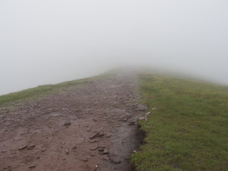
Typical Visibility for most of the day looking SE along the ridgeline towards the 642 trig
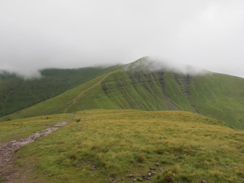
I headed SE down the ridge line that takes in Craig Gwan Taf, Rhiw yr Ysgyarnog, Craig Fan Ddu to the Trig at 642m.
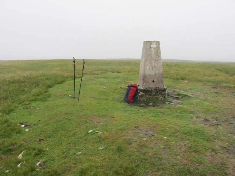
The Trig. Walking Poles (excellent Pacer Poles) and Daysack.
The Trig has a couple of Memorial Plaques I knew about the one to Tony Swierzy. But there was a new plaque dedicated to Richard Larkin.
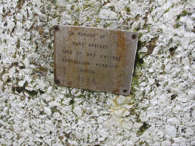
Tony Swierzy died on the 3[SUP]rd[/SUP] of April 1984 in an avalanche on Everests North Face he was part of an SAS climbing expedition being run by Bronco Lane.
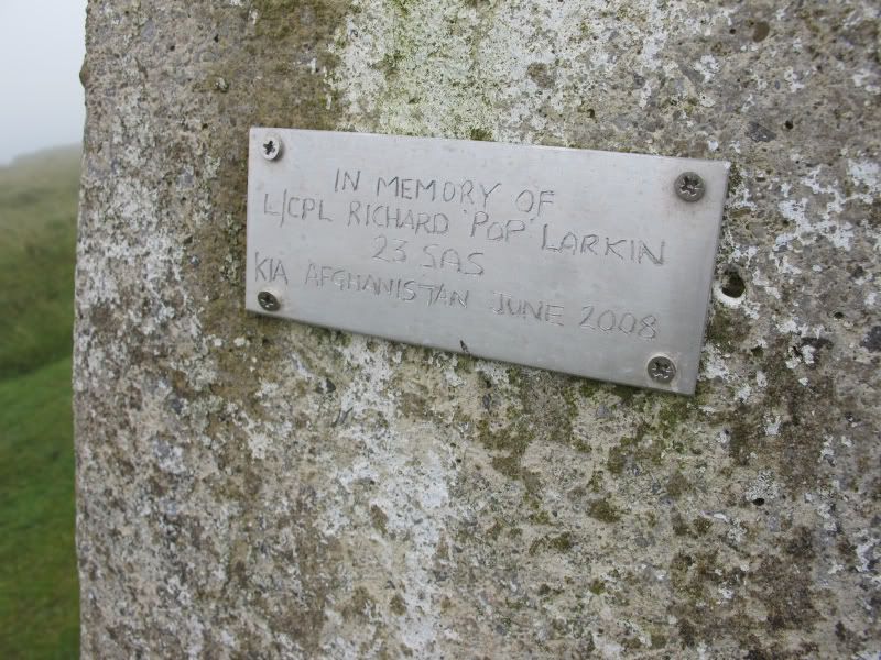
Richard Larkin was KIA in Afghanistan on the 17[SUP]th[/SUP] Of June 2008. He was killed in a Roadside IED. L/Cpl Larkin was 39 and served with 23 SAS.
The 642 Trig on Twn Mwyalchod is a nice spot so I sat down and had a brew and a snack and contemplated the descent down to the Neuadd Reservoirs. The mist was swirling around but it had stopped raining for a while. I took a quick bearing and set this on the compass.
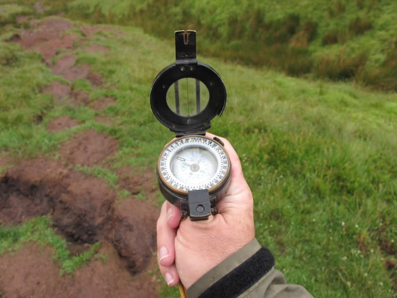
Bearing set for the descent to the Reservoir
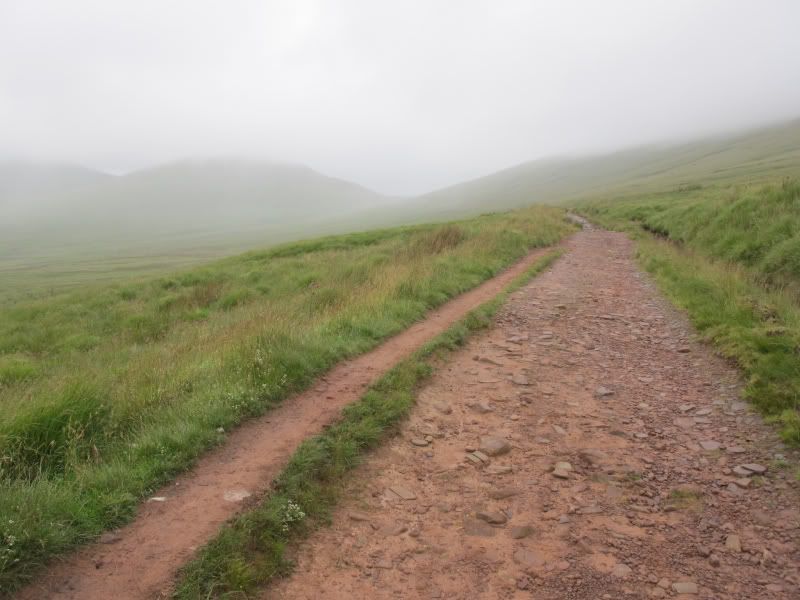
The Descent from the ridge to the Reservoir was steep and also Boggy underfoot. I passed some good bivvy spots near to the reservoir. After crossing the reservoir I headed up the old road / track from Torpantau to the col between Fan y Big and Cribyn. This Track forms part of the route of the Fan Dance part of UKSF selection. I met up with another fit walker on the way up the track and we chatted about walking stuff, weather, life in NZ for me and life in Pontralis for him. We didnt exchange names and at the col he broke left to climb Cribyn, while I broke right to climb Fan y Big.
Looking up the track towards Cribyn and Fan Y Big
The climb from the col to the Summit of Fan y Big is steep but short once on top I found a spot near the Bronze Plaque and had another brew before retracing my steps and then cracking up Cirbyn then down and up to the Summit of Pen Y Fan via the new ( to me) paved track up Craig Cwm Sere passing and chatting to a worried looking outdoor pursuits instructor from Hampshire who was looking for his DoE group. Hed been sat on top of the Fan for 2 hrs with no sign of them Id seen a group heading up the Ridge line of Bryn Teg while I was at the summit of Cribyn so I advised him of this and he seemed greatful for the info.
Fan y Big from the col.
Pen y Fan and Craig Cwm Sere from the Summit of Cribyn
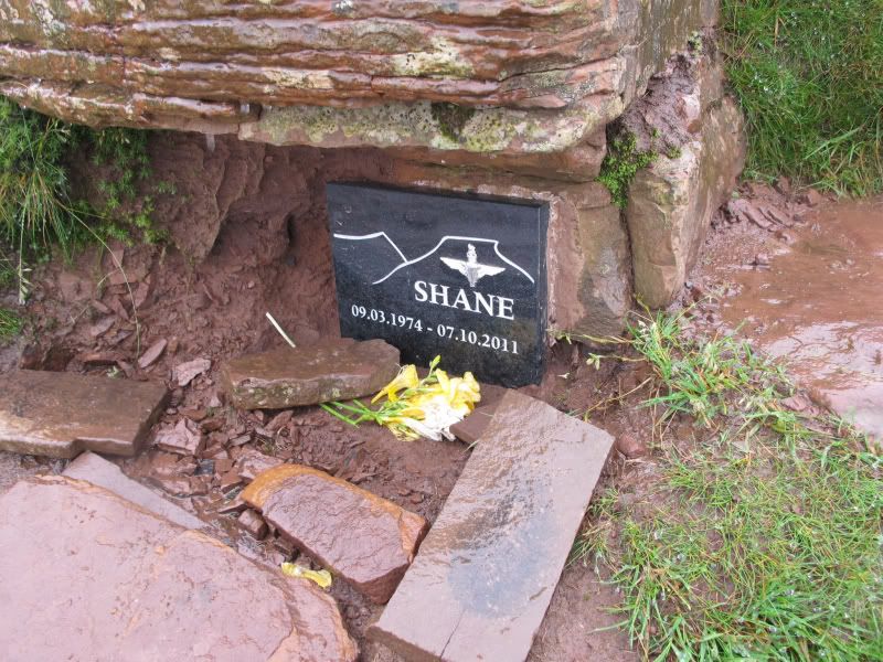
On the summit rocks of the Fan I passed another Memorial Plaque tucked in amongst the rocks.
Untrique Paratus Shane .
By now it was raining quite heavily and the Summit was busy with folk. A Welsh bloke was giving some route advice to a young couple. Once he finished I asked him if he minded taking my photo on the Summit. He asked me where I had come from so I gave him a précis of my route thus far and where I was heading. It was lunch time so I chucked on an insulating layer and tucked down to enjoy my sandwiches and another brew.
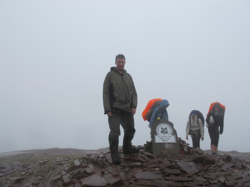
On the Summit of Pen Y Fan with Standard issue D of E folk in the Background .
Then onto the summit of Corn Du the Summit was well clagged in by now so a quick check of the compass got me heading down the line of Craig Cwm Llwch towards the Tommy Jones Memorial.
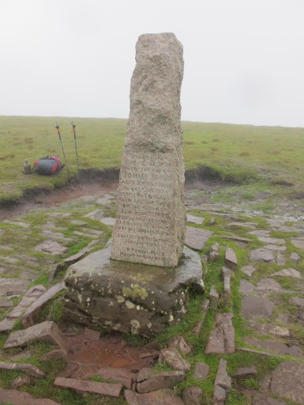
TJM this is marked as an Obelisk on the 160 1:50k Map GR 001218
I then headed over to the spot height on Y Gyrn before rejoining the main paved track down to Storey Arms and then back to the car for a bew of soup on the Trangia and then the drive back to W-S-M
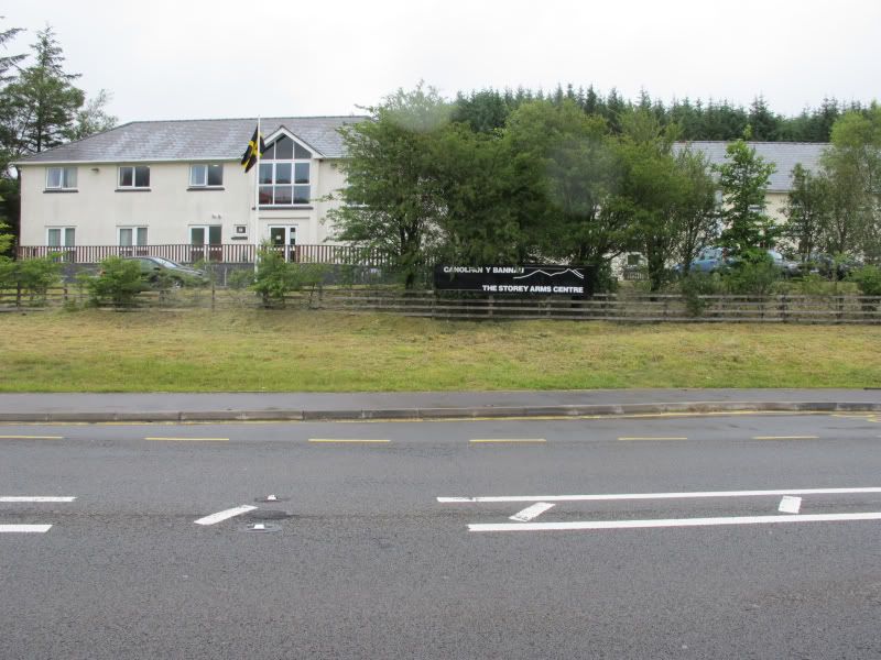
Storey Arms
I parked up in the Pont ar Daf car park about ½ a k below the Storey Arms a quick check of my kit and a Banana for a pre walk snack and I was off.
Car park at Pont ar Daf
I had decided on brining over an Old M73 Prismatic compass from NZ as the Prismatic is happy wherever you are in the world I used the compass in conjunction with a home made Protractor and this combination was more than accurate enough for navigation in conjunction with the 1:25K map.
M73 Protractor and map in a decent Ortlieb Map case
The Weather was pretty clagged in with the odd rain shower but I made good time on the climb up to Bwlch Duwynt hitting the col at about 07:30 I was happy with approx 400m of vertical ascent over about 1.5k in about 30mins of walking.
Typical Visibility for most of the day looking SE along the ridgeline towards the 642 trig
I headed SE down the ridge line that takes in Craig Gwan Taf, Rhiw yr Ysgyarnog, Craig Fan Ddu to the Trig at 642m.
The Trig. Walking Poles (excellent Pacer Poles) and Daysack.
The Trig has a couple of Memorial Plaques I knew about the one to Tony Swierzy. But there was a new plaque dedicated to Richard Larkin.
Tony Swierzy died on the 3[SUP]rd[/SUP] of April 1984 in an avalanche on Everests North Face he was part of an SAS climbing expedition being run by Bronco Lane.
Richard Larkin was KIA in Afghanistan on the 17[SUP]th[/SUP] Of June 2008. He was killed in a Roadside IED. L/Cpl Larkin was 39 and served with 23 SAS.
The 642 Trig on Twn Mwyalchod is a nice spot so I sat down and had a brew and a snack and contemplated the descent down to the Neuadd Reservoirs. The mist was swirling around but it had stopped raining for a while. I took a quick bearing and set this on the compass.
Bearing set for the descent to the Reservoir
The Descent from the ridge to the Reservoir was steep and also Boggy underfoot. I passed some good bivvy spots near to the reservoir. After crossing the reservoir I headed up the old road / track from Torpantau to the col between Fan y Big and Cribyn. This Track forms part of the route of the Fan Dance part of UKSF selection. I met up with another fit walker on the way up the track and we chatted about walking stuff, weather, life in NZ for me and life in Pontralis for him. We didnt exchange names and at the col he broke left to climb Cribyn, while I broke right to climb Fan y Big.
Looking up the track towards Cribyn and Fan Y Big
The climb from the col to the Summit of Fan y Big is steep but short once on top I found a spot near the Bronze Plaque and had another brew before retracing my steps and then cracking up Cirbyn then down and up to the Summit of Pen Y Fan via the new ( to me) paved track up Craig Cwm Sere passing and chatting to a worried looking outdoor pursuits instructor from Hampshire who was looking for his DoE group. Hed been sat on top of the Fan for 2 hrs with no sign of them Id seen a group heading up the Ridge line of Bryn Teg while I was at the summit of Cribyn so I advised him of this and he seemed greatful for the info.
Fan y Big from the col.
Pen y Fan and Craig Cwm Sere from the Summit of Cribyn
On the summit rocks of the Fan I passed another Memorial Plaque tucked in amongst the rocks.
Untrique Paratus Shane .
By now it was raining quite heavily and the Summit was busy with folk. A Welsh bloke was giving some route advice to a young couple. Once he finished I asked him if he minded taking my photo on the Summit. He asked me where I had come from so I gave him a précis of my route thus far and where I was heading. It was lunch time so I chucked on an insulating layer and tucked down to enjoy my sandwiches and another brew.
On the Summit of Pen Y Fan with Standard issue D of E folk in the Background .
Then onto the summit of Corn Du the Summit was well clagged in by now so a quick check of the compass got me heading down the line of Craig Cwm Llwch towards the Tommy Jones Memorial.
TJM this is marked as an Obelisk on the 160 1:50k Map GR 001218
I then headed over to the spot height on Y Gyrn before rejoining the main paved track down to Storey Arms and then back to the car for a bew of soup on the Trangia and then the drive back to W-S-M
Storey Arms
")