"The first casualty of every engagement is the plan"
The plan was simple, load up my pack, get an early morning train to Dover, Walk the North Downs Way towards Wye, when night falls, bivvi for the night, then continue the rest of the way to the pub in Wye in time for a Sunday Roast.
That was that plan. It was ambitious. But in theory, it should be achievable.
I spent my Friday evening loading up my pack, evaluating what I was taking, removing things, adding things, removing more things. Until I was happy with what I was taking. All in a very respectable 7.5kg dry weight. To which 1kg of food, and 1.5kg of water would be added.
Pack packed. I hit the hay, in anticipation of the adventure to come...
The plan started to fall apart when my brain decided to wake me at 2am. I have insomnia at the best of times, and spent the rest of the night staring at the ceiling, and running over the plan in my head.
With just 3 hours sleep, I headed off to the station, via a cafe for a fry up. I was planning about 20km with a 10kg pack, so felt no guilt while tucking into Sausages and Bacon.
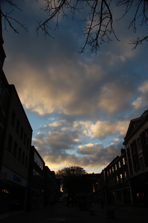
The walk to the station as the sun rose gave me hope for fine weather. Fluffy clouds, and sunshine.
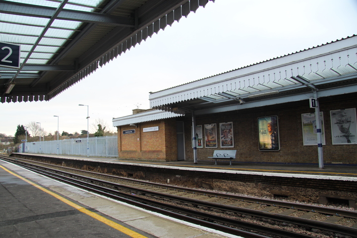
Due to the measures taken to improve the train service, it turns out that the train to dover is no longer once every 30 minutes, but hourly. I spent 30 minutes at the station awaiting the train. I smiled when I spotted the poster for Wild on the wall of the opposite platform. This was no PCT, but I was hoping for my own little adventure.
The North Downs way runs for 125 miles from Farnham in Surrey, to Dover in Kent. For years the route finished in the Market Square in Dover, before being relocated to the sea front in recent years.
Many people choose to walk the NDW from Farnham to Dover, the idea that finishing at the coast is a much better finish, than an inland town. The reality is, for anyone that's ever been to Dover, that it's a dump, and something of an anti climax. With this in mind, and with Dover being the easier end for me to access, I thought I'd start at Dover.
The first stage of the North Downs way is shared with the Saxon Shore Way and European Long Distance Routes E2 and E9. At Etchinghill, The Saxon Shore Way and E9 turn south, while E2 and the NDW continue on towards Wye.
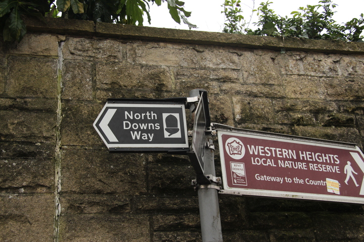
For a length of footpath that comprises not only a UK National Trail, but parts of 2 European Long distance paths, you would think that there would be some indication of where it is. I wandered round Dover, looking for the first sign with the North Downs Way mentioned. I'd seen from other trip reports that there should be a sign in the Market Square.
There wasn't. I had to navigate by map and compass alone, to try and find the first indications of the route. Once I did, the sign was beaten and bent. Harking of neglect.
I may not have made all the best choices, but I was pretty sure that I was right to start in Dover, not finish here.
One of the overarching memories that I will have of my first miles of the North Downs way is that it's all up hill. Every bit of it, even the down hill.
Leaving the Arctics and HGV's of Dover behind, I followed the signs up a couple of backstreets towards the western heights. The whole area is littered with fortifications dating from the Napoleonic era and beyond. I followed the signs and came to the base of a very steep set of stairs. With a typically James May like exclamation, I began going up.
I would like to say that at the top of the hill I was greeted with a picturesque view that made the climb worth while. The reality is I was greeted with a view of the docks, a substantial amount of dog mess, and a large cow pat.
I stopped to take a couple of photos, and rejig how my camera was carried. This fittings on this pack differ slightly from my old pack, and carrying my camera bag on my chest, it's a lot higher than I was used to. High enough to double as a chin rest. Will have to rethink that...
Having found the path littered with numerous cow pats, I soon found that it was also littered with the perpetrators. A herd of small cows was being used in conservation grazing of the western heights, and they seemed slightly confused to find a backpack with legs walking across their lunch. Three staring matches later, they wandered off in search of some grass. I continued onwards.
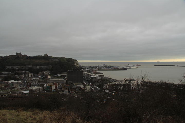
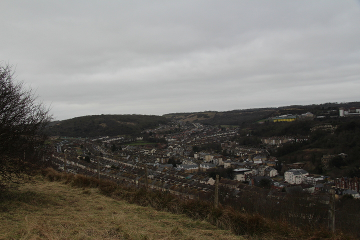
Leaving the seaward side of the Western Heights behind, I rounded to see the other side of Dover. The row upon row of houses spreading up the valleys. It kinda reminded me of glaciers flowing down a valley...
For my whole time on the North Downs way, at no point did I leave the sound of lorries. If you look at the route on a map, you'll see that it variously follows the routes of the M20, M2 and the M25, even sharing a bridge with a section of the M2 when it crosses the Medway. Near Dover, the path crosses under the A20. Laden with stationary trucks waiting for their turn to board a ferry to france.
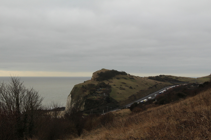
Every so often you would see a pulse of lorries head up the hill away from Dover, an indication that a ferry has just disgorged it's payload into Kent.
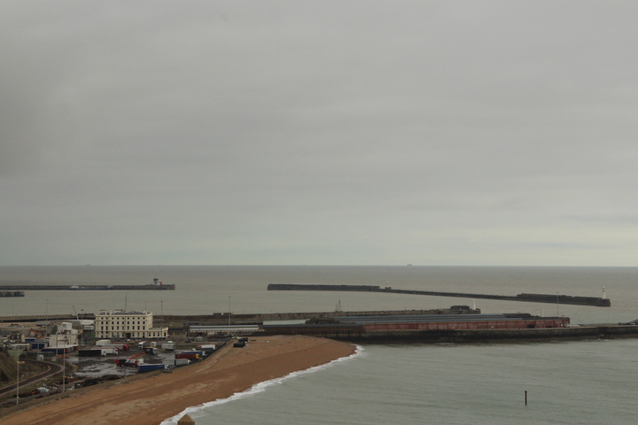
Before I lost sight of Dover completely, I turned to sit on what I have since found out is a sculpture, to take a photo of Dover Marine Station.
Dover Marine is a station of historic importance to the UK. Here the Unknown Soldier of the great war landed on his way from France. Where he boarded a train to Victoria Station.
For years it was a bustling station, frequented by boat trains on their way from London to Paris. Now it's listed status leaves it to decay slowly over time, like the memories of it's height. Unable to be developed into anything, unable to be destroyed.
It gives one something to think about as I turned, put one foot in front of the other, and headed towards Wye.
Being a National Trail, walked by thousands of people each year, you would think that the surface of the path would be in reasonable repair, not too hard on the feet, and well... wide enough to walk along.
This trip was in February, so it's not exactly the warmest or driest time of year to walk. But the path was hell. The top layer was a damp, slippery mud. Every time a foot is placed, it slides back by about ⅛th of a foot. The path is warn into the chalk grassland, forming a slight depression. Thing is, that depression is exactly too small for an average human to walk on comfortably. Both feet slope slightly along the long axis of your feet as you walk, putting horrendous strain on the ankles and calves. Each step slides.
On such a windy exposed area very little grows. In some areas a variety of Brassica grew, short plants like partially developed sprout plants, battered by the wind. Elsewhere, Hawthorn seemed to be the only thing other than grass that could cling onto life here. And where the Hawthorn grew, the North Downs Way cuts straight through it. In many locations Large sections have been cut through the Hawthorn to allow the NDW through. Only these cuts are made to be just big enough that you think you'll fit through with a pack on, while being just small enough that you don't... Crossing through one section of Hawthorn bushes, my Hair got caught on one of the branches.
For my whole walk I only encountered 2 other walkers, both out exercising their dogs. But I did encounter a group or Orange Hi vi clad workers. This section of the North Downs is criss crossed at various heights by communications links. From the A20 thundering by on the top, to the Dover to London railway line passing through Shakespeare tunnel and then along the bottom of Shakespeare cliff, down even further to the channel tunnel carrying highspeed trains off to France. All these bits of infrastructure need looking after, and on a Saturday Morning in February, a group of roped access contractors were hanging off the Shakespeare cliff trying to stabilise the cliff face. This work diverted the path away from it's normal route, 1.5m away from the cliff edge, to a new section a few meters inland. This was a blessed relief. Here rather than the weirdly cambered tiny game trail that I had been following, they had laid large plastic duckboards, that were level. For a hundred yards of path my feet didn't scream with agony quite so much on each step. Alas, they couldn't duckboard the whole route, and so after 100 yards of relative bliss, the path returned to it's tiny rut, and I plodded on with increasing levels of pain.
Those who have followed my trip reports will know that I experienced injury to my feet over a year ago and have been slowly building back up to the ability to walk any distance again. Last July I managed to climb Pen-y-Fan, albeit in quite a bit of pain by the end of it. Since then I've done several local 10-15k walks without much issue. I thought I was on the mend, I thought I was going to be able to make some of the trips I'd spent the last year planning for when I might walk again. Turns out, that wasn't the case. By the time I was 5km into the route, my feet were really starting to hurt. I was making substantially slower progress than I had intended. Day light was starting to become a concern. I wasn't going to get beyond Folkestone towards somewhere suitable to wild camp today. Wye by tomorrow was looking even harder.
I plodded on in ever increasing pain. My feet screaming out with each step. Being on the cliff top, there was nowhere out of the cold wind that I could easily shelter, so I just kept plodding along. One step at a time.
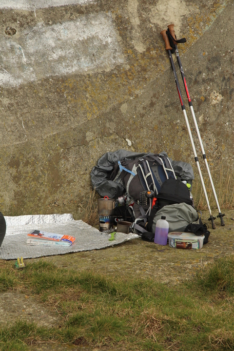
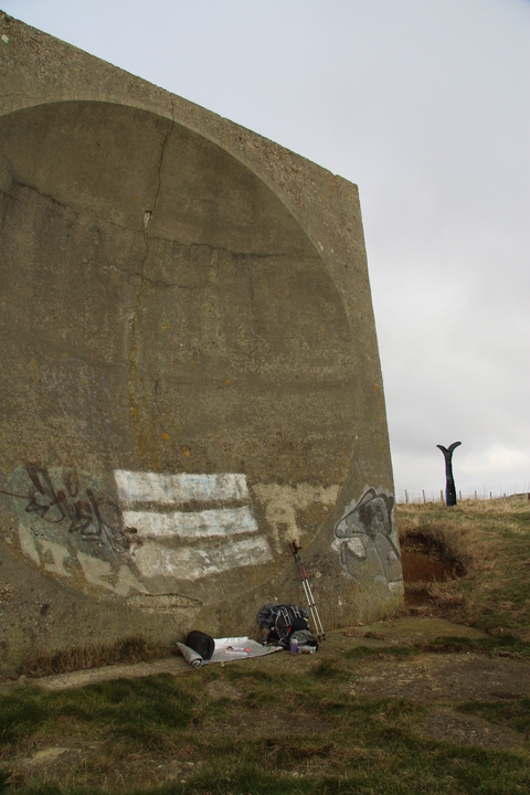
Six kilometres into my walk, I came across a large concrete sculpture by the side of the path. I knew there was one of these along the route, and had been looking forward to it for a couple of kilometres. For I knew it would offer me some shelter from the wind.
I call it a sculpture, but the reality is that it's a sounding dish. Built in the interwar years, the idea was that you stand at the epicentre of the dish, and use it to amplify the sound of inbound air craft, to give you a crucial heads up that someone was flying your way. A number were built along the south coast, the largest down near Dungeness. Here, on top of Shakespeare cliff, lay this concrete dish. Built, but never needed. Made redundant by Radar.
I collapsed down in a heap in the shelter of the dish. It was noon, and it had taken me since 0930, to do the 6km to here. I was cold, and in considerable pain.
So I did what any British woman should do in such a situation. I made a cup of tea.
My new toy, that I was testing on this trip was my Evernew Appalachian set. A meths/Hex/wood burning stove and 500ml mug, all combined in one shiny titanium package. It's a lovely set, except for being very thirsty, and in need of a decent wind shield.
I'd found a decent wind shield. Several feet across, cast of solid concrete. The sounding dish made the perfect stove wind shield...
Sitting back and drinking my tea a couple of thoughts occured to me:
"This would be a nice place for a geocache"
"If I was going to hide a geocache here, I would put it there ... by that rock that looks at of place..."
I hobbled over to the rock, lifted it up, and pulled the geocache out from behind it. Great minds think alike...
I signed the log and returned the cache to it's hidey hole, logging it's position so I could log it later when I got home.
I sat back down and pondered what to do. I was a 3rd of the way into my planned mileage for the day. I was in considerable pain. And I had just 4.5 hours of usable day light left.
There wasn't much I could do, I had to plod on.
The next 4km were agony. There was a big more human habitation in this section of the route, which meant the path goes in and out of the undergrowth, round houses, across greens, and along roads. At one point the path is just 1.5m from the edge, slippery with mud, and yet has a 20° slop across the path towards the cliff edge, and the 150m drop to the railway tracks below...
I plodded on, the pain getting worse with every step.
Eventually, after what felt like forever, I arrived at the Battle of Britain Memorial, and hobbled into the cafe with tears streaming from my eyes, and collapsed in a heap in a chair.
What was I to do? I couldn't really go on. I wasn't sure I could walk as far as the bus stop 100 yards up the road.
My housemate chose this as an opportune time to phone me and wonder why I wasn't at home. Unprompted, he offered me a lift. It would have to be in 3 hours time, but it would be a lift. It was a bit of a weight off my mind.
A few minutes later a friend who I was checking in with periodically, texted with a guess of my position.
I texted back to say I was in a cafe awaiting rescue by my housemate.
He replied that he was in the area, could pick me up in 25 minutes, and what's the postcode of my location.
That sort of offer you can't refuse. I texted back accepting the offer. Then sipped my mug of tea and pondered my failure. Tears streaming, awaiting rescue. I managed 10km of the 19km I had intended to do that day. Less than a ⅓rd of 35km total I had hoped to do over the weekend.
--
It's taken me several days to write this trip report. Trying to work out how to word it, or if I should even write it in the first place. The emotions that have gone through my mind since Saturday lunch time have varied, through anger, depression, despair, and more besides. I lay in bed for hours, my feet too sore even to walk to the kitchen and get a drink. Only venturing from bed when the pain in my bladder got close to the pain in my feet.
I'm gonna have to go back to my GP, to see what options are open to me, 2 podiatrists and 2 rounds of physio haven't worked so far. In the mean time I'll have to think about my options. Perhaps I'll have to concentrate on cycle based adventures for the time being. But for now the answer to the question of "Wye?" Is "not until my feet are better".
Julia

")

