That rare confluence of a British bank holiday and a good weather forecast offered an opportunity that seemed to be too good to miss. In particular the forecast showed a promise of a relatively warm night time temperatures (over 5°C). This seemed like a good chance to put the winter sleeping bag away, break out the summer kit and hit the trail.
The North Downs way looked like the obvious choice. At this point I had a couple of gaps on the route at the Eastern end. One from the Battle of Britain Monument to Postling (courtesy of my first aborted attempt), and one from Dover to Canterbury. My GPX of the route showed that Dover to Canterbury was 30km, with a nice break in the middle around Shepherdswell. I threw some kit into my pack, opting at the last minute to add my Páramo Torres jacket in case it was slightly colder than planned, and headed for the station.
Disembarking at Dover I bimbled towards the sea front to find the official start/end point of the North Downs Way. Being a national trail, I expected there to be some sort of obvious sign on the front. I stood in the sunshine looking around for any indication of a sign. With nothing obvious showing up, I sat down on an uncomfortable seat and googled the start of the North Downs way. I had hoped to find coordinates or a grid reference. Ah, such naivety. Eventually I found a picture that suggested that the start finish post is actually a line on the ground. With this info I soon found the start of the trail. I was glad I hadn't just walked here from Farnham to find it...
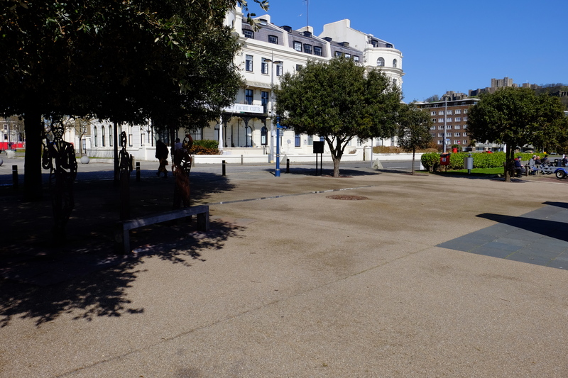 -The Start/Finish of the North Downs Way (the shiny line in the middle of the picture).
For anyone else hoping to find such a point I saved a waypoint into my GPS - 51.122521°N 1.315339°E (or TR 32098 41142 in OS Grid).
Having found the trail I followed the first NDW sign through an underpass into the bustling heart of Dover's high street. Here I promptly lost the signs again, and with not enough detail on my 1:40k map, I wandered round to Pencester Road, where I finally picked up the trail again. Here the sign was more obvious showing where I should have gone.
I followed the signs through the wide streets of Dover, the route showing a gentle incline. Here and there signs of spring poked through. Daffodils, Blackthorn blossom, Hazel catkins.

I left the streets on Connaught road and followed a sunken path through a grave yard to join the old Roman Road, that climbs the hill out of the Valley and left Dover proper.
By now the sun had come out and the it was warming up into a pleasant spring day. Alas there was a slight chilly breeze so I wasn't able to lose my windproof. The first part of the path towards the A2 has recently been resurfaced and was rather pleasant to walk along with fields on each side. Like much of the North Downs Way you can't get far from the sound of traffic and as I headed north the sound of the A2 got louder.
On the OS map the North Downs Way is shown as crossing the A2 directly near what is now a slip road, but the Harveys Map and the sign posts show a detour to cross the A2 at a bridge.
Crossing the bridge I found the green lane that the NDW follows at this point with a large concrete block in the middle of it. I didn't think much of this, and continued on. From here, with the A2 just metres away on my left, looking north I could see all the way to Ramsgate, and the Thanet wind farm in the distance. Shame that the foreground seemed to involve someones dump...
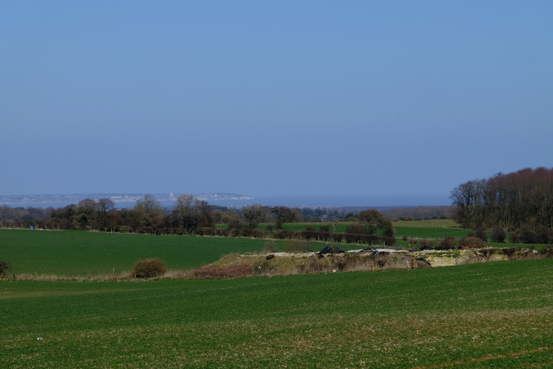 -Ramsgate and the Isle of Thanet in the distance.
The path was heavily rutted, boggy in places, and made for interesting travel. At one point I had to inch along the side hanging off the branches of the hawthorn bushes to avoid the bog the path had become. When I got to the end of the rutted section I found another large concrete block and a sign. Apparently this section has been closed for 6 months so that they can fix the damaged surface. Alas the sign saying this seems to have gone missing from the other end. I took the opportunity of a seat (the concrete block) to have a snack and a drink. I then filtered some water from a nearby cattle trough before continuing on.
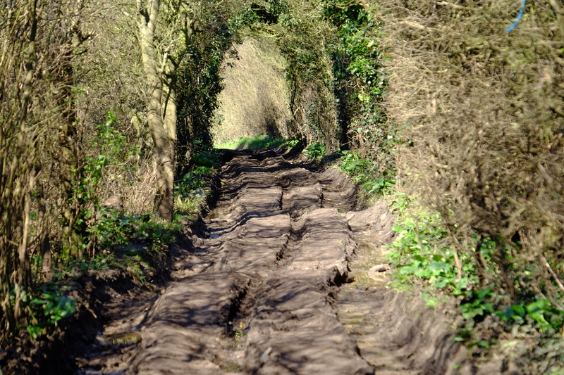
The path opened out onto open farmland, you could see from the terrain that this section used to be an trackway used for carts, but hasn't seen such traffic in years. The fields were lush with green growth. Because of the noise of the traffic on the earlier section, I was walking along listening to podcasts on my headphones. This meant I didn't hear when the dry bag with my loo roll in it fell off the outside of my pack where I had tied it on earlier. I only realised this as I was approaching the A256. I wasn't prepared to backtrack to find it, so pressed on.
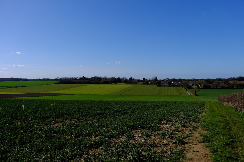
In need of the loo and to refill my water bottles, I diverted just past the A256 to the Cider Works. It's marked as a pub on the Harveys Map, but it's actually a licensed cafe with slightly odd opening hours. I arrived just before the shut at 4pm, bought a slice of cake and an apple juice. They kindly refilled my water bottles. Restocked and rested, I once again moved on.
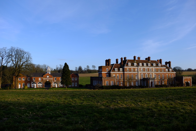
Rejoining the NDW, the landscape changes once again. I crossed through a church yard into pasture, through a small copse and into the lands of a country estate. I wandered past giant mature trees, timeless pasture, and a country pile the size of which I had not expected.
Leaving the pastoral land I crossed into a wheat field that filled a whole valley. I ascended the other side into a small woodland, then back into farmland for the last couple of kilometres to Shepherdswell.
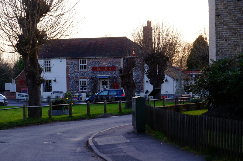
The staff at the Cider works had said that one of the pubs in Shepherswell had recently closed, but they couldn't remember which one it was. Fortunately the one that is still open is the one nearest the NDW, and I exited the path next to the church yard and into the pub.
The pub had a small crowd round the main bar area, and the conversation seemed to reduce somewhat as I came in. I walked past them all with my large pack, a couple of them making comments. I collapsed onto a sofa and ordered a pint.
I knew I had only a kilometre or so until my planned bivvi location and I had a couple of hours until sunset. Not wanting to make camp until the sun was down, it seemed the logical choice was to stay in the pub until dark... It's a hard life sometimes...
Three pints of courage and a delicious fish 'n' chips later, I left the pub into the star light. I wandered through the horse pastures of Shepherdswell onto where the NDW joins a country lane heading north. Away from much of the light pollution I had a clear view of the stars, and with Orion on my left, and Cassiopeia on my right, I headed north.
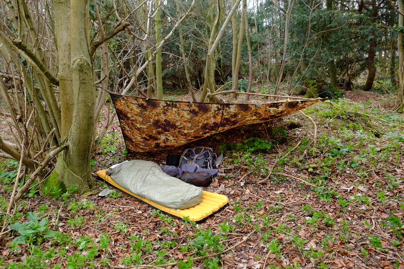
Somewhere north of Shepherdswell I left the NDW and found a spot to bivvi in an area of coppiced broadleaf trees. It wasn't the best spot, but it was away from the trail, had some shelter from an earth bank, and it wasn't under a Yew tree. Between the exhaustion of the hike, the 3 pints of beer and the cold, I didn't linger long. I put up my tarp, rolled out the bivvi bag, and crawled in, still fully dressed. It was cold so I wore my Torres jacket inside the sleeping bag.
I lay there listening to the local wildlife, something rustled in the leaf litter, and in the distance an owl called. But as I lay there I realised that I was shivering. Actual body shaking shivers. This was not good. I was in a 5°C sleeping bag, inside a heat reflecting bivvi bag, with an insulating jacket inside that. I rooted about in my pack to find the space blanket that was inevitably at the bottom. I unfolded it and put it between the bivvi bag and the sleeping bag. With this in place, I curled up tight and drifted off to sleep.
I woke just after first light, I might have started the night shivering cold but I was now comfortably warm. I ventured a hand out of the warmth to check the outside of my sleeping bag. As I had feared the non breathable space blanket had lead to lots of condensation on the outside of my sleeping bag. I crawled out into the woodland and stretched, before wandering off a short way to irrigate a tree. As I returned to my camp I realised just how badly I had made camp the night before. Certainly not my finest camp...
I stretched my sleeping bag out so that it could dry. The DWR coating on the bag had done it's job and the moisture had pooled on the outside of the bag. It dried quite quickly, and just 45 minutes after I had crawled out of my bivvi bag, I stepped back out onto the trail.
Whilst Friday had been warm with beautiful spring sunshine, Saturday was an altogether chillier and greyer affair.
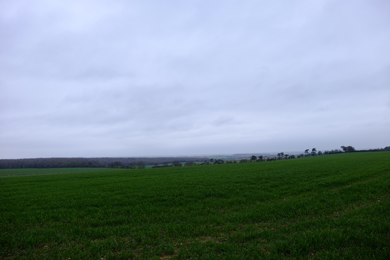 -Grey skies looking towards Thanet.
From here onwards the NDW passes along side large open fields. The hedgerows of the previous day were gone, and with them their shelter from the wind. Where the path came close to a road edge, some scrote had fly tipped their rubbish.
I trudged northwards. Whilst on Friday I had covered 21.8km and didn't feel too bad, just 5km into Saturdays hike and my feet were starting to ache. My old injury back with vengeance. I continued on, the pain increasing with every passing kilometre.
At Barham Downs I found the field the NDW passes through being ploughed by a couple of very large tractors, taking with it the obvious route through the field. I skirted along the edge where there was another path. On reaching the end of the field I had a small navigational hickup, and stopped to double check using viewranger. Position checked, I found the path a few metres beyond where I had thought it would be, and continued on.
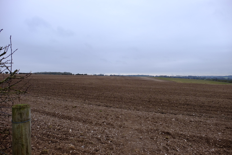 -Freshly ploughed path...
Once again the NDW joins a large road, this time following along the A2 for a short section near Bridge. The pain in my feet was getting considerable, and I decided that it would be best if I diverted to Bekesbourne station and the train back to Canterbury.
Bekesbourne only has one train an hour in each direction, and not wanting to have to wait 58 minutes on a platform with no seat or shelter having watched a train depart, I pressed onwards. I passed through the pretty village of Patrixbourne, before turning off the North Downs Way into Bekesbourne.
As I hobbled along Station Approach, I heard the sound of the approaching train, and with the last drops of will power, broke into a run. The train pulled into the station when I was about 50 yards from the platform. The Guard stepped onto the platform as a handful of passengers got off. The guard saw me and I waved, calling out "please wait!". The kind guard held the train for me blowing his whistle and closing the door behind me as I stepped onto the train. I collapsed into a seat for the short trip to Canterbury. I'd managed just over 10km today, crossing off most of the NDW between Dover and Canterbury. I'll have to come back for the final 3.5km.
The North Downs way looked like the obvious choice. At this point I had a couple of gaps on the route at the Eastern end. One from the Battle of Britain Monument to Postling (courtesy of my first aborted attempt), and one from Dover to Canterbury. My GPX of the route showed that Dover to Canterbury was 30km, with a nice break in the middle around Shepherdswell. I threw some kit into my pack, opting at the last minute to add my Páramo Torres jacket in case it was slightly colder than planned, and headed for the station.
Disembarking at Dover I bimbled towards the sea front to find the official start/end point of the North Downs Way. Being a national trail, I expected there to be some sort of obvious sign on the front. I stood in the sunshine looking around for any indication of a sign. With nothing obvious showing up, I sat down on an uncomfortable seat and googled the start of the North Downs way. I had hoped to find coordinates or a grid reference. Ah, such naivety. Eventually I found a picture that suggested that the start finish post is actually a line on the ground. With this info I soon found the start of the trail. I was glad I hadn't just walked here from Farnham to find it...

For anyone else hoping to find such a point I saved a waypoint into my GPS - 51.122521°N 1.315339°E (or TR 32098 41142 in OS Grid).
Having found the trail I followed the first NDW sign through an underpass into the bustling heart of Dover's high street. Here I promptly lost the signs again, and with not enough detail on my 1:40k map, I wandered round to Pencester Road, where I finally picked up the trail again. Here the sign was more obvious showing where I should have gone.
I followed the signs through the wide streets of Dover, the route showing a gentle incline. Here and there signs of spring poked through. Daffodils, Blackthorn blossom, Hazel catkins.

I left the streets on Connaught road and followed a sunken path through a grave yard to join the old Roman Road, that climbs the hill out of the Valley and left Dover proper.
By now the sun had come out and the it was warming up into a pleasant spring day. Alas there was a slight chilly breeze so I wasn't able to lose my windproof. The first part of the path towards the A2 has recently been resurfaced and was rather pleasant to walk along with fields on each side. Like much of the North Downs Way you can't get far from the sound of traffic and as I headed north the sound of the A2 got louder.
On the OS map the North Downs Way is shown as crossing the A2 directly near what is now a slip road, but the Harveys Map and the sign posts show a detour to cross the A2 at a bridge.
Crossing the bridge I found the green lane that the NDW follows at this point with a large concrete block in the middle of it. I didn't think much of this, and continued on. From here, with the A2 just metres away on my left, looking north I could see all the way to Ramsgate, and the Thanet wind farm in the distance. Shame that the foreground seemed to involve someones dump...

The path was heavily rutted, boggy in places, and made for interesting travel. At one point I had to inch along the side hanging off the branches of the hawthorn bushes to avoid the bog the path had become. When I got to the end of the rutted section I found another large concrete block and a sign. Apparently this section has been closed for 6 months so that they can fix the damaged surface. Alas the sign saying this seems to have gone missing from the other end. I took the opportunity of a seat (the concrete block) to have a snack and a drink. I then filtered some water from a nearby cattle trough before continuing on.

The path opened out onto open farmland, you could see from the terrain that this section used to be an trackway used for carts, but hasn't seen such traffic in years. The fields were lush with green growth. Because of the noise of the traffic on the earlier section, I was walking along listening to podcasts on my headphones. This meant I didn't hear when the dry bag with my loo roll in it fell off the outside of my pack where I had tied it on earlier. I only realised this as I was approaching the A256. I wasn't prepared to backtrack to find it, so pressed on.

In need of the loo and to refill my water bottles, I diverted just past the A256 to the Cider Works. It's marked as a pub on the Harveys Map, but it's actually a licensed cafe with slightly odd opening hours. I arrived just before the shut at 4pm, bought a slice of cake and an apple juice. They kindly refilled my water bottles. Restocked and rested, I once again moved on.
Rejoining the NDW, the landscape changes once again. I crossed through a church yard into pasture, through a small copse and into the lands of a country estate. I wandered past giant mature trees, timeless pasture, and a country pile the size of which I had not expected.

Leaving the pastoral land I crossed into a wheat field that filled a whole valley. I ascended the other side into a small woodland, then back into farmland for the last couple of kilometres to Shepherdswell.
The staff at the Cider works had said that one of the pubs in Shepherswell had recently closed, but they couldn't remember which one it was. Fortunately the one that is still open is the one nearest the NDW, and I exited the path next to the church yard and into the pub.

The pub had a small crowd round the main bar area, and the conversation seemed to reduce somewhat as I came in. I walked past them all with my large pack, a couple of them making comments. I collapsed onto a sofa and ordered a pint.
I knew I had only a kilometre or so until my planned bivvi location and I had a couple of hours until sunset. Not wanting to make camp until the sun was down, it seemed the logical choice was to stay in the pub until dark... It's a hard life sometimes...
Three pints of courage and a delicious fish 'n' chips later, I left the pub into the star light. I wandered through the horse pastures of Shepherdswell onto where the NDW joins a country lane heading north. Away from much of the light pollution I had a clear view of the stars, and with Orion on my left, and Cassiopeia on my right, I headed north.
Somewhere north of Shepherdswell I left the NDW and found a spot to bivvi in an area of coppiced broadleaf trees. It wasn't the best spot, but it was away from the trail, had some shelter from an earth bank, and it wasn't under a Yew tree. Between the exhaustion of the hike, the 3 pints of beer and the cold, I didn't linger long. I put up my tarp, rolled out the bivvi bag, and crawled in, still fully dressed. It was cold so I wore my Torres jacket inside the sleeping bag.
I lay there listening to the local wildlife, something rustled in the leaf litter, and in the distance an owl called. But as I lay there I realised that I was shivering. Actual body shaking shivers. This was not good. I was in a 5°C sleeping bag, inside a heat reflecting bivvi bag, with an insulating jacket inside that. I rooted about in my pack to find the space blanket that was inevitably at the bottom. I unfolded it and put it between the bivvi bag and the sleeping bag. With this in place, I curled up tight and drifted off to sleep.
I woke just after first light, I might have started the night shivering cold but I was now comfortably warm. I ventured a hand out of the warmth to check the outside of my sleeping bag. As I had feared the non breathable space blanket had lead to lots of condensation on the outside of my sleeping bag. I crawled out into the woodland and stretched, before wandering off a short way to irrigate a tree. As I returned to my camp I realised just how badly I had made camp the night before. Certainly not my finest camp...

I stretched my sleeping bag out so that it could dry. The DWR coating on the bag had done it's job and the moisture had pooled on the outside of the bag. It dried quite quickly, and just 45 minutes after I had crawled out of my bivvi bag, I stepped back out onto the trail.
Whilst Friday had been warm with beautiful spring sunshine, Saturday was an altogether chillier and greyer affair.

From here onwards the NDW passes along side large open fields. The hedgerows of the previous day were gone, and with them their shelter from the wind. Where the path came close to a road edge, some scrote had fly tipped their rubbish.
I trudged northwards. Whilst on Friday I had covered 21.8km and didn't feel too bad, just 5km into Saturdays hike and my feet were starting to ache. My old injury back with vengeance. I continued on, the pain increasing with every passing kilometre.
At Barham Downs I found the field the NDW passes through being ploughed by a couple of very large tractors, taking with it the obvious route through the field. I skirted along the edge where there was another path. On reaching the end of the field I had a small navigational hickup, and stopped to double check using viewranger. Position checked, I found the path a few metres beyond where I had thought it would be, and continued on.

Once again the NDW joins a large road, this time following along the A2 for a short section near Bridge. The pain in my feet was getting considerable, and I decided that it would be best if I diverted to Bekesbourne station and the train back to Canterbury.
Bekesbourne only has one train an hour in each direction, and not wanting to have to wait 58 minutes on a platform with no seat or shelter having watched a train depart, I pressed onwards. I passed through the pretty village of Patrixbourne, before turning off the North Downs Way into Bekesbourne.
As I hobbled along Station Approach, I heard the sound of the approaching train, and with the last drops of will power, broke into a run. The train pulled into the station when I was about 50 yards from the platform. The Guard stepped onto the platform as a handful of passengers got off. The guard saw me and I waved, calling out "please wait!". The kind guard held the train for me blowing his whistle and closing the door behind me as I stepped onto the train. I collapsed into a seat for the short trip to Canterbury. I'd managed just over 10km today, crossing off most of the NDW between Dover and Canterbury. I'll have to come back for the final 3.5km.
