Where does the adventure begin? When you leave the house? When you stop off the train? or when the idea of the adventure enters your mind?
This adventure really begins on a Bridge floating upon the Lac de la Haute-Sûre, Luxembourgs largest lake. It's October 2014, and I am here with some friends to scout out locations for an event that we are organising in August 2015. Standing looking up at the mountainside covered in vibrant autumnal colours, I knew I would have to come back and spend more time here, to explore it better. Later that day I picked up a 1:20000 map of the local area, and work began on a plan.
I had to be in Wiltz for the weekend in April for some planning meetings for the event in August. A plan started to form to arrive in the country a few days earlier and hike through the beautiful landscape of the Ardenne, to arrive in Wiltz on the Friday, wild camping as I went.
Hours with paper & electronic maps, and bus timetables resulted in a route for a 53km walk from near the border with Belgium to the centre of Wiltz, over about 48 hours. Alas, the first casualty of every engagement is the plan, and this one never even got as far as contact with the enemy. As I lay in agony following my aborted attempt at the North Downs Way, I realised that hiking 53km through the Ardenne was going to have to be put back in the crazy plans folder for a later date.
This still left me with the time booked off work, and the hope of a few days exploring the Ardennes. Walking was out the question. But cycling, that doesn't cause the same foot pain. The plan reforms.
Day 1
Route: Luxembourg centre to Luxembourg centre
Status: Everything's beautiful
Distance: 33.18km
April finds me standing outside Luxembourg railway station with a loaded Brompton. I'd got here by a combination of ferry to France, 40km bike ride to Belgium, a train journey, a night on a friends sofa, a lift to Brussels Zuid, and a train to Luxembourg. Just to get to the start line of my adventure.
I'd been expecting that early April in the Ardenne was going to be on the cool side, maybe 5-10°C. I'd dressed accordingly. The sky was blue and the sun beat down. This wasn't quite what I had expected or dressed for. I had a rummage in my bag for the sun block I knew was in there somewhere. Sun block in April. Something wasn't right. But dressed all in black lingering here is getting uncomfortably hot, time to hit the road.
What isn't clear from the maps I had used to plan this leg of the journey, is that Luxembourg City is located around a steep sided valley. The station is around 280masl. The cycle route I had been intending to pick up was located 40m below me. This wasn't right, I've only gone 300m and already the route plan isn't working. Adapt and overcome. I took the next turning that looked like it was going the right way, following the road down through tight hairpin bends. The roads where cobbled, with eratic camber and in places large wheel eating gaps between the stones. I slalomed between the bemused tourists heading down.
More by luck than judgment I reached the level of the cycle route I was aiming for clattered down the gears, and headed off out the city.
I knew the first 10k or so would be relatively urban and it would take a while to get out the city and into the countryside. Well that's what I thought. Luxembourg city, whilst a Capital, is smaller than Cambridge. It didn't take me long to leave the cobble streets behind, and follow the river past market gardens into the countryside.
I had planned for a shorter first day, to ease myself into the journey, and not over do it. Alas, my unintended 40k ride the previous day meant that this was something I was more greatful of than I had expected. I followed the signs along the river and railway line.
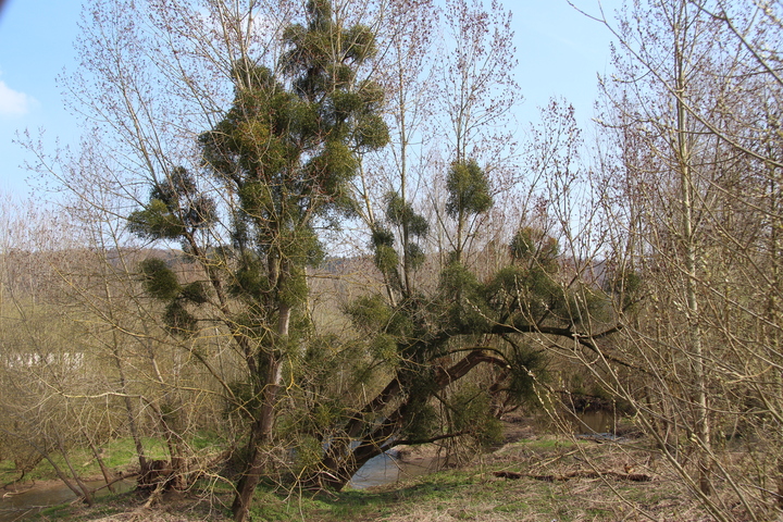
The trees along the river were adorned with mistletoe in quantities I had never seen before. In the UK mistletoe is something I associate with old orchards, and had not really consciously seen it else where. Yet, here, along the banks of the Alzette, nearly every tree was covered.
I continued on in the afternoon sunshine, following the signs for Piste cyclable de l'Alzette. The sun was shining, the sky a brilliant blue. I was enjoying myself. So much so, that I forgot to follow the signs, and took a slight diversion up a farmers driveway. Slightly embarrassed by this 1km detour, I returned to the route and continued on.
I wasn't alone on the cycleway, many families were out to enjoy the sunshine, as were a seemingly endless number of Lycra clad road cyclists. Each smiling and saying hello (I think that's what they were saying) as they cycle past.
I had expected the path to be made from hard packed dirt, like many of the traffic free sections of the UK National Cycle Network. What I hadn't expected was some of the smoothest tarmac, and neatly concreted path I've ever cycled on. This meant I could make good progress, and maintain a high speed. For one flat section, I managed to hit 30kph, pedalling flat out. Not bad for a Brompton with Luggage.
I stopped after 15km at a tap, hoping to fill my water bottles up. Alas it hadn't yet been turned on. I'd have to continue on with the water I already had.
When planning the trip, I had noticed on Open Cycle Map that the Geographic Centre of Luxembourg was marked. It would only add a couple of km to my route to visit it. When I then found out that there was a geocache located here, the detour was on. 24km after leaving Luxembourg I left the cycle route, and headed up hill. I managed about 0.5km of up hill cycling before admitting defeat and getting off to push. I climbed from 215masl to 283masl over just over 1km.
This was the first real up hill I'd done since leaving the UK, at this point I didn't know how much the up would continue.
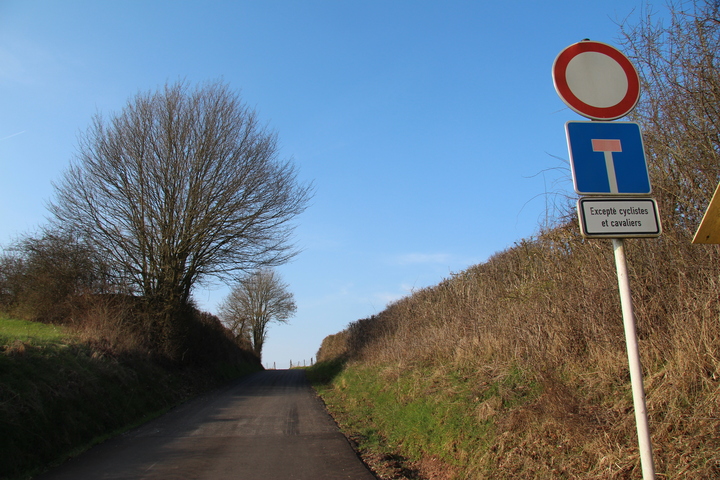
The sign on the road made me wonder about cavalier cyclists...
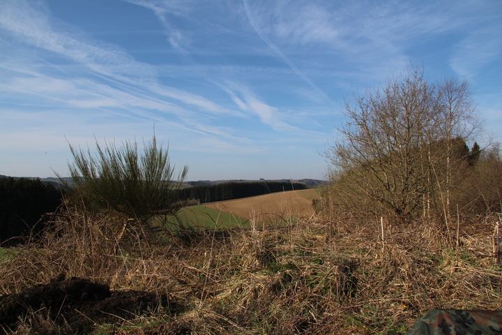
As well as the first hill, this was also the point where I entered woodland for the first time. Spring was in full swing, with wood anemones in full bloom. The birds sang. Heaven.
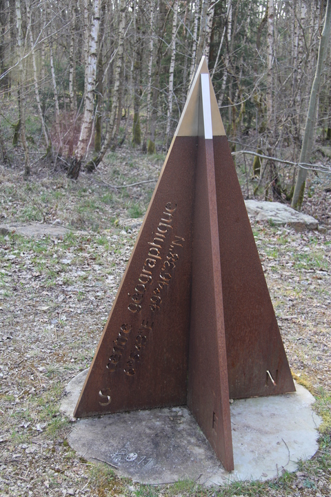
I stopped off at the Centre of Luxembourg, and did a spot of geocaching. The log was soaking wet so I couldn't sign it. I rehid the cache, and took some photos. 26km after leaving the Centre of Luxembourg, I had arrived in the Centre of Luxembourg...
Time was marching on, I had just over an hour of daylight left. It was time to start hunting for a bivvi site.
I had planned to bivvi somewhere in this woodland, but as I was feeling still fit and able to cycle, I wanted to eat up a few kilometres from tomorrow's distance, and maybe camp near the river.
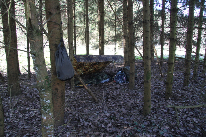
Alas, as I cycled on for a further 7km, it was apparent that somewhere flat and secluded to put up my tarp was going to be hard to find. Eventually with light fading fast, I had to accept the best option that was available, I climbed down a very steep bank by the side of the cycle path, and into a small plantation of pine trees. It wasn't the ideal position, less than 10m from the cycle path, only a hundred yards or so from the motorway, and a similar distance to the railway line. Beggers can't be choosers. I folded the bike, and covered it plus all the luggage with my flecktarn poncho, then sat under a tree waiting for sunset. I didn't want to draw too much attention to my being here, so didn't want to setup camp while there was light for people to see what I was doing.
After half hour of listening to the birds, I was happy enough that noone would spot my position. I strung up my tarp, inflated my bed, and crawled into my bivvi bag.
Day 2
Route: Luxembourg centre to Lac de la Haute-Sûre
Status: Everything's uphill... even the down hill bits.
Distance: 45.23km
It's becoming a bit of a running joke in the Kent Bushcraft group that I sleep better outdoors than I do at home. So it'll come as no surprise to them that I woke up just after 1300. Oops. So much for rise early and get on the road.
I was quite pleased with how tidy my camp was, considering I'd set it up in the dark by touch. It took me far too long to pack it all up.
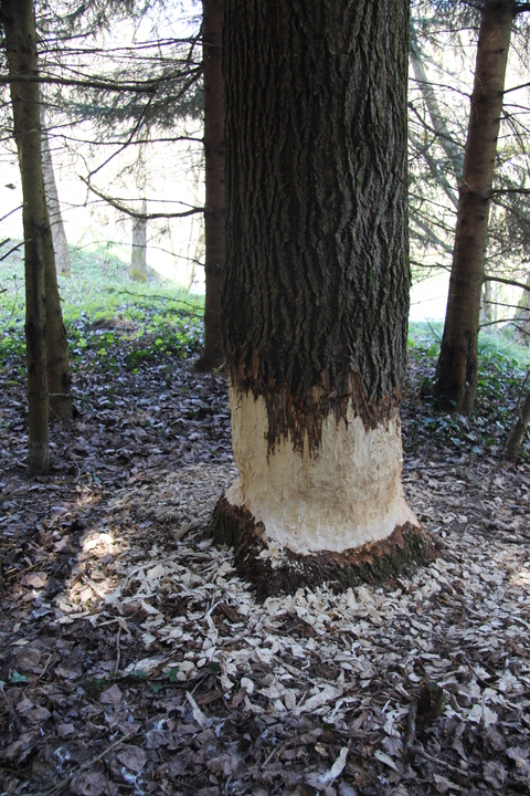
While packing up, I explored the area where I had camped. It seems that a beaver had taken a liking to one of the pine trees and made an enthusiastic attempt at felling it.
Camp packed, I returned to the cycle path. Slicing my hand up nicely on the brambles in the progress.
Having overslept, and then dawdled too long in breaking camp, my planned long day leisurely cycling up to the lake would have to be a bit more hurried, with less stopping. I knew the day would involve a fair amount of up, so wanted to make the most of the flat that I had to eat up those miles quickly. But before I could do any of that, I needed to do something about water. I was down to my last few mouthfuls of the 2L I left the train with the previous day. I had hoped to use streams, but with the fields full of tractors spraying gnu only knows what on them, I didn't trust any of the streams. This was compounded by the maps I was using using the same symbol to mark a spring, as an ornamental fountain. I would have to rely on man made watering holes for this trip. Or as the rest of you call them, bars.
I stopped off at the first open bar I came to, in the village of Colmar-Berg, under 3km from where I camped. I bought a coke and asked the bar maid if she could fill my water bag up. She seemed kinda bemused by the weird Brit with the plastic bag, but filled it up anyway. I sat on the step outside the bar filtering the water into my bottle, sipping my coke, and nibbling on a pack of cookies. In glorious sunshine, in beautiful countryside I was content.
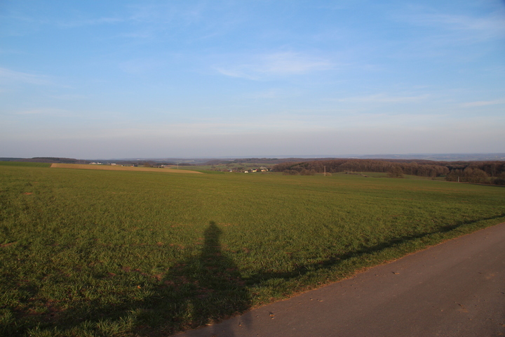
Back in the saddle I followed the cycle route out of the town, and into the countryside. The path would follow either the river or the railway line for much of the day, initially this was close enough to benefit from the relatively flat terrain, but as I passed the 7km point the route turned away from the river to cross a hill before decending to rejoin the river in Boevange-sur-Attert. This would be the first significiant climb of the day, rising 50m over less than 1km. After a few hundred yards of peddling, I got off and pushed. I wanted to make good time, but I also wanted to enjoy the landscape I was travelling through, so didn't really mind too much as I pushed the bike passed freshly felled and replanted softwood plantations. The lack of shade resulting from the recent felling meant that I was cooking in the spring sunshine. I started to question just how wise my choice of clothing was, given the all black colour scheme seemed to maximise passive solar gain.
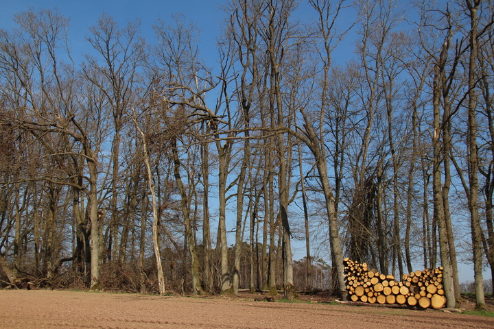
Throughout my time in the Ardennes, one thing (of many) that struck me were the plethora of neat stacks of logs. Nearly every house had one, and I passed many yards where multiple stacks of wood lay seasoning. As I reached the crest of this first hill, a neat stack of wood between two trees caught my eye in the sunshine.
The first hill also gave me the chance at the first descent. I cruised down the hill into Boevange-Sur-Attert.
Leaving Boevange-Sur-Attert I rounded the corner and looked up at a climb. My exlamation was loud, and not really printable. I was about to start in 1st gear on the long slog, when a sign caught my eye, and I realised that the path didn't go up the hill, but instead returned to following the river. Phew.
The next few kilmetres I passed throughs stunning scenery and sleepy villages. I had hoped to find a village shop somewhere where I could grab a couple of mars bars, or a bakery I could get some bread. As it happens, in my entire time in Luxembourg, I wouldn't see a single food shop until I reached Wiltz at the end of my journey. On the plus side, if I had wanted to buy decorating supplies, nearly every village had a shop selling those...
I passed through gently undulating terrain, surrounded by fields that seemed greener than those back home. I passed through Useldange where I raided another bar for a diet coke, and a litre of tap water. From here the path maintained it's upward tendency for the rest of the route. I wouldn't get any real down hill again until I passed the highest point of the route, 518masl near Rambrouch.
It's common to lump Luxembourg in with Belgium and the Netherlands, as the low countries, the BeNeLux. As such we think of them as flat, or at least not really a hilly place. Until you try to cycle in Luxembourg that is. I made a final water stop at a bar in Redange before starting the hard slog up over the 5km up onto a what felt like a high plateau. The view from up here was amazing, but the effort of ascending from 208masl where I woke up, to the eventual height of 518masl was a killer. Large sections of the journey were done in first gear at barely 7kph. Slowing grinding away up the hills. In many places I had to get off and push, or simply stop to let my legs recover. The view from the top was worth it.
As I reached 495masl just outside the village of Rambrouch, I looked at my planned cycle route, and it's descent to 474masl before it climbed to 504masl, and looked on the map at the slightly longer road, that maintained a steady gradient, and took my first detour from the plan.
On a route like this I try to keep to a policy of plan your ride and ride your plan. I am on my own typically, and if something happens, the only way that help will arrive is due to a search being triggered by a friend following failure to contact them at set times. If I'm not on the route they think I'm on, then a lot of time could be spent searching where I've never even got to. I reasoned that on such a quiet but large road through a village, the risk was worth it.
Passing the highest point of the trip, 518masl I could relax a bit with some downhill, eating up some distance. I flew through Koetschette, and down the country lanes, past some very startled highland cows in one field, at 40+kph. The sun wasn't far off setting, and the sudden 40kph wind chill coupled with the drop in solar gain, meant I was a bit chilly. I didn't care. After the climb, the descent was worth it.
Arsdorf took the wind out my sails somewhat by the discovery that I had another 50m of altitude to climb. I dismounted and pushed.
The end of the planned ascent for the day was marked by passing under the N27. From here it was a nice downhill round sweaping curves, cambered hair pins, and long straights. Sure the 51.5kph headwind was chilly, but I didn't care. The descent was amazing, and terrifying in equal measures. As the speed built up I tried to swear loudly, but only the F came out. For the record, 51.5kph on a Brompton is every bit as terrifying as you think it is.
A thought occured to me as I hurtled down the hillside - These are the original brake blocks that were fitted when I bought the bike 8 years ago...
I screached to a halt just before the bridge over Lac de la Haute-Sûre. This was my planned end point for the day. All I had to do was find a quiet flat spot to bivvi, and I would be done. The sun had just gone behind the hills. It was all going to plan.
I took the path along the lake hoping to find a flat spot in the trees that I could roll out my bivvi. What I found were foot prints.
I wasn't sure if the prints were Boar or not, but their prescence, made me not really want to sleep here. As it happens, the only flat land was the path, I would have to come up with a better option. I mounted up and crossed the bridge to the north side of the lake. The map showed potential in the woods on a headland that jutted out into the lake. What I hadn't quite realised from the map was just how steep the terrain round the lake would be. I had expected there would be a few meters of flat land around the lake, and I would be able to sneak my bivvi in somewhere there. This wasn't the case.
My following of the road along the lake brought me to a weir and a deadend. The weir had a substantial drop on it, including an overhang. This, along with another weir I found later, would put pay to any thoughts I had of a future trip pootling around on the lake in a canoe... there is no way to portage around this one.
I retreated up the road to another road marked on my map. Reading the map in the twilight, it looked like it was a short hop up the side of the hill to a road at the top. Late in the day, with fading light, hungry and worn out. I made my big error. The path goes up the side of the hill at something approaching a 50° angle. It's wide enough for a bike, or wide enough for a person, but not really wide enough for a person pushing a bike. The surface of the path started off reasonable, it was a hardpacked ground that allowed me to get the first 10m of height gain relatively easily. It got worse from then on. Rocks, roots and mud made up the path. The articulation of the Brompton started to work against me, upon pushing up against a root or rock, the front wheel wouldn't pass over it, and the bike would try to fold up. Time and time again this happened. I sat down to catch my breath and admire the view.
It was apparent that I wouldn't get up this hill with this technique, so detaching the bags from the bike, I shuttled first the bike, than the bags, 10-15m at a time up the slope. In hindsight I probably should have turned back, rock climbing with a loaded Brompton is foolhardy at best, down right stupid at worst. But I by the time this thought entered my head, I was nearer the top than the bottom, and it made sense at the time to continue onwards. To do the 100m of distance to the top of the path, a height gain of over 50m took me an hour. So slow infact my GPS trace doesn't think I was moving at all.
By the time I reached the top it was 2200 and I was damp with sweat, exhausted, and the land here was no flatter than the land nearer water level. I had to find somewhere, anywhere, to sleep, and do so soon. I turned on my bike light, which seemed to illuminate the whole hillside, and pushed on up along the road.
It's marked on the map as a road, but in reality it's a dirt track. Either side of which the hillside rose or fell at 45° angles. I pushed on up another 25m of altitude gain, where the trees gave way to fields, and the land started to level off. The absence of trees was a slight concern, I feel safer bivviing in woodland than in such obviously occupied land. But with little other option, I chose an area of land to the side of the road, where a digger had cleared it relatively recently, but long enough ago that the grass had grown back. There was nothing really to shield my position from view, I had to hope that the lightly used farm track was as lightly used as I thought it was. I made my camp entirely by touch, inflating my bed, setting up the bivvi bag, and brewing a mug of tea. I could see headlights on the other side of the lake, several kilmoteres away. It felt like I was on top of the world.
A friend had texted me to let me know the weather forecast was for a chilly night. Sitting on my bivvi bag on the side of a hill sipping my tea, I could see why. Not a cloud in the sky. I had an amazing view of the stars. I had written down the times of the ISS passes for while I was away in the hope I might see it. Tonight, laying in my bivvi bag, I watched as the ISS drifted across the sky some 300km or so above. It made the hard slog and gruelling climb worth it.
Drifting off to sleep with a sky full of stars is one of the most memorable experiences of the trip.
Day 3
Route: Lac de la Haute-Sûre to Wiltz
Status: Everything's hurts... and it's all still up hill...
Distance: 17.77km
I woke in the early hours of the morning to see the sky in the east starting to brighten. I reached out of my bag to pull the hood round, and felt damp. I felt round a bit more. The outside of my sleeping bag was soaking wet. I touched the inside of my bivvi bag. It ran with condensation. I sat up. My bivvi bag crackled as the thin layer of frost that covered it broke up. While I'd slept the dew had settled on everything, and then frosted over. I hadn't noticed snug and warm in my sleeping bag. I rearranged my pillow and went back to sleep.
I woke to beautiful sunshine, a dry sleeping bag and a dry bivvi bag. The early morning sunshine had dried off the worst of the dew. Just to be on the safe side before packing, I spread most of my kit out to dry in the sunshine, while I finished off a pack of cookies for breakfast. The view from my bivvi was as nice in the daylight as it was in the star light.
Packing up this morning was a lot faster than the day before, and it wasn't long until I was slowly cycling up the hill to join the road. I had a 3 potential plans for todays ride, depending on how I felt and how times worked out, in the end I opted for the shortest, most direct, and least hilly option.
I headed north towards my target destination, Wiltz.
As I cycled through the farmland and woodland twice I saw a large raptor. One was sitting in the top of a tree, and as I approached swooped down to land on the field. Another was flew across through a field as I as cycling along. The beauty of their controlled flight brightened my morning even further.
After a brief climb, I was able enjoy a short descent, alas, I wasn't able to capitalise on the speed boost as at the bottom the surface turned to loose chippings and went through a 90° bend. Once again I pushed up the other side. This was another brief ascent, and once at the top I had 5km of descent to the Bavigne. This was a straighter road than the descent to the lake the previous night and I as able to utilise the speed more. I tried to break my 51.5kph record of the night before, but the best I could do was 51kph. Even trying to take a more aerodynamic position didn't help. I'd obviously hit the point where friction was having a greater influence than drag. I enjoyed the descent non the less.
This was another brief ascent, and once at the top I had 5km of descent to the Bavigne. This was a straighter road than the descent to the lake the previous night and I as able to utilise the speed more. I tried to break my 51.5kph record of the night before, but the best I could do was 51kph. Even trying to take a more aerodynamic position didn't help. I'd obviously hit the point where friction was having a greater influence than drag. I enjoyed the descent non the less.
From Bavigne would be the final ascent of the trip, 323masl at Bavigne to 483masl at Café Schumann. The 4km ascent would take me the best part of 50 minutes, and yet would be one of the most beautiful bits of country I went through.
Softwood plantations and hardwood woodland covered the hillsides, with small patches of pasture land here and there. At one point I came across a cabin by a small lake, with the ubiquitous neat stack of firewood and a couple of bee hives. It reminded me of so many I've seen on cabin porn.
The uphill continued, the final leg into Schumannseck was perhaps the most brutal climb of the trip that wasn't an actual rock climb. A dead straight road lined by avenues of trees. By now I was pushing the bike more than I was riding it, and this leg I pushed entirely. Tractors and lorries thundered past occasionally. All of them giving me plenty of space. I wonder what they made of the funny brit pushing the clowns bike up the hill.
Finally I reached the top of the hill, and crossed the main road to Bastogne. From here I felt like I was on the final leg. I eased the bike over the crest and started down.
My plan had been to hang a right onto a back road to Roullingen, before continuing on to finish my ride at Wiltz castle. But as I approached the turning I could see that this road would involve another climb. Worn out, battered, bruised and with sore knees, I decided to take the wimps route, and stuck to the main road for the decent into Wiltz.
I cruised down the hill at in excess of 45kph, overtaken only by a Porsche and a motor bike. It was down hill all the way, I wouldn't need to peddle again until I reached the campsite at Kaul where I had a cabin booked for the weekend. In my excitement and with the slight shock at civilisation, I blew through a red light, fortunately the roads were pretty much deserted. I continued down the hill, as the decline eased off, my speed eased off as well into something a bit more reasonable as I coasted to the Bar at the campsite. The final sting in the tail was the flight of stairs upto the bar, and my hard earned meal and a bottle of Wëllen Ourdaller.
Postscript
Since leaving the UK I had done 140km, climbing over 1km, in 3 countries, spoken 4 languages, slept under trees, and under stars. What I had thought would be a pleasant ride through a picturesque part of Europe had become a challenging, yet rewarding journey. Sure I'm no Sarah Outen, but the trip has made me realise perhaps what is possible with a limited budget and a couple of days to spare. I've got to be in Wiltz again in August, and I'll be arriving a couple of days early with a Brompton rigged up for touring. All I have to do now is decide on a route.
This adventure really begins on a Bridge floating upon the Lac de la Haute-Sûre, Luxembourgs largest lake. It's October 2014, and I am here with some friends to scout out locations for an event that we are organising in August 2015. Standing looking up at the mountainside covered in vibrant autumnal colours, I knew I would have to come back and spend more time here, to explore it better. Later that day I picked up a 1:20000 map of the local area, and work began on a plan.
I had to be in Wiltz for the weekend in April for some planning meetings for the event in August. A plan started to form to arrive in the country a few days earlier and hike through the beautiful landscape of the Ardenne, to arrive in Wiltz on the Friday, wild camping as I went.
Hours with paper & electronic maps, and bus timetables resulted in a route for a 53km walk from near the border with Belgium to the centre of Wiltz, over about 48 hours. Alas, the first casualty of every engagement is the plan, and this one never even got as far as contact with the enemy. As I lay in agony following my aborted attempt at the North Downs Way, I realised that hiking 53km through the Ardenne was going to have to be put back in the crazy plans folder for a later date.
This still left me with the time booked off work, and the hope of a few days exploring the Ardennes. Walking was out the question. But cycling, that doesn't cause the same foot pain. The plan reforms.
Day 1
Route: Luxembourg centre to Luxembourg centre
Status: Everything's beautiful
Distance: 33.18km
April finds me standing outside Luxembourg railway station with a loaded Brompton. I'd got here by a combination of ferry to France, 40km bike ride to Belgium, a train journey, a night on a friends sofa, a lift to Brussels Zuid, and a train to Luxembourg. Just to get to the start line of my adventure.
I'd been expecting that early April in the Ardenne was going to be on the cool side, maybe 5-10°C. I'd dressed accordingly. The sky was blue and the sun beat down. This wasn't quite what I had expected or dressed for. I had a rummage in my bag for the sun block I knew was in there somewhere. Sun block in April. Something wasn't right. But dressed all in black lingering here is getting uncomfortably hot, time to hit the road.
What isn't clear from the maps I had used to plan this leg of the journey, is that Luxembourg City is located around a steep sided valley. The station is around 280masl. The cycle route I had been intending to pick up was located 40m below me. This wasn't right, I've only gone 300m and already the route plan isn't working. Adapt and overcome. I took the next turning that looked like it was going the right way, following the road down through tight hairpin bends. The roads where cobbled, with eratic camber and in places large wheel eating gaps between the stones. I slalomed between the bemused tourists heading down.
More by luck than judgment I reached the level of the cycle route I was aiming for clattered down the gears, and headed off out the city.
I knew the first 10k or so would be relatively urban and it would take a while to get out the city and into the countryside. Well that's what I thought. Luxembourg city, whilst a Capital, is smaller than Cambridge. It didn't take me long to leave the cobble streets behind, and follow the river past market gardens into the countryside.
I had planned for a shorter first day, to ease myself into the journey, and not over do it. Alas, my unintended 40k ride the previous day meant that this was something I was more greatful of than I had expected. I followed the signs along the river and railway line.
The trees along the river were adorned with mistletoe in quantities I had never seen before. In the UK mistletoe is something I associate with old orchards, and had not really consciously seen it else where. Yet, here, along the banks of the Alzette, nearly every tree was covered.
I continued on in the afternoon sunshine, following the signs for Piste cyclable de l'Alzette. The sun was shining, the sky a brilliant blue. I was enjoying myself. So much so, that I forgot to follow the signs, and took a slight diversion up a farmers driveway. Slightly embarrassed by this 1km detour, I returned to the route and continued on.
I wasn't alone on the cycleway, many families were out to enjoy the sunshine, as were a seemingly endless number of Lycra clad road cyclists. Each smiling and saying hello (I think that's what they were saying) as they cycle past.
I had expected the path to be made from hard packed dirt, like many of the traffic free sections of the UK National Cycle Network. What I hadn't expected was some of the smoothest tarmac, and neatly concreted path I've ever cycled on. This meant I could make good progress, and maintain a high speed. For one flat section, I managed to hit 30kph, pedalling flat out. Not bad for a Brompton with Luggage.
I stopped after 15km at a tap, hoping to fill my water bottles up. Alas it hadn't yet been turned on. I'd have to continue on with the water I already had.
When planning the trip, I had noticed on Open Cycle Map that the Geographic Centre of Luxembourg was marked. It would only add a couple of km to my route to visit it. When I then found out that there was a geocache located here, the detour was on. 24km after leaving Luxembourg I left the cycle route, and headed up hill. I managed about 0.5km of up hill cycling before admitting defeat and getting off to push. I climbed from 215masl to 283masl over just over 1km.
This was the first real up hill I'd done since leaving the UK, at this point I didn't know how much the up would continue.
The sign on the road made me wonder about cavalier cyclists...
As well as the first hill, this was also the point where I entered woodland for the first time. Spring was in full swing, with wood anemones in full bloom. The birds sang. Heaven.
I stopped off at the Centre of Luxembourg, and did a spot of geocaching. The log was soaking wet so I couldn't sign it. I rehid the cache, and took some photos. 26km after leaving the Centre of Luxembourg, I had arrived in the Centre of Luxembourg...
Time was marching on, I had just over an hour of daylight left. It was time to start hunting for a bivvi site.
I had planned to bivvi somewhere in this woodland, but as I was feeling still fit and able to cycle, I wanted to eat up a few kilometres from tomorrow's distance, and maybe camp near the river.
Alas, as I cycled on for a further 7km, it was apparent that somewhere flat and secluded to put up my tarp was going to be hard to find. Eventually with light fading fast, I had to accept the best option that was available, I climbed down a very steep bank by the side of the cycle path, and into a small plantation of pine trees. It wasn't the ideal position, less than 10m from the cycle path, only a hundred yards or so from the motorway, and a similar distance to the railway line. Beggers can't be choosers. I folded the bike, and covered it plus all the luggage with my flecktarn poncho, then sat under a tree waiting for sunset. I didn't want to draw too much attention to my being here, so didn't want to setup camp while there was light for people to see what I was doing.
After half hour of listening to the birds, I was happy enough that noone would spot my position. I strung up my tarp, inflated my bed, and crawled into my bivvi bag.
Day 2
Route: Luxembourg centre to Lac de la Haute-Sûre
Status: Everything's uphill... even the down hill bits.
Distance: 45.23km
It's becoming a bit of a running joke in the Kent Bushcraft group that I sleep better outdoors than I do at home. So it'll come as no surprise to them that I woke up just after 1300. Oops. So much for rise early and get on the road.
I was quite pleased with how tidy my camp was, considering I'd set it up in the dark by touch. It took me far too long to pack it all up.
While packing up, I explored the area where I had camped. It seems that a beaver had taken a liking to one of the pine trees and made an enthusiastic attempt at felling it.
Camp packed, I returned to the cycle path. Slicing my hand up nicely on the brambles in the progress.
Having overslept, and then dawdled too long in breaking camp, my planned long day leisurely cycling up to the lake would have to be a bit more hurried, with less stopping. I knew the day would involve a fair amount of up, so wanted to make the most of the flat that I had to eat up those miles quickly. But before I could do any of that, I needed to do something about water. I was down to my last few mouthfuls of the 2L I left the train with the previous day. I had hoped to use streams, but with the fields full of tractors spraying gnu only knows what on them, I didn't trust any of the streams. This was compounded by the maps I was using using the same symbol to mark a spring, as an ornamental fountain. I would have to rely on man made watering holes for this trip. Or as the rest of you call them, bars.
I stopped off at the first open bar I came to, in the village of Colmar-Berg, under 3km from where I camped. I bought a coke and asked the bar maid if she could fill my water bag up. She seemed kinda bemused by the weird Brit with the plastic bag, but filled it up anyway. I sat on the step outside the bar filtering the water into my bottle, sipping my coke, and nibbling on a pack of cookies. In glorious sunshine, in beautiful countryside I was content.
Back in the saddle I followed the cycle route out of the town, and into the countryside. The path would follow either the river or the railway line for much of the day, initially this was close enough to benefit from the relatively flat terrain, but as I passed the 7km point the route turned away from the river to cross a hill before decending to rejoin the river in Boevange-sur-Attert. This would be the first significiant climb of the day, rising 50m over less than 1km. After a few hundred yards of peddling, I got off and pushed. I wanted to make good time, but I also wanted to enjoy the landscape I was travelling through, so didn't really mind too much as I pushed the bike passed freshly felled and replanted softwood plantations. The lack of shade resulting from the recent felling meant that I was cooking in the spring sunshine. I started to question just how wise my choice of clothing was, given the all black colour scheme seemed to maximise passive solar gain.
Throughout my time in the Ardennes, one thing (of many) that struck me were the plethora of neat stacks of logs. Nearly every house had one, and I passed many yards where multiple stacks of wood lay seasoning. As I reached the crest of this first hill, a neat stack of wood between two trees caught my eye in the sunshine.
The first hill also gave me the chance at the first descent. I cruised down the hill into Boevange-Sur-Attert.
Leaving Boevange-Sur-Attert I rounded the corner and looked up at a climb. My exlamation was loud, and not really printable. I was about to start in 1st gear on the long slog, when a sign caught my eye, and I realised that the path didn't go up the hill, but instead returned to following the river. Phew.
The next few kilmetres I passed throughs stunning scenery and sleepy villages. I had hoped to find a village shop somewhere where I could grab a couple of mars bars, or a bakery I could get some bread. As it happens, in my entire time in Luxembourg, I wouldn't see a single food shop until I reached Wiltz at the end of my journey. On the plus side, if I had wanted to buy decorating supplies, nearly every village had a shop selling those...
I passed through gently undulating terrain, surrounded by fields that seemed greener than those back home. I passed through Useldange where I raided another bar for a diet coke, and a litre of tap water. From here the path maintained it's upward tendency for the rest of the route. I wouldn't get any real down hill again until I passed the highest point of the route, 518masl near Rambrouch.
It's common to lump Luxembourg in with Belgium and the Netherlands, as the low countries, the BeNeLux. As such we think of them as flat, or at least not really a hilly place. Until you try to cycle in Luxembourg that is. I made a final water stop at a bar in Redange before starting the hard slog up over the 5km up onto a what felt like a high plateau. The view from up here was amazing, but the effort of ascending from 208masl where I woke up, to the eventual height of 518masl was a killer. Large sections of the journey were done in first gear at barely 7kph. Slowing grinding away up the hills. In many places I had to get off and push, or simply stop to let my legs recover. The view from the top was worth it.
As I reached 495masl just outside the village of Rambrouch, I looked at my planned cycle route, and it's descent to 474masl before it climbed to 504masl, and looked on the map at the slightly longer road, that maintained a steady gradient, and took my first detour from the plan.
On a route like this I try to keep to a policy of plan your ride and ride your plan. I am on my own typically, and if something happens, the only way that help will arrive is due to a search being triggered by a friend following failure to contact them at set times. If I'm not on the route they think I'm on, then a lot of time could be spent searching where I've never even got to. I reasoned that on such a quiet but large road through a village, the risk was worth it.
Passing the highest point of the trip, 518masl I could relax a bit with some downhill, eating up some distance. I flew through Koetschette, and down the country lanes, past some very startled highland cows in one field, at 40+kph. The sun wasn't far off setting, and the sudden 40kph wind chill coupled with the drop in solar gain, meant I was a bit chilly. I didn't care. After the climb, the descent was worth it.
Arsdorf took the wind out my sails somewhat by the discovery that I had another 50m of altitude to climb. I dismounted and pushed.
The end of the planned ascent for the day was marked by passing under the N27. From here it was a nice downhill round sweaping curves, cambered hair pins, and long straights. Sure the 51.5kph headwind was chilly, but I didn't care. The descent was amazing, and terrifying in equal measures. As the speed built up I tried to swear loudly, but only the F came out. For the record, 51.5kph on a Brompton is every bit as terrifying as you think it is.
A thought occured to me as I hurtled down the hillside - These are the original brake blocks that were fitted when I bought the bike 8 years ago...
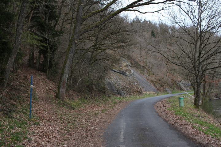
I screached to a halt just before the bridge over Lac de la Haute-Sûre. This was my planned end point for the day. All I had to do was find a quiet flat spot to bivvi, and I would be done. The sun had just gone behind the hills. It was all going to plan.
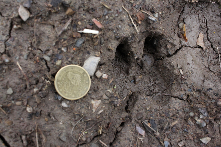
I took the path along the lake hoping to find a flat spot in the trees that I could roll out my bivvi. What I found were foot prints.
I wasn't sure if the prints were Boar or not, but their prescence, made me not really want to sleep here. As it happens, the only flat land was the path, I would have to come up with a better option. I mounted up and crossed the bridge to the north side of the lake. The map showed potential in the woods on a headland that jutted out into the lake. What I hadn't quite realised from the map was just how steep the terrain round the lake would be. I had expected there would be a few meters of flat land around the lake, and I would be able to sneak my bivvi in somewhere there. This wasn't the case.
My following of the road along the lake brought me to a weir and a deadend. The weir had a substantial drop on it, including an overhang. This, along with another weir I found later, would put pay to any thoughts I had of a future trip pootling around on the lake in a canoe... there is no way to portage around this one.
I retreated up the road to another road marked on my map. Reading the map in the twilight, it looked like it was a short hop up the side of the hill to a road at the top. Late in the day, with fading light, hungry and worn out. I made my big error. The path goes up the side of the hill at something approaching a 50° angle. It's wide enough for a bike, or wide enough for a person, but not really wide enough for a person pushing a bike. The surface of the path started off reasonable, it was a hardpacked ground that allowed me to get the first 10m of height gain relatively easily. It got worse from then on. Rocks, roots and mud made up the path. The articulation of the Brompton started to work against me, upon pushing up against a root or rock, the front wheel wouldn't pass over it, and the bike would try to fold up. Time and time again this happened. I sat down to catch my breath and admire the view.
It was apparent that I wouldn't get up this hill with this technique, so detaching the bags from the bike, I shuttled first the bike, than the bags, 10-15m at a time up the slope. In hindsight I probably should have turned back, rock climbing with a loaded Brompton is foolhardy at best, down right stupid at worst. But I by the time this thought entered my head, I was nearer the top than the bottom, and it made sense at the time to continue onwards. To do the 100m of distance to the top of the path, a height gain of over 50m took me an hour. So slow infact my GPS trace doesn't think I was moving at all.
By the time I reached the top it was 2200 and I was damp with sweat, exhausted, and the land here was no flatter than the land nearer water level. I had to find somewhere, anywhere, to sleep, and do so soon. I turned on my bike light, which seemed to illuminate the whole hillside, and pushed on up along the road.
It's marked on the map as a road, but in reality it's a dirt track. Either side of which the hillside rose or fell at 45° angles. I pushed on up another 25m of altitude gain, where the trees gave way to fields, and the land started to level off. The absence of trees was a slight concern, I feel safer bivviing in woodland than in such obviously occupied land. But with little other option, I chose an area of land to the side of the road, where a digger had cleared it relatively recently, but long enough ago that the grass had grown back. There was nothing really to shield my position from view, I had to hope that the lightly used farm track was as lightly used as I thought it was. I made my camp entirely by touch, inflating my bed, setting up the bivvi bag, and brewing a mug of tea. I could see headlights on the other side of the lake, several kilmoteres away. It felt like I was on top of the world.
A friend had texted me to let me know the weather forecast was for a chilly night. Sitting on my bivvi bag on the side of a hill sipping my tea, I could see why. Not a cloud in the sky. I had an amazing view of the stars. I had written down the times of the ISS passes for while I was away in the hope I might see it. Tonight, laying in my bivvi bag, I watched as the ISS drifted across the sky some 300km or so above. It made the hard slog and gruelling climb worth it.
Drifting off to sleep with a sky full of stars is one of the most memorable experiences of the trip.
Day 3
Route: Lac de la Haute-Sûre to Wiltz
Status: Everything's hurts... and it's all still up hill...
Distance: 17.77km
I woke in the early hours of the morning to see the sky in the east starting to brighten. I reached out of my bag to pull the hood round, and felt damp. I felt round a bit more. The outside of my sleeping bag was soaking wet. I touched the inside of my bivvi bag. It ran with condensation. I sat up. My bivvi bag crackled as the thin layer of frost that covered it broke up. While I'd slept the dew had settled on everything, and then frosted over. I hadn't noticed snug and warm in my sleeping bag. I rearranged my pillow and went back to sleep.
I woke to beautiful sunshine, a dry sleeping bag and a dry bivvi bag. The early morning sunshine had dried off the worst of the dew. Just to be on the safe side before packing, I spread most of my kit out to dry in the sunshine, while I finished off a pack of cookies for breakfast. The view from my bivvi was as nice in the daylight as it was in the star light.
Packing up this morning was a lot faster than the day before, and it wasn't long until I was slowly cycling up the hill to join the road. I had a 3 potential plans for todays ride, depending on how I felt and how times worked out, in the end I opted for the shortest, most direct, and least hilly option.
I headed north towards my target destination, Wiltz.
As I cycled through the farmland and woodland twice I saw a large raptor. One was sitting in the top of a tree, and as I approached swooped down to land on the field. Another was flew across through a field as I as cycling along. The beauty of their controlled flight brightened my morning even further.
After a brief climb, I was able enjoy a short descent, alas, I wasn't able to capitalise on the speed boost as at the bottom the surface turned to loose chippings and went through a 90° bend. Once again I pushed up the other side. This was another brief ascent, and once at the top I had 5km of descent to the Bavigne. This was a straighter road than the descent to the lake the previous night and I as able to utilise the speed more. I tried to break my 51.5kph record of the night before, but the best I could do was 51kph. Even trying to take a more aerodynamic position didn't help. I'd obviously hit the point where friction was having a greater influence than drag. I enjoyed the descent non the less.
This was another brief ascent, and once at the top I had 5km of descent to the Bavigne. This was a straighter road than the descent to the lake the previous night and I as able to utilise the speed more. I tried to break my 51.5kph record of the night before, but the best I could do was 51kph. Even trying to take a more aerodynamic position didn't help. I'd obviously hit the point where friction was having a greater influence than drag. I enjoyed the descent non the less.
From Bavigne would be the final ascent of the trip, 323masl at Bavigne to 483masl at Café Schumann. The 4km ascent would take me the best part of 50 minutes, and yet would be one of the most beautiful bits of country I went through.
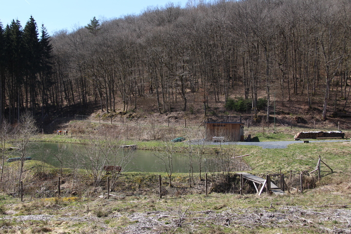
Softwood plantations and hardwood woodland covered the hillsides, with small patches of pasture land here and there. At one point I came across a cabin by a small lake, with the ubiquitous neat stack of firewood and a couple of bee hives. It reminded me of so many I've seen on cabin porn.
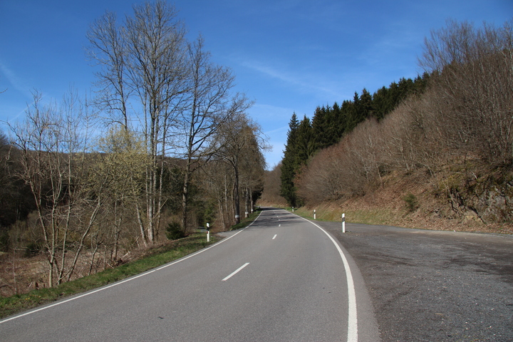
The uphill continued, the final leg into Schumannseck was perhaps the most brutal climb of the trip that wasn't an actual rock climb. A dead straight road lined by avenues of trees. By now I was pushing the bike more than I was riding it, and this leg I pushed entirely. Tractors and lorries thundered past occasionally. All of them giving me plenty of space. I wonder what they made of the funny brit pushing the clowns bike up the hill.
Finally I reached the top of the hill, and crossed the main road to Bastogne. From here I felt like I was on the final leg. I eased the bike over the crest and started down.
My plan had been to hang a right onto a back road to Roullingen, before continuing on to finish my ride at Wiltz castle. But as I approached the turning I could see that this road would involve another climb. Worn out, battered, bruised and with sore knees, I decided to take the wimps route, and stuck to the main road for the decent into Wiltz.
I cruised down the hill at in excess of 45kph, overtaken only by a Porsche and a motor bike. It was down hill all the way, I wouldn't need to peddle again until I reached the campsite at Kaul where I had a cabin booked for the weekend. In my excitement and with the slight shock at civilisation, I blew through a red light, fortunately the roads were pretty much deserted. I continued down the hill, as the decline eased off, my speed eased off as well into something a bit more reasonable as I coasted to the Bar at the campsite. The final sting in the tail was the flight of stairs upto the bar, and my hard earned meal and a bottle of Wëllen Ourdaller.
Postscript
Since leaving the UK I had done 140km, climbing over 1km, in 3 countries, spoken 4 languages, slept under trees, and under stars. What I had thought would be a pleasant ride through a picturesque part of Europe had become a challenging, yet rewarding journey. Sure I'm no Sarah Outen, but the trip has made me realise perhaps what is possible with a limited budget and a couple of days to spare. I've got to be in Wiltz again in August, and I'll be arriving a couple of days early with a Brompton rigged up for touring. All I have to do now is decide on a route.
")